Survey of London: Volumes 43 and 44, Poplar, Blackwall and Isle of Dogs. Originally published by London County Council, London, 1994.
This free content was digitised by double rekeying. All rights reserved.
'Plate 135', in Survey of London: Volumes 43 and 44, Poplar, Blackwall and Isle of Dogs, ed. Hermione Hobhouse (London, 1994), British History Online https://prod.british-history.ac.uk/survey-london/vols43-4/plate-135 [accessed 11 May 2025].
'Plate 135', in Survey of London: Volumes 43 and 44, Poplar, Blackwall and Isle of Dogs. Edited by Hermione Hobhouse (London, 1994), British History Online, accessed May 11, 2025, https://prod.british-history.ac.uk/survey-london/vols43-4/plate-135.
"Plate 135". Survey of London: Volumes 43 and 44, Poplar, Blackwall and Isle of Dogs. Ed. Hermione Hobhouse (London, 1994), British History Online. Web. 11 May 2025. https://prod.british-history.ac.uk/survey-london/vols43-4/plate-135.
In this section
a. Thornfield House, Rosefield Gardens, Birchfield Estate, in 1990. LCC, 1960–2 (p. 91)
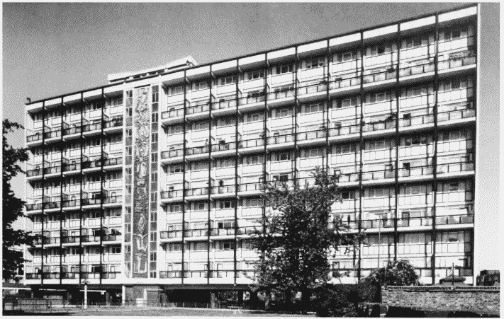
Thornfield House, Birchfield Estate, in 1990.
Thornfield House, Rosefield Gardens, Birchfield Estate, in 1990. LCC, 1960–2 (p. 91)
b (right). Mobile Homes in Upper North Street in 1992 (p. 48).
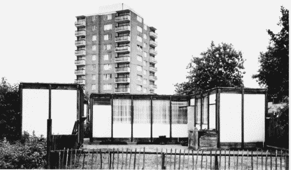
Mobile Homes, Upper North Street, in 1992.
(right). Mobile Homes in Upper North Street in 1992 (p. 48).
Colebrook House point block in the distance (p. 242)
c. Arcadian Self-Build Housing, Bartlett Close, looking south-west in 1993 (pp. 245–6)
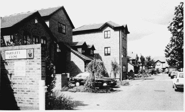
Arcadian Self-Build Housing, Bartlett Close, in 1993.
Arcadian Self-Build Housing, Bartlett Close, looking south-west in 1993 (pp. 245–6)