Survey of London: Volumes 43 and 44, Poplar, Blackwall and Isle of Dogs. Originally published by London County Council, London, 1994.
This free content was digitised by double rekeying. All rights reserved.
'Plate 136', in Survey of London: Volumes 43 and 44, Poplar, Blackwall and Isle of Dogs, ed. Hermione Hobhouse (London, 1994), British History Online https://prod.british-history.ac.uk/survey-london/vols43-4/plate-136 [accessed 10 May 2025].
'Plate 136', in Survey of London: Volumes 43 and 44, Poplar, Blackwall and Isle of Dogs. Edited by Hermione Hobhouse (London, 1994), British History Online, accessed May 10, 2025, https://prod.british-history.ac.uk/survey-london/vols43-4/plate-136.
"Plate 136". Survey of London: Volumes 43 and 44, Poplar, Blackwall and Isle of Dogs. Ed. Hermione Hobhouse (London, 1994), British History Online. Web. 10 May 2025. https://prod.british-history.ac.uk/survey-london/vols43-4/plate-136.
In this section
Public Housing of The 1960s
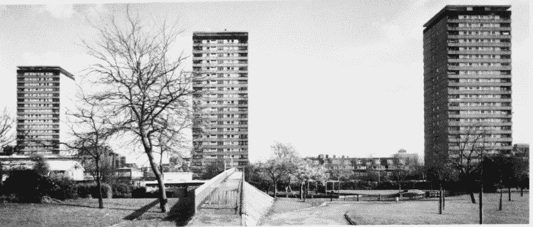
a. The Barkantine Estate, view from the west in 1993 showing (left to right) Midship, Knighthead and Bowsprit Points.

The Barkantine Estate in 1993.
The Barkantine Estate, view from the west in 1993 showing (left to right) Midship, Knighthead and Bowsprit Points.
LCC/GLC, 1965–70 (p. 446)
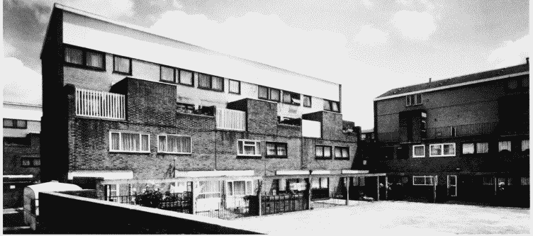
b. Lingard House, Strattondale Street, view from west in 1993.

Lingard House, Strattondale Street, in 1993.
Lingard House, Strattondale Street, view from west in 1993.
Begun by Poplar Borough Council, finished by Tower Hamlets Borough Council, 1963–6 (p. 541)
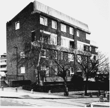
c. Norwood House, Poplar High Street, in 1994.

Norwood House, Poplar High Street, in 1994.
Norwood House, Poplar High Street, in 1994.
GLC, late 1960s (p. 96)
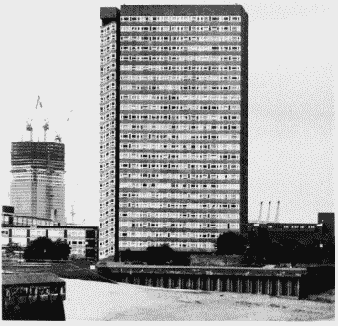
d. Kelson House, Samuda Estate, Manchester Road, in 1990.

Kelson House, Samuda Estate, in 1990.
Kelson House, Samuda Estate, Manchester Road, in 1990.
GLC, 1965–7 (pp. 542–3)