Survey of London: Volume 40, the Grosvenor Estate in Mayfair, Part 2 (The Buildings). Originally published by London County Council, London, 1980.
This free content was digitised by double rekeying. All rights reserved.
'Plate 67: Park Lane', in Survey of London: Volume 40, the Grosvenor Estate in Mayfair, Part 2 (The Buildings), ed. F H W Sheppard (London, 1980), British History Online https://prod.british-history.ac.uk/survey-london/vol40/pt2/plate-67 [accessed 16 April 2025].
'Plate 67: Park Lane', in Survey of London: Volume 40, the Grosvenor Estate in Mayfair, Part 2 (The Buildings). Edited by F H W Sheppard (London, 1980), British History Online, accessed April 16, 2025, https://prod.british-history.ac.uk/survey-london/vol40/pt2/plate-67.
"Plate 67: Park Lane". Survey of London: Volume 40, the Grosvenor Estate in Mayfair, Part 2 (The Buildings). Ed. F H W Sheppard (London, 1980), British History Online. Web. 16 April 2025. https://prod.british-history.ac.uk/survey-london/vol40/pt2/plate-67.
In this section
Park Lane
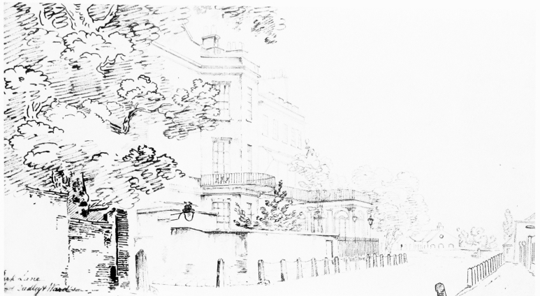
a. Looking south from corner with Upper Brook Street in c. 1811.

Park Lane
Looking south from corner with Upper Brook Street in c. 1811.
No. 30 Upper Brook Street and old Dudley House, left, Grosvenor Gate, right, and Duke of Gloucester's riding school in distance. All demolished
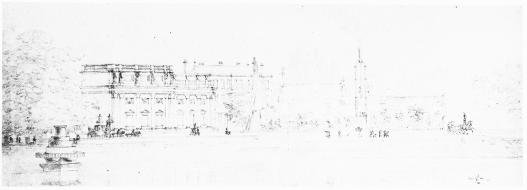
b. Looking east across the reservoir of the Chelsea Waterworks towards Grosvenor House in c. 1827.

Park Lane
Looking east across the reservoir of the Chelsea Waterworks towards Grosvenor House in c. 1827.
Waterworks engine house right of centre, and Dorchester House in distance. In front of Grosvenor House are stacked scaffold poles recently used in constructing the picture galleries. All demolished
c. Looking north from Hyde Park in 1841.

Park Lane
Looking north from Hyde Park in 1841.
Grosvenor House and Breadalbane House on right and Grosvenor Gate in distance. Partly demolished