Survey of London: Volume 40, the Grosvenor Estate in Mayfair, Part 2 (The Buildings). Originally published by London County Council, London, 1980.
This free content was digitised by double rekeying. All rights reserved.
'Plate 68: Park Lane', in Survey of London: Volume 40, the Grosvenor Estate in Mayfair, Part 2 (The Buildings), ed. F H W Sheppard (London, 1980), British History Online https://prod.british-history.ac.uk/survey-london/vol40/pt2/plate-68 [accessed 16 April 2025].
'Plate 68: Park Lane', in Survey of London: Volume 40, the Grosvenor Estate in Mayfair, Part 2 (The Buildings). Edited by F H W Sheppard (London, 1980), British History Online, accessed April 16, 2025, https://prod.british-history.ac.uk/survey-london/vol40/pt2/plate-68.
"Plate 68: Park Lane". Survey of London: Volume 40, the Grosvenor Estate in Mayfair, Part 2 (The Buildings). Ed. F H W Sheppard (London, 1980), British History Online. Web. 16 April 2025. https://prod.british-history.ac.uk/survey-london/vol40/pt2/plate-68.
In this section
Park Lane
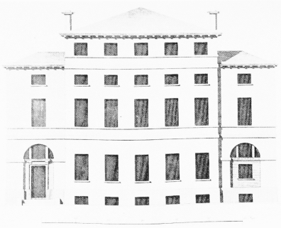
a. Elevation of Lord Petre's (later Breadalbane) House.
Park Lane
Elevation of Lord Petre's (later Breadalbane) House.
James Paine, architect, 1766–70 (p. 269). Demolished
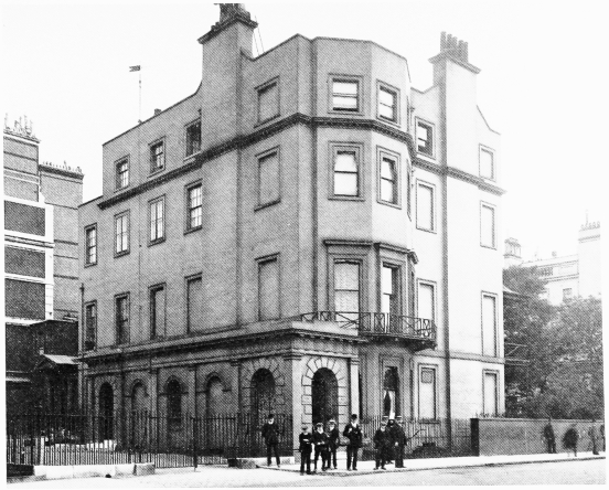
b. Somerset House from north-west on 30 July 1912 (p. 285).
Park Lane
Somerset House from north-west on 30 July 1912 (p. 285).
Demolished
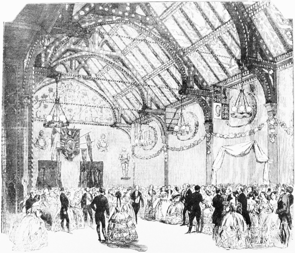
c. Breadalbane House, 'Baronial Hall' in 1854.
Park Lane
Breadalbane House, 'Baronial Hall' in 1854.
J.G. Crace, decorator (pp. 269–70). Demolished
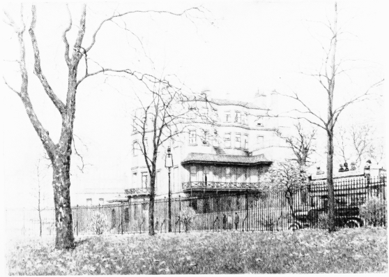
d. Somerset House from south-west in 1913 (p. 285).
Park Lane
Somerset House from south-west in 1913 (p. 285).
Demolished. No. 36 omnibus on right