Survey of London: Volume 45, Knightsbridge. Originally published by London County Council, London, 2000.
This free content was digitised by double rekeying. All rights reserved.
'Plate 59: Montpelier Square.', in Survey of London: Volume 45, Knightsbridge, ed. John Greenacombe (London, 2000), British History Online https://prod.british-history.ac.uk/survey-london/vol45/plate-59 [accessed 12 May 2025].
'Plate 59: Montpelier Square.', in Survey of London: Volume 45, Knightsbridge. Edited by John Greenacombe (London, 2000), British History Online, accessed May 12, 2025, https://prod.british-history.ac.uk/survey-london/vol45/plate-59.
"Plate 59: Montpelier Square.". Survey of London: Volume 45, Knightsbridge. Ed. John Greenacombe (London, 2000), British History Online. Web. 12 May 2025. https://prod.british-history.ac.uk/survey-london/vol45/plate-59.
In this section
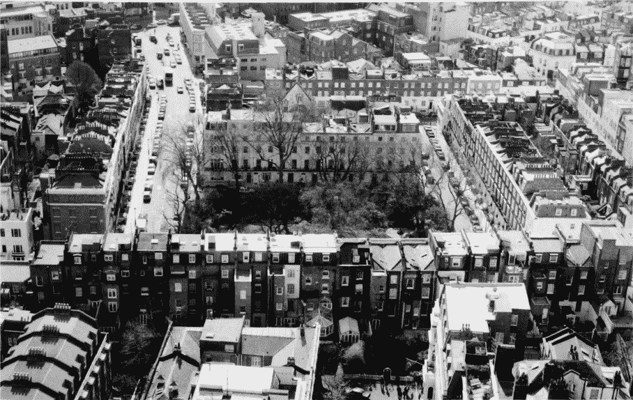
Montpelier Square: developed c. 1825–53 (pp. 109 –16)
a. Bird's-eye view from the barracks tower in 1995
Montpelier Square.
Bird's-eye view from the barracks tower in 1995
b. South side, built 1826 c. 1830: looking west in 1993

Montpelier Square.
South side, built 1826 c. 1830: looking west in 1993