Survey of London: Volume 41, Brompton. Originally published by London County Council, London, 1983.
This free content was digitised by double rekeying. All rights reserved.
'Plate 2: Maps of Brompton Road and district', in Survey of London: Volume 41, Brompton, ed. F H W Sheppard (London, 1983), British History Online https://prod.british-history.ac.uk/survey-london/vol41/plate-2 [accessed 15 April 2025].
'Plate 2: Maps of Brompton Road and district', in Survey of London: Volume 41, Brompton. Edited by F H W Sheppard (London, 1983), British History Online, accessed April 15, 2025, https://prod.british-history.ac.uk/survey-london/vol41/plate-2.
"Plate 2: Maps of Brompton Road and district". Survey of London: Volume 41, Brompton. Ed. F H W Sheppard (London, 1983), British History Online. Web. 15 April 2025. https://prod.british-history.ac.uk/survey-london/vol41/plate-2.
In this section
Brompton Road , Maps
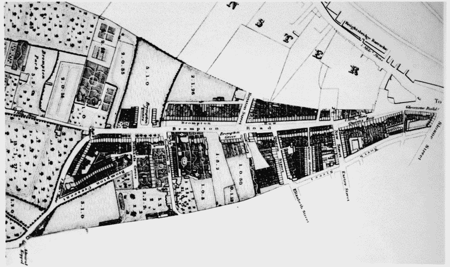
a Extract from map of Kensington published by T. Starling, 1822
Maps of Brompton Road and district
Extract from map of Kensington published by T. Starling, 1822
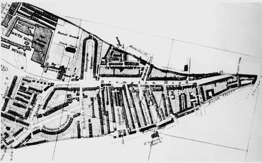
b Extract from Edmund Daw's map of Kensington, 1879
Maps of Brompton Road and district
Extract from Edmund Daw's map of Kensington, 1879