Survey of London: Volume 23, Lambeth: South Bank and Vauxhall. Originally published by London County Council, London, 1951.
This free content was digitised by double rekeying. All rights reserved.
'Plate 30: Shot Tower, Belvedere Road, plans, elevation and section, 1948', in Survey of London: Volume 23, Lambeth: South Bank and Vauxhall, ed. Howard Roberts, Walter H Godfrey (London, 1951), British History Online https://prod.british-history.ac.uk/survey-london/vol23/plate-30 [accessed 4 April 2025].
'Plate 30: Shot Tower, Belvedere Road, plans, elevation and section, 1948', in Survey of London: Volume 23, Lambeth: South Bank and Vauxhall. Edited by Howard Roberts, Walter H Godfrey (London, 1951), British History Online, accessed April 4, 2025, https://prod.british-history.ac.uk/survey-london/vol23/plate-30.
"Plate 30: Shot Tower, Belvedere Road, plans, elevation and section, 1948". Survey of London: Volume 23, Lambeth: South Bank and Vauxhall. Ed. Howard Roberts, Walter H Godfrey (London, 1951), British History Online. Web. 4 April 2025. https://prod.british-history.ac.uk/survey-london/vol23/plate-30.
SHOT TOWER, BELVEDERE ROAD, 1948
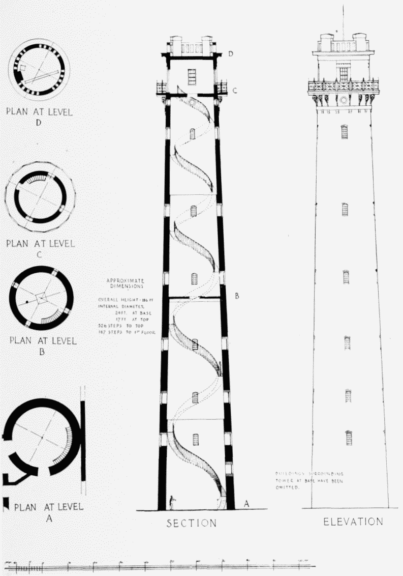
Shot Tower, Belvedere Road, plans, elevation and section, 1948
SHOT TOWER, BELVEDERE ROAD, 1948