An Inventory of the Historical Monuments in the County of Northamptonshire, Volume 3, Archaeological Sites in North-West Northamptonshire. Originally published by Her Majesty's Stationery Office, London, 1981.
This free content was digitised by double rekeying. All rights reserved.
'Plate 18: Holdenby, Details of Maps of 1580 and 1587', in An Inventory of the Historical Monuments in the County of Northamptonshire, Volume 3, Archaeological Sites in North-West Northamptonshire(London, 1981), British History Online https://prod.british-history.ac.uk/rchme/northants/vol3/plate-18 [accessed 19 April 2025].
'Plate 18: Holdenby, Details of Maps of 1580 and 1587', in An Inventory of the Historical Monuments in the County of Northamptonshire, Volume 3, Archaeological Sites in North-West Northamptonshire(London, 1981), British History Online, accessed April 19, 2025, https://prod.british-history.ac.uk/rchme/northants/vol3/plate-18.
"Plate 18: Holdenby, Details of Maps of 1580 and 1587". An Inventory of the Historical Monuments in the County of Northamptonshire, Volume 3, Archaeological Sites in North-West Northamptonshire. (London, 1981), British History Online. Web. 19 April 2025. https://prod.british-history.ac.uk/rchme/northants/vol3/plate-18.
Holdenby: Details of Maps of 1580 and 1587
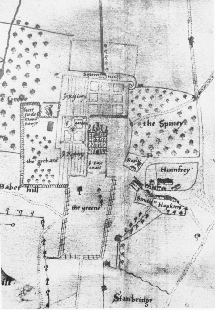
Detail of map of 1580, showing part of the village, the site of the early manor house and an early phase of the garden (see Plate 16). (NRO) Holdenby (3–5)
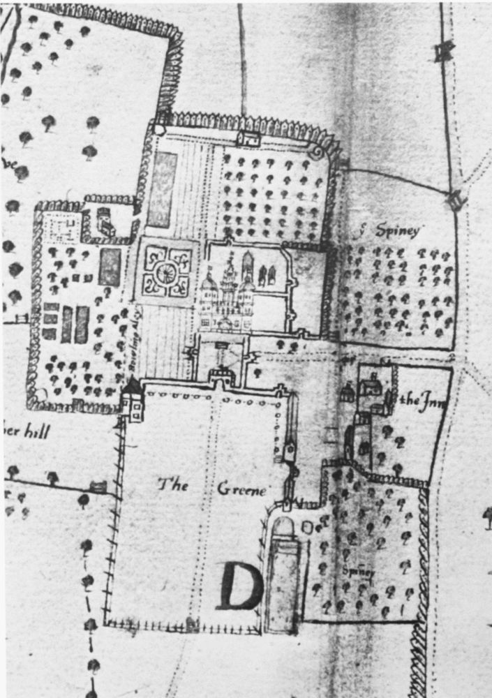
Detail of map of 1587, showing alterations to village and gardens and creation of deer park (see Plate 17). (NRO)