An Inventory of the Historical Monuments in the County of Northamptonshire, Volume 3, Archaeological Sites in North-West Northamptonshire. Originally published by Her Majesty's Stationery Office, London, 1981.
This free content was digitised by double rekeying. All rights reserved.
'Plate 17: Holdenby, Map of Parish, 1587', in An Inventory of the Historical Monuments in the County of Northamptonshire, Volume 3, Archaeological Sites in North-West Northamptonshire(London, 1981), British History Online https://prod.british-history.ac.uk/rchme/northants/vol3/plate-17 [accessed 19 April 2025].
'Plate 17: Holdenby, Map of Parish, 1587', in An Inventory of the Historical Monuments in the County of Northamptonshire, Volume 3, Archaeological Sites in North-West Northamptonshire(London, 1981), British History Online, accessed April 19, 2025, https://prod.british-history.ac.uk/rchme/northants/vol3/plate-17.
"Plate 17: Holdenby, Map of Parish, 1587". An Inventory of the Historical Monuments in the County of Northamptonshire, Volume 3, Archaeological Sites in North-West Northamptonshire. (London, 1981), British History Online. Web. 19 April 2025. https://prod.british-history.ac.uk/rchme/northants/vol3/plate-17.
Holdenby: Map of Parish, 1587
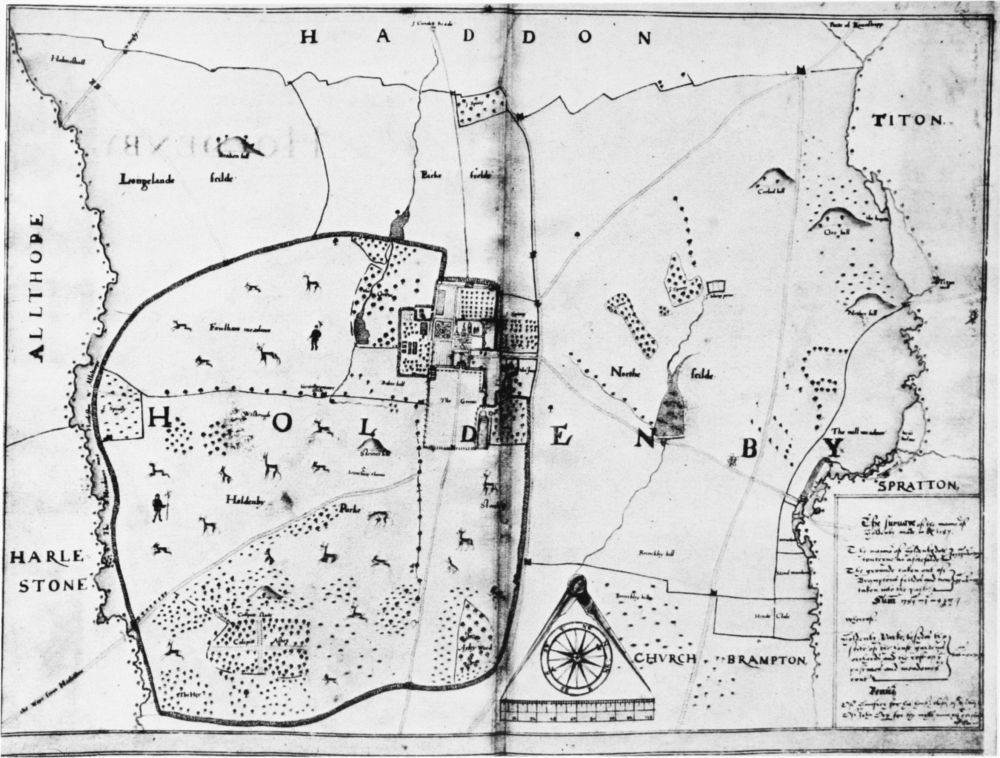
Holdenby (3–7). Map of parish, 1587, showing changes after 1580, including creation of deer park and ponds (for detail, see Plate 18). (NRO)