Ancient and Historical Monuments in the County of Gloucester Iron Age and Romano-British Monuments in the Gloucestershire Cotswolds. Originally published by Her Majesty's Stationery Office, London, 1976.
This free content was digitised by double rekeying. All rights reserved.
'Icomb', in Ancient and Historical Monuments in the County of Gloucester Iron Age and Romano-British Monuments in the Gloucestershire Cotswolds(London, 1976), British History Online https://prod.british-history.ac.uk/rchme/ancient-glos/pp66-67 [accessed 5 May 2025].
'Icomb', in Ancient and Historical Monuments in the County of Gloucester Iron Age and Romano-British Monuments in the Gloucestershire Cotswolds(London, 1976), British History Online, accessed May 5, 2025, https://prod.british-history.ac.uk/rchme/ancient-glos/pp66-67.
"Icomb". Ancient and Historical Monuments in the County of Gloucester Iron Age and Romano-British Monuments in the Gloucestershire Cotswolds. (London, 1976), British History Online. Web. 5 May 2025. https://prod.british-history.ac.uk/rchme/ancient-glos/pp66-67.
ICOMB
(18 miles N.E. of Cirencester)
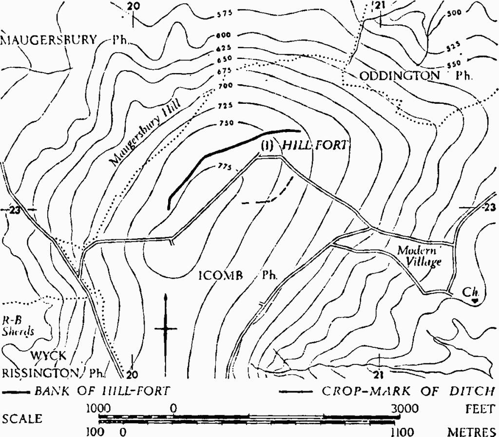
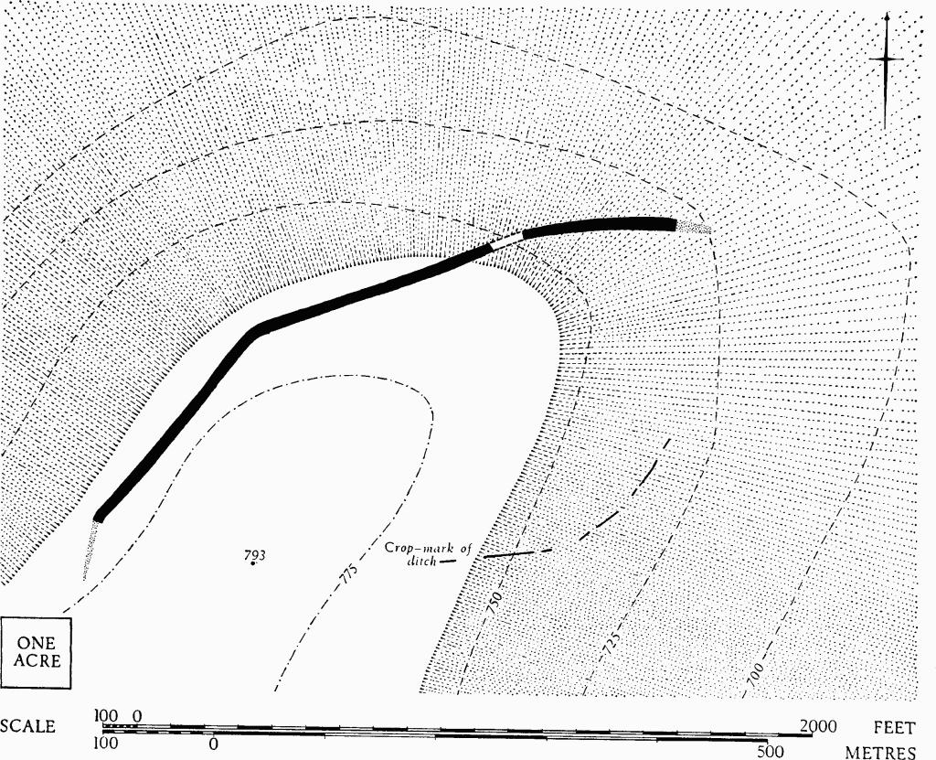
(1) Probable Hill-fort (SP 205230), unexcavated and almost completely destroyed, stands on Icomb Hill, ¾ mile N.W. of the village, its E. end dropping below the summit of the hill (Plate 36).

Monuments in Icomb.
The surviving bank, 30 ft. wide and generally under 1 ft. high, with a ditch formerly on the N. side, can be traced for about 780 yds. in arable fields, along the N. and N.W. sides of the hill only. There are indications of discontinuous ditches on the S. slope of the hill, in a position that could suggest an unfinished part of the supposed hill-fort. Plan, p. 67.
During investigation three featureless sherds of coarse hand-made pottery (now in Gloucester City Museum) were recovered from ploughsoil over the E. end of the bank.
A late 18th-century map, made when the bank was already extensively ploughed, depicts an irregular oval enclosure in which the N.W.-S.E. diameter measured approximately 1,100 ft. (I. Taylor, Map of Gloucestershire (1777); T. Nash, Collections for the History of Worcestershire, II (1782), 2). In its N. half this plan conforms to that on O.S., 1816, which shows the bank continuing S. for some 700 ft. beyond the point where it now disappears.
Playne (1876), 208, No. 7. Witts (1883), 27, No. 55. Bagendon, 25, n. 4.
N.M.R., OAP SP 2023/4/199 to 2023/7/208.

Icomb. (1) Probable Hill-fort.