Ancient and Historical Monuments in the County of Gloucester Iron Age and Romano-British Monuments in the Gloucestershire Cotswolds. Originally published by Her Majesty's Stationery Office, London, 1976.
This free content was digitised by double rekeying. All rights reserved.
'Kemble', in Ancient and Historical Monuments in the County of Gloucester Iron Age and Romano-British Monuments in the Gloucestershire Cotswolds(London, 1976), British History Online https://prod.british-history.ac.uk/rchme/ancient-glos/p68 [accessed 5 May 2025].
'Kemble', in Ancient and Historical Monuments in the County of Gloucester Iron Age and Romano-British Monuments in the Gloucestershire Cotswolds(London, 1976), British History Online, accessed May 5, 2025, https://prod.british-history.ac.uk/rchme/ancient-glos/p68.
"Kemble". Ancient and Historical Monuments in the County of Gloucester Iron Age and Romano-British Monuments in the Gloucestershire Cotswolds. (London, 1976), British History Online. Web. 5 May 2025. https://prod.british-history.ac.uk/rchme/ancient-glos/p68.
KEMBLE
(3 miles S.W. of Cirencester)
The Foss Way forms the N.W. boundary of the parish. 'Roman flue-tiles' are reported from Ewen (su 00489721), (fn. 1) but field investigation has not confirmed the existence of a building.

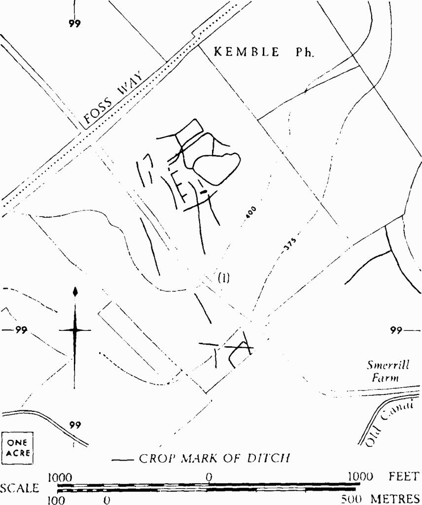
Kemble. (1) Probable Settlement.
(1) Probable Settlement (ST 993993), undated, is revealed by crop-marks 100 yds. S.E. of the Foss Way (Plate 63); the main area, about 6 acres, occupies generally level ground on a spur of the plateau.
C.U.A.P., OAP AOS 7–8.