Survey of London: Volume 39, the Grosvenor Estate in Mayfair, Part 1 (General History). Originally published by London County Council, London, 1977.
This free content was digitised by double rekeying. All rights reserved.
'Plate 44: Elevations in stone, 1900–1914', in Survey of London: Volume 39, the Grosvenor Estate in Mayfair, Part 1 (General History), ed. F H W Sheppard (London, 1977), British History Online https://prod.british-history.ac.uk/survey-london/vol39/pt1/plate-44 [accessed 12 February 2025].
'Plate 44: Elevations in stone, 1900–1914', in Survey of London: Volume 39, the Grosvenor Estate in Mayfair, Part 1 (General History). Edited by F H W Sheppard (London, 1977), British History Online, accessed February 12, 2025, https://prod.british-history.ac.uk/survey-london/vol39/pt1/plate-44.
"Plate 44: Elevations in stone, 1900–1914". Survey of London: Volume 39, the Grosvenor Estate in Mayfair, Part 1 (General History). Ed. F H W Sheppard (London, 1977), British History Online. Web. 12 February 2025. https://prod.british-history.ac.uk/survey-london/vol39/pt1/plate-44.
In this section
Elevations in Stone, 1900–1914
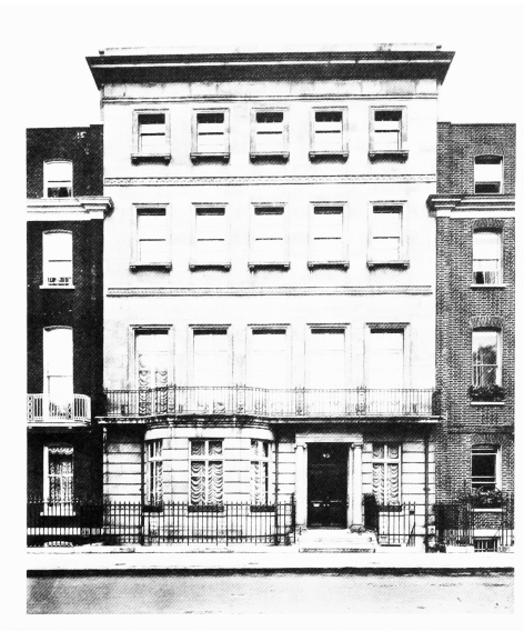
a. No. 45 Grosvenor Square in 1910.

Elevations in stone, 1900–1914
No. 45 Grosvenor Square in 1910.
Edmund Wimperis and Hubert East, architects of front, 1902. Demolished
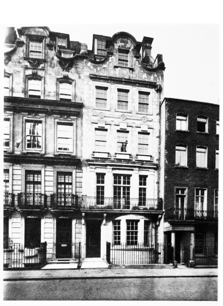
b. Nos. 16 (centre) and 17 (left) Upper Brook Street in 1913.

Elevations in stone, 1900–1914
Nos. 16 (centre) and 17 (left) Upper Brook Street in 1913.
Edmund Wimperis and J. R. Best, architects, 1907–13
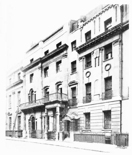
c. Nos. 73 (centre right), 74 (left centre) and 75 (far left) South Audley Street in 1943.

Elevations in stone, 1900–1914
Nos. 73 (centre right), 74 (left centre) and 75 (far left) South Audley Street in 1943.
Front of No. 73 by Paul Waterhouse (1909), of No. 74 by Balfour and Turner (1908), and of No. 75 by Cyrille J. Corblet (1906–7)
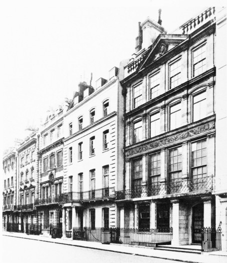
d. Nos. 17–21 (consec.) Upper Grosvenor Street (right to left) in 1927.

Elevations in stone, 1900–1914
Nos. 17–21 (consec.) Upper Grosvenor Street (right to left) in 1927.
No. 17 by Balfour and Turner (1906–7); No. 19 by Maurice C. Hunbert (1909–10); No. 20 probably by Boehmer and Gibbs (1909); and No. 21 by Ralph Knott and E. Stone Collins (1908)
