A History of the County of Oxford: Volume 18. Originally published by Boydell & Brewer for the Institute of Historical Research, Woodbridge, Suffolk, 2016.
This free content was digitised by double rekeying. All rights reserved.
'Plates', in A History of the County of Oxford: Volume 18, ed. Simon Townley (Woodbridge, Suffolk, 2016), British History Online https://prod.british-history.ac.uk/vch/oxon/vol18/plates [accessed 31 January 2025].
'Plates', in A History of the County of Oxford: Volume 18. Edited by Simon Townley (Woodbridge, Suffolk, 2016), British History Online, accessed January 31, 2025, https://prod.british-history.ac.uk/vch/oxon/vol18/plates.
"Plates". A History of the County of Oxford: Volume 18. Ed. Simon Townley (Woodbridge, Suffolk, 2016), British History Online. Web. 31 January 2025. https://prod.british-history.ac.uk/vch/oxon/vol18/plates.
In this section
Plates
The local landscape
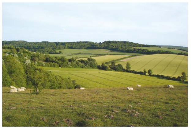
Looking south from Swyncombe Downs across the undulating Chiltern foothills.
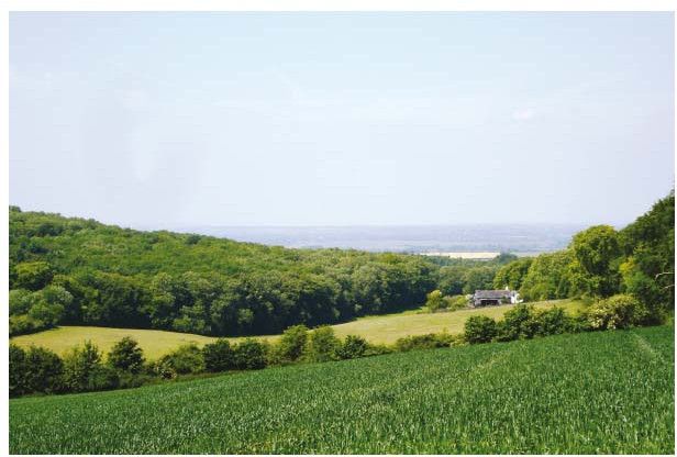
Looking west towards the clay vale and the Thames, down the wooded Chiltern scarp near Nuffield.
Early estate maps

Newington in 1595 (north to left), showing rectory house, church, and manor house ('Mr Oglethorps'), and houses at Newington green.
Warborough green in 1606, showing church and vicarage and (west of the road) the parsonage barns.
Early estate maps
Huntercombe (in Nuffield) in 1665, showing the manor house north of the Henley road (labelled the 'way from Gloucester').
Great Haseley church and manor house in 1729, showing adjoining open fields and the surviving medieval barn north of the church.
Early estate maps
The shared fields of Benson, Ewelme, and Berrick Salome in 1788; blue-coloured strips owed tithe to Benson, yellow to Ewelme, and pink to Berrick.
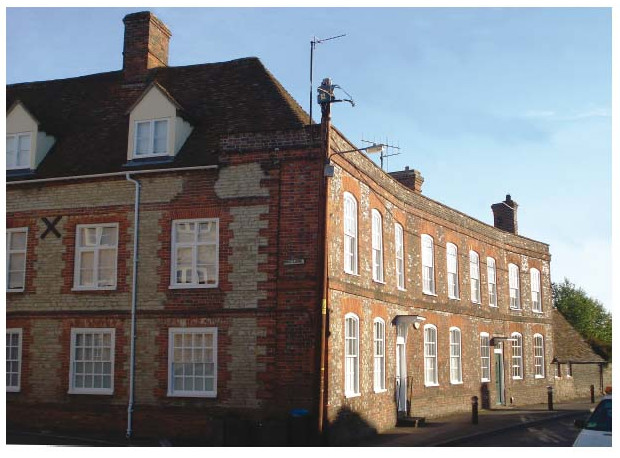
Vernacular buildings
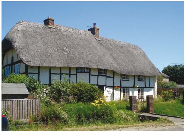
No. 59 High Street, Chalgrove (predominantly 17th-century): timber framing and thatch.
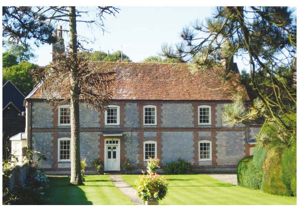
Fords Farm in Ewelme (17th- to 18th-century): coursed clunch rubble, brick dressings, and tiled roof.
Former coaching inns
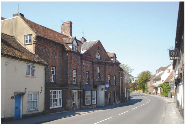
The former Bull Inn at Nettlebed, with its 18th-century pedimented front.
The former Red Lion at Benson, remodelled piecemeal c.1680–1752.
Ewelme Almshouses (God's House), built c.1437–50s
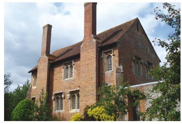
The grammar (now primary) school from the south-east.
The almshouse cloister entrance from the south-west, with its decorative brickwork.
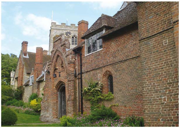
Church interiors
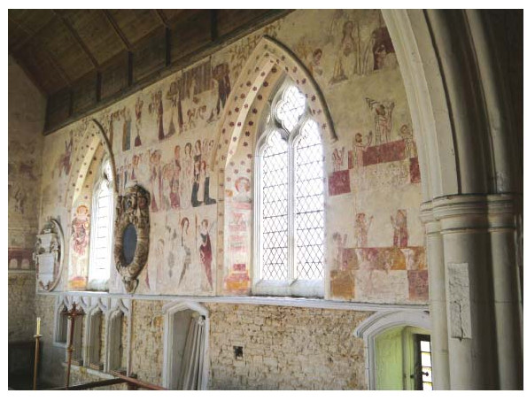
Chalgrove: early 14th-century wall paintings in the chancel, including scenes from the life of the Virgin.
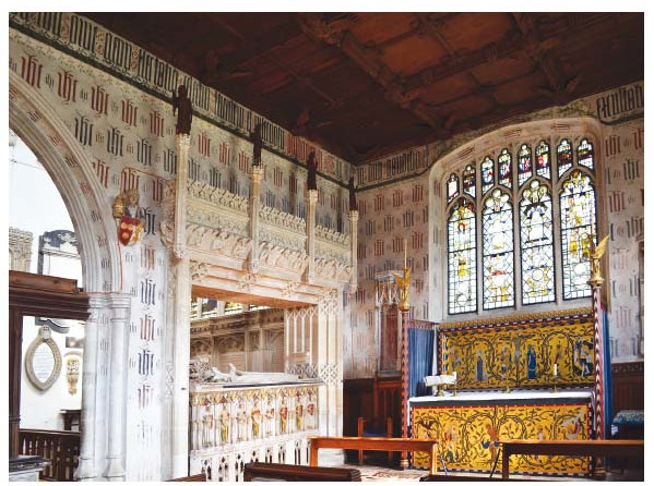
St John's chapel in Ewelme church, showing Alice de la Pole's tomb and Ninian Comper's altarpiece of 1904.