Ancient and Historical Monuments in the County of Gloucester Iron Age and Romano-British Monuments in the Gloucestershire Cotswolds. Originally published by Her Majesty's Stationery Office, London, 1976.
This free content was digitised by double rekeying. All rights reserved.
'Quenington', in Ancient and Historical Monuments in the County of Gloucester Iron Age and Romano-British Monuments in the Gloucestershire Cotswolds(London, 1976), British History Online https://prod.british-history.ac.uk/rchme/ancient-glos/pp95-97 [accessed 24 February 2025].
'Quenington', in Ancient and Historical Monuments in the County of Gloucester Iron Age and Romano-British Monuments in the Gloucestershire Cotswolds(London, 1976), British History Online, accessed February 24, 2025, https://prod.british-history.ac.uk/rchme/ancient-glos/pp95-97.
"Quenington". Ancient and Historical Monuments in the County of Gloucester Iron Age and Romano-British Monuments in the Gloucestershire Cotswolds. (London, 1976), British History Online. Web. 24 February 2025. https://prod.british-history.ac.uk/rchme/ancient-glos/pp95-97.
QUENINGTON
(7 miles E. of Cirencester)
(1) Probable Settlement and Linear Ditches (SP 121046), undated, exist as crop-marks over an area of at least 6 acres, extending N.-S., 600 ft. S. of the Roman road (2). Plan, p. 96.
N.M.R., OAP SP 1204/1/397–401.
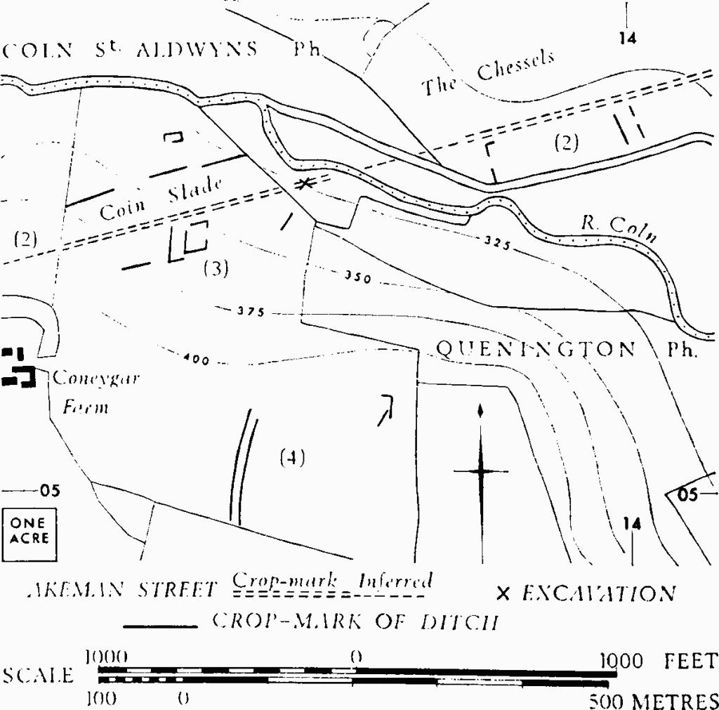
(2) Roman Road, Akeman Street (SP 12400504, SP 13010520). The agger survives in pasture as an earthwork 1 ft. high and 24 ft. across, much disturbed by quarrying; it also forms the S. boundary of a copse. Plan, p. 96.
Excavations in 1952 at x (SP 13670538), across the line of the road where it sloped down to the R. Coln, revealed an agger of rammed gravel 31 ft. wide with a central channel. Kerbstones existed on the S. side, but on the N. the edge was obscured by Roman walling.
R.A.F., VAP 106G/UK/1721: 5271–3.
TBGAS, 76 (1957), 35–43.
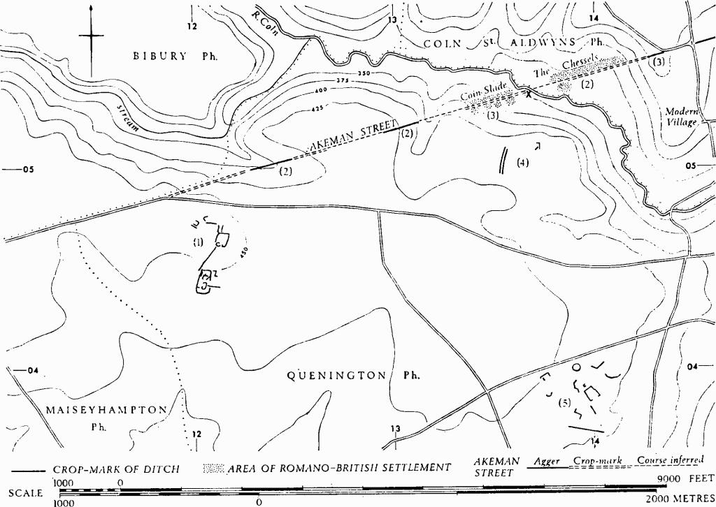
Monuments in Quenington and Coln St. Aldwyns.
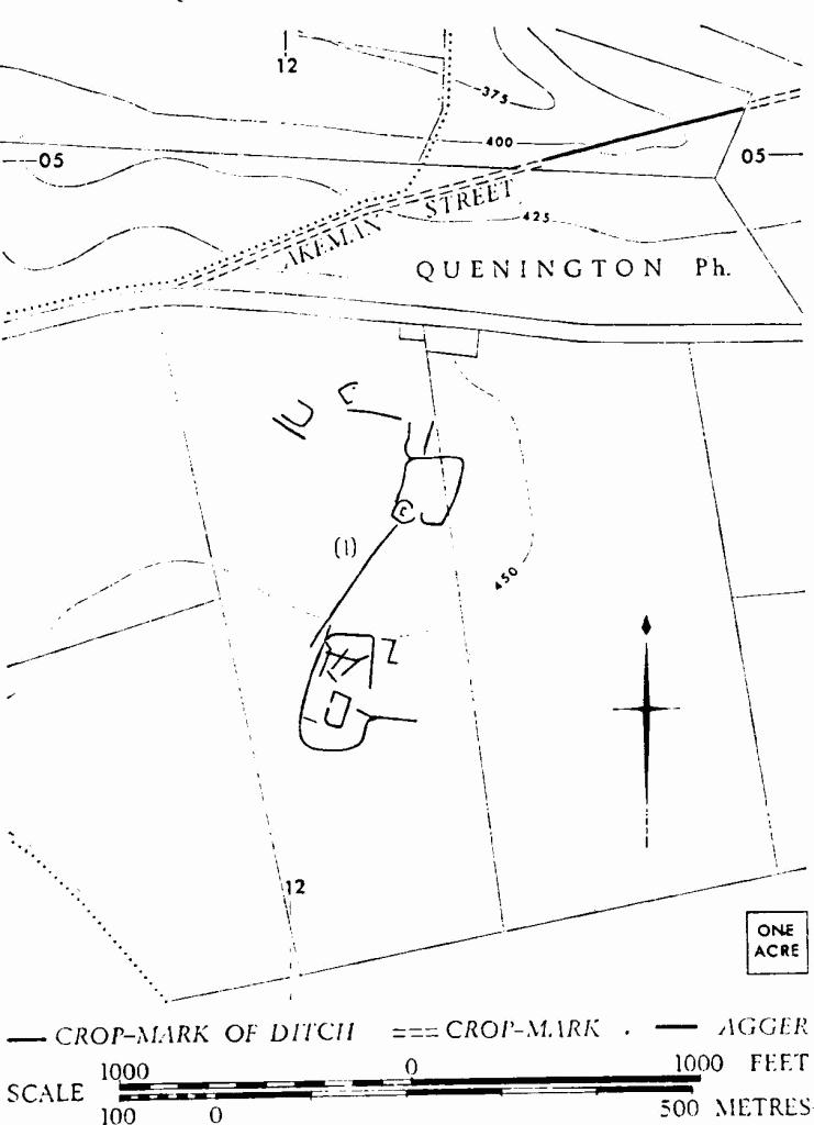
Quenington. (1) Probable Settlement.
Quenington. (2) Roman Road. (3) Probable Settlement. (4) Wide Track.
(3) Probable Settlement (SP 135054), Romano-British, Coin Slade (fn. 1) (TBGAS, 76 (1957), 35–43), lies on both sides of Akeman Street as it descends to the R. Coln and is marked on the ground by a scatter of worked limestone blocks from buildings, and by samian ware and 3rd and 4th-century coarse pottery. A limited excavation in 1951–2 in the area around SP 13670538 (x) yielded a quantity of coarse pottery, largely of the 4th century and including a few stamped sherds; also 28 coins ranging from Gallienus to Valens and the gold bezel of a ring inscribed CONCORDIA. Roman coins in Corinium Museum from this site are not distinguished from others recovered at Coln St. Aldwyns.
A remarkable collection of almost complete samian vessels, at least ten of them with potters' stamps, was found near the settlement in 1958; this pottery is in Corinium Museum.
(4) Wide Track (SP 135050), shows as a crop-mark about 300 yds. S. of Akeman Street.
N.M.R., OAP SP 1304/1/176–7.
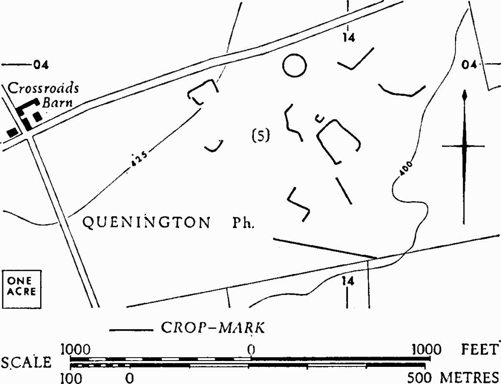
Quenington. (5) Enclosures and Linear Ditches.
(5) Enclosures and Linear Ditches (SP 140039), undated, show as crop-marks covering at least 20 acres, E. of Crossroads Barn.
N.M.R., OAP SP 1303/1/181–2.