Ancient and Historical Monuments in the County of Gloucester Iron Age and Romano-British Monuments in the Gloucestershire Cotswolds. Originally published by Her Majesty's Stationery Office, London, 1976.
This free content was digitised by double rekeying. All rights reserved.
'Coln St. Aldwyns', in Ancient and Historical Monuments in the County of Gloucester Iron Age and Romano-British Monuments in the Gloucestershire Cotswolds( London, 1976), British History Online https://prod.british-history.ac.uk/rchme/ancient-glos/pp36-37 [accessed 23 November 2024].
'Coln St. Aldwyns', in Ancient and Historical Monuments in the County of Gloucester Iron Age and Romano-British Monuments in the Gloucestershire Cotswolds( London, 1976), British History Online, accessed November 23, 2024, https://prod.british-history.ac.uk/rchme/ancient-glos/pp36-37.
"Coln St. Aldwyns". Ancient and Historical Monuments in the County of Gloucester Iron Age and Romano-British Monuments in the Gloucestershire Cotswolds. (London, 1976), , British History Online. Web. 23 November 2024. https://prod.british-history.ac.uk/rchme/ancient-glos/pp36-37.
COLN ST. ALDWYNS
(8 miles E.N.E. of Cirencester)
The Roman Settlements on Akeman Street, Coln St. Aldwyns (2) and Quenington (3), 200 yds. apart, are divided by the now marshy floor of the Coln valley. Roman coins in Corinium Museum have been collected from both sites.

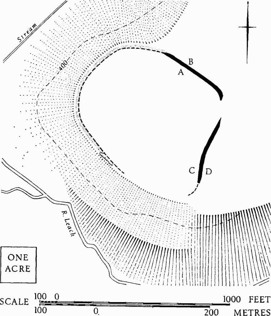
Coln St. Aldwyns. (1) Dean Camp.
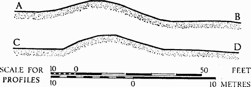
(1) Dean Camp (SP 165087), univallate hill-fort, unexcavated, encloses 12 acres on a spur of Great Oolite at the junction of the R. Leach and a tributary, 2¼ miles N.N.E. of the village. The E. and N.E. sides are defined by a bank up to 40 ft. wide and 6 ft. high, with no visible ditch; the N. and W. sides are defined by a short scarp which does not continue on the S. The entrance is probably marked by a gap in the bank on the E.
Playne (1876), 213, No. 26. Witts (1883), 30, No. 60 (Ladborough Camp). Bagendon, 25, n. 4.

Coln St. Aldwyns. (1) Dean Camp. Profiles.
(2) Romano-British Settlement (SP 140055), The Chessels (TBGAS, 76 (1957), 35), lies at about 325 ft. above O.D., in arable, on an E.-W. terrace above the R. Coln (plan, p. 96, s.v. Quenington). It is marked by building debris in the form of large limestone blocks, pottery of the 2nd to 4th centuries, 3rd and 4th-century coins, and other small finds made along and immediately N. of Akeman Street, over a length of 300 yds. or more. Similar debris is scattered in a restricted area on the S. of the Roman road, at the W. limit of settlement (SP 13840540).
Small finds include a fragment of glass, a 4th-century tinned bronze spoon with ring-and-dot ornament, and 3rd and 4th-century coarse pottery; these are in the Ashmolean Museum. Part of the neck of a coarse-ware flagon in the form of a woman's head, and bronze coins of Constantine I and Constantine II are in Gloucester City Museum.
(3) Roman Road, Akeman Street (SP 141055), is traceable through The Chessels (2) as a crop-mark, and its line is further marked on the ground by a later hollow-way on the steep rise at SP 14280555. To the E., where ploughing has taken place in Williamstrip Park, the straight line of the road is confirmed by crop-marks. (Plan s.v. Quenington).
