A History of the County of York North Riding: Volume 2. Originally published by Victoria County History, London, 1923.
This free content was digitised by double rekeying. All rights reserved.
'Parishes: Alne', in A History of the County of York North Riding: Volume 2, ed. William Page (London, 1923), British History Online https://prod.british-history.ac.uk/vch/yorks/north/vol2/pp85-91 [accessed 19 April 2025].
'Parishes: Alne', in A History of the County of York North Riding: Volume 2. Edited by William Page (London, 1923), British History Online, accessed April 19, 2025, https://prod.british-history.ac.uk/vch/yorks/north/vol2/pp85-91.
"Parishes: Alne". A History of the County of York North Riding: Volume 2. Ed. William Page (London, 1923), British History Online. Web. 19 April 2025. https://prod.british-history.ac.uk/vch/yorks/north/vol2/pp85-91.
In this section
ALNE
Alen (xi cent.).
Alne comprises the townships of Alne, Tholthorpe, Aldwark, Flawith, Youlton and Tollerton.
The whole parish covers an area of about 9,992 acres. It lies in the plain of York at a height varying between 50 ft. and 75 ft. above the ordnance datum, while much of the land about the River Kyle in the south of the parish is liable to floods. There is a large tract of alluvium, but sand and loam are found in the west of the parish. About 4,890 acres are under cultivation as arable land and 3,950 acres are laid down to permanent grass. (fn. 1) Wheat, oats, barley and beans are grown, while 188 acres are covered with woods and plantations.
The main line of the North Eastern railway passes through the parish and there are stations at Tollerton and Alne, the latter being the junction for the main line and the light railway to Easingwold.
The chief road is that running north-west from York to Brafferton. On this road the villages of Tollerton and Flawith are built, while the village of Alne itself lies off the road and towards the north. At the starting-point of the connecting lane stands an old cross known as the Plague Stone; according to tradition, when the plague was raging in Yorkshire in 1604 the inhabitants deposited their goods and purchase money on this stone.
The lane crosses the Kyle by Alne Bridge and runs along the west side of Alne Park past an ancient well. Alne Hall, now the residence of Mr. John Swainston-Strangwayes, D.L., J.P., was in the Middle Ages the country house of the treasurers of St. Peter's, York. The house is mentioned in 1301, (fn. 2) when the treasurer's proctor was pardoned for having received Sir Erard de Baro into his house with venison poached from the royal forest of Galtres. An interesting inventory is given of the manor-house in 1508, showing it to have been of considerable size and well-furnished. (fn. 3)
The last treasurer, Lancelot Collins, was living there when news was brought him of the insurrection in Lincolnshire. (fn. 4) It was afterwards inhabited by the Bethells, and in 1672 (fn. 5) Lady Bethell was licensed to hold a Nonconformist meeting at her house at Alne. There is a Wesleyan chapel at Alne, built in 1848. Hall Garth, mentioned in 1611–12, was no doubt near the site of the old manor-house. (fn. 6)
The Kyle flows through Alne Park and is joined there by Whitecarr Ings Beck not far from the supposed site of a Roman road which crosses Alne Park.
The water-mill on the Kyle at the south-east extremity of the park and close to Carrholme Bridge formerly belonged to the treasurer of St. Peter's of York, (fn. 7) from whom it passed to Thomas first Lord Fauconberg. It was granted by him to John Russell, (fn. 8) the miller, together with a cottage and meadows called 'Foggerlandsides' and 'Taberflatt.'
Windmill Field, beside the main road, no doubt derives its name from the treasurer's windmill which was leased by James I to Edmund Sawyer. (fn. 9)
The village of Alne lies to the north of the hall and may be reached by either of two forking lanes. It consists of a number of cottages of no great age standing back from the road and with gardens in front. The church of St. Mary lies down the more western of these branches, but most of the houses are built along a road running east and west. Snowfield Farm, in the fields north of the village, was formerly included in the treasurer's manor, and was granted (fn. 10) with a dovecote and fields called Longlanding Acre, Willingstoneing, Rothinge and Christenberking to various freeholders in 1611–12. The township of Alne covers 2,268 acres.
Tollerton is a large and picturesque hamlet with a station lying a mile and a half south of Alne. It contains no features of particular interest.
The township, covering 2,201 acres, in 1901 contained 504 inhabitants and is built along the York road and a fork formed by a cross lane, the triangular village green lying at the junction of these two roads. Here milling and malting are carried on, while there are brick and tile works in the east of the township. There is a Wesleyan chapel, built in 1869.
York Bridge, Fleet Bank, Warehill, Wetland, Middle Cavil and Breckland Fields with Angram Closes probably represent the old open fields which were inclosed under an Act obtained in 1810. (fn. 11)
West of Tollerton and bordered by Linton-uponOuse is Youlton, a hamlet lying on the road from Aldwark Bridge over the Ouse to the Plague Stone; it consists of a group of early 18th-century farmhouses and buildings. Its chief interest centres in its hall, now occupied by Mr. J. W. Middleton. Here stood the capital messuage of a younger branch of the family of Roos, and traces of an extensive moat remain in the field about the house. James I is said to have rested here on the occasion of various journeys between London and Edinburgh. (fn. 12) Youlton Lodge lies in an isolated position among fields to the east of the hamlet and close to the River Kyle. The township covers 803 acres.
The township of Aldwark, covering 2,337 acres, lies on the east bank of the River Ouse. The village stands on low ground by the river bank, and is built along Rice Lane, which, leading from Aldwark Bridge, runs parallel with the river for some distance, and then turns north through the fields till it joins the road from York to Brafferton. The houses in the village on the west side have each a close running down to the water, and just to the north-west of the village is the town pasture. The moat marking the site of Aldwark Hall lies in a large park at the southern end of the village.
The present Aldwark Manor, the property of Lord Walsingham and the residence of Mrs. Gunter, is a large modern mansion; it lies considerably to the south of the old house, of which no traces are now left except these portions of the moat. Close by is a field known as Chapel Garth. This possibly marks the site of a domestic chapel. Legend says that this neighbourhood was once haunted by a wandering ghost, which was eventually exorcised and confined under what is still called the 'Conjuring Stone. (fn. 13)
To the east of Aldwark is Aldwark Moor, of which the tract known as Hall Moor is the only part not under cultivation.
In the 13th century meadows are mentioned called 'Coningsrise' and 'Aiketrelandes,' on the north side between the water of the Ure and the high road which goes through the middle of Aldwark (fn. 14); they belonged at an early date to Fountains Abbey.
Beyond the hamlet of Flawith is the larger village of Tholthorpe, built on low-lying ground by the Kyle, here called Derring's Beck. At the east end of the village street is a large green with a pond of considerable size. The Methodist chapel stands near the river, which is here crossed by a bridge; the chapel was built in 1844 and restored in 1894. The manor-house lies at the west end of the main street. The eastern portion of the township is still called Tholthorpe Moor, though it has been long inclosed. To the south of the village lie Tholthorpe Fields, which with 'the Heads' in the adjoining township of Flawith, were inclosed under an Act obtained in 1800. The township of Flawith covers 607 acres and that of Tholthorpe 1,776 acres.
The whole of this district, and indeed most of the wapentake, once lay within the royal forest of Galtres, the bounds of which were described in 1316 as beginning at the foot of the wall of the city of York at the bridge of Layrthorpe following the wall as it goes up to the Boutham gates and so . . . to the river of Ouse thence to Benningburgh and Newton Bridge and so by Lynton brook and the midst of Lynton marsh going on to the west of the village of Tollerton as far as Carne brig, and from the bridge of Carne following the said brook through the midst of Alne marsh, and so following the water of Kyle through the midst of Mikelbar to Raskelf bridge and so going up by Waneless mill and Wyteker brook between the demesne of our lord the king and Thornton wood to the park of Crayk, going up and following the bounds of the said park to the water of Foss and to the mill of Stillington and by the same water to the priory of Melsenby and so to the Brendmilne of Farlington and so by the said water to the mill of Bulford and so to Strensale and so to Huntingdon by the same water even to the foot of the wall of Layrthorpe bridge where the perambulation began, and in the aforesaid perambulation were situated without the forest in the balliwick of Kyle, the villages of Lynton, Aldwark, Tholthorpe, Brafferton, Helperby, Flathworth, Miton, Faldington, Thornotby, Cessey, Raskelf and Youlton with their woods and fields.
The aforesaid villages were in the forest at some time before the enclosure of the forest made by Henry II. (fn. 15)
Alne itself was waste in 1086, and later was included in the forest of Galtres. (fn. 16) From the 13th century, however, the land was being assarted and brought into cultivation. (fn. 17) Traces of its former character may still be found in the names of Alne and Tollerton Forests given to the wooded fields in the east of those townships.

Archbishopric of York. Gules St. Peter's keys argent crossed saltirewise with the mitre of the pope or in the chief.
Manors
At the time of the Domesday Survey and also before 8 carucates at ALNE were included in the lands of the Archbishop of York. (fn. 18) The vill was assigned, probably in the 12th century, together with Tollerton to the treasurer of St. Peter's, York, the two forming one manor (fn. 19) in the liberty of St. Peter. (fn. 20)
Alne remained in the hands of the treasurer until the Dissolution, (fn. 21) when he held the manor of Alne and Tollerton as well as the rectory manor of Alne, both of which came to the Crown, and were granted by Edward VI to Edward Duke of Somerset in 1547. (fn. 22) On his attainder they reverted to the Crown.
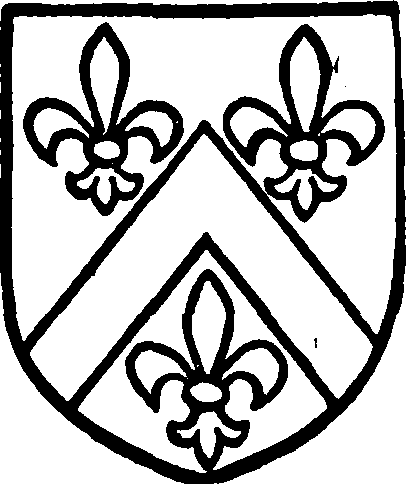
Bellasis, Viscount Fauconberg. Argent a cheveron gules between three fleurs de lis azure.

Wombwell, baronet. Gules a bend between six unicorns' heads argent.
In 1612 the manor of Alne and Tollerton was sold by James I (fn. 23) to John Ibson, Robert Fawdington, (fn. 24) Thomas Graver and John Fountains, yeomen, for the use of the tenants. (fn. 25) These tenants, 'of purpose to preserve the said manor and services thereto belonging,' sold it in 1618 to Sir Henry Bellasis, bart., (fn. 26) and Thomas his son and heir, who as Viscount Fauconberg held it in 1651. (fn. 27) From this time the manor has followed the descent of that of Newburgh (fn. 28) (q.v.), and Sir George O. Wombwell, bart., V.C., J.P., is now lord of the manor.
In 1588 what would appear to have been the RECTORY MANOR of Alne and Tollerton was granted to Richard Branthwait and Roger Bromley, (fn. 29) and before 1603 (fn. 30) it had passed to Sir Hugh Bethell, who in that year settled it on his nephew Walter Bethell and Mary Slingsby his wife in tail-male with remainder to his own male issue and contingent remainders to Hugh Bethell and others. In 1611 Sir Hugh Bethell died. (fn. 31) He left no sons, (fn. 32) his heir being his only daughter Grizell, the wife of Sir John Wray. In 1614 (fn. 33) she quitclaimed her right to these lands in favour of Walter Bethell, whose property was increased in 1618 by the purchase of a fourth part of the treasurer's manor from John Fountains. (fn. 34) Walter Bethell died in 1623, (fn. 35) his son and heir Hugh being nineteen years old. Hugh was followed by a son Walter, who held the manor in 1668. (fn. 36) His son Hugh died without children, (fn. 37) when the family estates passed to a cousin William Bethell. He died in 1699, leaving a son Hugh and a daughter Elizabeth. (fn. 38) Alne appears to have passed to Elizabeth, who married Sir William Codrington. (fn. 39) Her third son Christopher assumed the surname of Bethell, and it seems probable he inherited the family estates at Alne. (fn. 40) He married the Hon. Anne Sandys and died without children, when Alne apparently passed to his nephew Christopher Codrington, who also assumed the additional surname of Bethell, and was holding this 'manor' in 1798 (fn. 41) with his wife Caroline Georgiana Harriet, the daughter of Lord Foley. (fn. 42) In that year his brother William John took the name of Bethell and with it the Alne estates. He died in 1831, (fn. 43) leaving one daughter Emma, who died unmarried in 1874. (fn. 44) This estate is probably identical with that now owned by Mr. J. T. Mintoft.
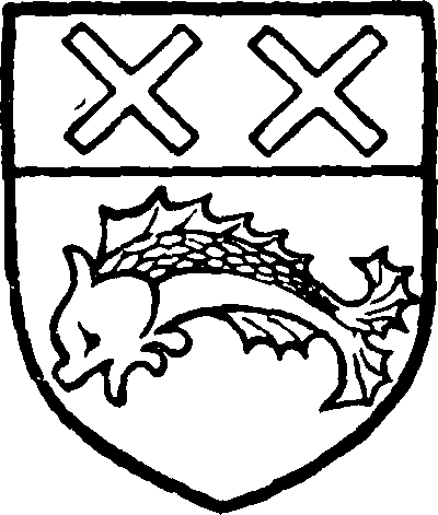
Bethell. Argent a cheveron between three boars' heads sable with a star argent upon the cheveron.
At the time of the Domesday Survey a 'manor' of 8 carucates in ALDWARK (Adewerca, xi cent.; Audewerk, Aldewerk, xiii–xv cent.; Aldwarke, xvi cent.), once held by Ligulf, was in the hands of the Count of Mortain. (fn. 45) It was granted, probably on the count's forfeiture, to the Archbishop of Canterbury and formed part of the barony of Whorlton (q.v.), which it followed in descent till 1418. With Yarm (q.v.) it was divided in 1556–7 among the daughters and co-heirs of John Conyers: Margaret, who died unmarried in February 1559–60, Anne wife of Anthony Kempe, Elizabeth wife of Thomas Darcy, and Katherine wife of John Atherton. (fn. 46) Anne Kempe died in 1567, (fn. 47) leaving a son Henry, aged six, who died without children. (fn. 48) Elizabeth Darcy left one son, Conyers Darcy, who in 1582–3 (fn. 49) held two-thirds of the manor. In 1585 (fn. 50) John Atherton and Katherine his wife sold their third of the manor to Richard Frankland and Brian Askwith, and in March 1587–8 Richard Frankland died (fn. 51) seised of the whole manor, having a few days before his death leased his lands in Aldwark for twenty-one years to Hugh and William Frankland. (fn. 52) Richard left three sons, of whom Henry, the eldest, succeeded his father and married first Jane daughter of Sir Charles Wren, on whom a settlement was made in 1591; they had one son Anthony. (fn. 53) Henry Frankland died in 1622, (fn. 54) leaving three sons, Anthony, Thomas and Henry. In 1636 Anthony sold Aldwark to his uncle Thomas, (fn. 55) who settled it the following year on his nephew Thomas, Anthony's half-brother. (fn. 56) Thomas died unmarried, and in 1644 Aldwark was in the hands of his brother Henry Frankland. (fn. 57) He married Dorothy Holcroft, a settlement being made in 1650, (fn. 58) and was followed by his son Anthony, who held the manor in 1672–3. (fn. 59)
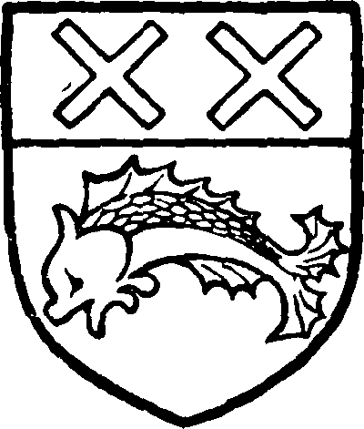
Frankland, baronet. Azure a dolphin or and a chief or with two saltires gules therein.

Grey, Lord Walsingham. Barry argent and azure with three rings gules in the chief.
At some date between 1688 (fn. 60) and 1735 (fn. 61) it passed to the branch of the family seated at Thirkleby (q.v.), which it followed in descent until the death in 1849 of Sir Robert Frankland, bart. (fn. 62) It then passed to his eldest daughter and co-heir Augusta Louisa, who had married Thomas fifth Lord Walsingham. (fn. 63) Her son Thomas Lord Walsingham is now lord of the manor.
Early in the 13th century 6 carucates here were held by Maud wife of Roger de Bavent (fn. 64) and possibly tenant of the Meynells. In 1229–30 Geoffrey de Bavent quitclaimed all right in 4 carucates here to Stephen de Meynell, (fn. 65) who by 1245–6 had acquired the whole fee. (fn. 66) Roger and Maud de Bavent gave to Fountains Abbey I carucate of land and pasture for 200 sheep, as well as a meadow called Coningsrise and 12 acres called 'Aiketrelands.' To this grant Maud de Bavent later added a culture here called 'Wideflat,' with a sheepfold. Both these grants were confirmed by Andrew son of Roger de Bavent and by Ralph son of Robert, the abbot receiving a further confirmation in 1268 from Nicholas de Middleton and John de Crancewyke. (fn. 67)
These lands were granted in 1547 (fn. 68) to Edward Duke of Somerset; from him they passed to Robert and Peter Fawdington, yeomen farmers, who sold them to Thomas Waite. (fn. 69) They were again sold to Thomas Dickinson; his sons Thomas and Richard held them in 1684, and claimed that they were exempt from tithes as part of the temporalities of Fountains Abbey. (fn. 70)
No mention of FLAWITH (Flathwath, Flatwat, xii cent.; Flawith, xvi cent.; Flowith, Flaworth, xvii cent.) is found in the Domesday Survey, but it was included later in the Wake fee (fn. 71) and in 1316 (fn. 72) it was held together with Tholthorpe by William de Roos as appurtenant to his manor of Youlton (q.v.).
In 1252 Luke de Flawith and Agnes his wife granted a toft with 2 oxgangs and 8 acres of wood in Flawith to the Master and Brethren of the hospital of St. Leonard, York, (fn. 73) whose possessions were further increased in 1322 by William de Hilderthorp. (fn. 74) At the Dissolution these lands were valued at 10s. (fn. 75)
In 1086 THOLTHORPE (Turulfestorp, xi cent.; Turoldestorp, xiii cent.; Thoraldthorp, Tolthorp, xiv cent.) was soke of Helperby and in the hands of the Archbishop of York. It eventually formed part of the possessions of the treasurer of St. Peter's, York, and followed the descent of his manor of Alne and Tollerton (fn. 76) (q.v.).
Sixteen oxgangs of land here were in the hands of the Wakes in the 14th century, and may have formed part of the Mortain fee at an earlier date. The overlordship continued in the Wake family till it fell into abeyance. (fn. 77)
Before 1272 a mesne lordship was held by Geoffrey de Mortimer, who died in that year, when his widow Sybil received dower. (fn. 78) Geoffrey was followed by a son and heir William, who in 1285 held 2 carucates and 3 oxgangs. (fn. 79) In 1301 William de Barneby and Walter de Stokesby held lands in Tholthorpe, (fn. 80) probably in right of their wives. Walter died before 1312 and in 1315 his widow Joan granted the manor to Thomas de Tholthorpe and Alice his wife and their heirs with contingent remainder to their daughter Elizabeth. (fn. 81) In the following year Thomas son of Walter de Stokesby quitclaimed the manor to Roger Dammory and the lords of the vill were returned as Roger Dammory and William de Barneby. (fn. 82) The Stokesby portion was granted in 1340 by Elizabeth daughter of Roger Dammory and her husband John Bardolf of Wormegay to Sir Nicholas Dammory, kt., for life. (fn. 83) No further history of this holding has been found. Various members of the family of Barneby are mentioned in the 14th century, (fn. 84) and in 1553 Robert Barneby died seised of a capital messuage here and was succeeded by Lancelot his son. (fn. 85) Certain lands here formed part of the settlement made in 1320 on William de Roos of Youlton (q.v.), which they followed in descent until 1584. Richard Ellerker then conveyed 'the manor' to his brother Anthony, who in 1598 sold two messuages to John Fountains, Thomas Wharff and Anthony Tennant. (fn. 86) A great part of the land here is freehold.
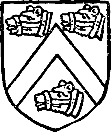
Barneby. Argent a cheveron between three bears' heads sable having muzzles or.
In 1285 the Abbot of Byland held 2 oxgangs and one toft in Tholthorpe, (fn. 87) and at the Dissolution a messuage and lands here belonging to the house were valued at 8s. (fn. 88)
The entry referring to TOLLERTON in the Domesday Survey shows that 8 carucates here were among the possessions of the Archbishop of York. (fn. 89) This land was granted to the treasurer of St. Peter's, York, and followed the descent of Alne (q.v.), being now in the hands of Sir George O. Wombwell, bart.
In 1291 the treasurer was granted a market every Wednesday at his manor of Tollerton and a yearly fair on the eve, day and morrow of the Assumption. (fn. 90) This grant was confirmed by Henry VIII in 1520. (fn. 91) The grant of the market was confirmed in 1358, when fairs were granted for the vigil, day and morrow of the Nativity of St. John the Baptist, and for the vigil, day and morrow of the Exaltation of the Holy Cross. (fn. 92)
Before 1366 lands in Tollerton, held of this fee in drengage, had been alienated by one of the treasurers to Theobald de Tollerton; after his death they passed to William his son and heir. (fn. 93) The latter alienated them in fee to Master Thomas de Twyselton; he was succeeded by his brother William, and they eventually passed to the daughter of William, who married Thomas Redman. (fn. 94) In 1367 John Redman and Cecily his wife sold six messuages, 5 ox gangs and other possessions in Tollerton to Robert de Rawcliff. (fn. 95) This land evidently remained in his family, three messuages being conveyed in 1513 from Robert Rawcliff to Roger Rawcliff. (fn. 96) In 1552 (fn. 97) Ralph Rawcliff sold the 'manor' and six messuages to Thomas Lawson 'of Poppleton.' Thomas was succeeded by a son Peter, (fn. 98) who with Elizabeth his wife sold the manor to William Sheppard in 1577. (fn. 99) William Sheppard and Elizabeth his wife conveyed land here to Guy Calvert in 1581, (fn. 100) but no further mention of this estate has been found. (fn. 101)
It seems probable that the greater part of YOULTON (Loletune, xi cent.; Yiolton, Yolton, xiii cent.) was assessed with the neighbouring vill of Linton-on-Ouse, where two 'manors' and 5 carucates of land once held by Torphin and Torn were in 1086 in the hands of the Count of Mortain. (fn. 102) This land followed the descent of Linton-on-Ouse (fn. 103) (q.v.), and the manorial rights are now exercised by University College, Oxford.
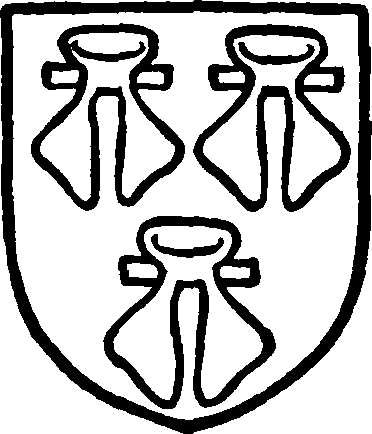
Roos. Gules three water budgets argent.
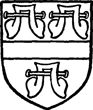
Ellerker. Argent a fesse between three water budgets gules.
A branch of the Roos family was enfeoffed in the manor of Youlton perhaps as early as the beginning of the 13th century, for a William de Roos disputed the right of Stephen de Meynell to land in Aldwark before 1245–6. (fn. 104) In 1301 William de Roos paid subsidy there, (fn. 105) and in 1312 he was at the head of a riotous party of forty-seven people (partly women) who raided the property of Joan widow of Walter de Stokesby of Tholthorpe, 'mowed her grass, burned part of her turves in her moor there, and carried away another part of her turves together with her grass.' (fn. 106) In 1315 William de Roos held 1 carucate in Youlton, (fn. 107) and the manor was settled on him and his wife Elizabeth with remainder to Joan their daughter in 1321 and 1322. (fn. 108) William died in 1345; he had two daughters, Joan the wife of John de Ellerker, and Margaret, who married Thomas de Musgrave and died during her father's lifetime, leaving a son Thomas, co-heir with his aunt Joan. (fn. 109) In accordance with the settlement, however, Elizabeth entered into possession (fn. 110) and was the tenant in 1352–3. (fn. 111) On her death the manor passed to the heirs of Joan wife of John de Ellerker, and in 1369 it was in the hands of Nicholas de Ellerker and Nicholaa his wife. (fn. 112) In 1415 Joan widow of Nicholas de Ellerker held the manor. (fn. 113)
Robert Ellerker was farmer of tithes in Youlton in 1508, (fn. 114) and was followed by a son Richard (fn. 115); Richard had a son Richard, who died in 1584 seised of a capital messuage or 'manor,' having two years before his death made a settlement in tail-male on his son and heir Richard on his marriage with Ann Thornton. (fn. 116) The last Richard was followed by his son Ralph, who died in 1639. (fn. 117) Richard son of Ralph succeeded and married Jane Atkinson, on whom a settlement was made in 1646. (fn. 118) He died in 1658, (fn. 119) leaving two sons, Richard and Thomas, and a daughter Elizabeth. (fn. 120)

Swainston. Azure a fesse or charged with three maidens' heads with veils in their proper colours.
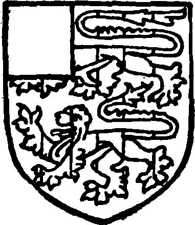
Strangwayes. Sable two lions passant paly argent and gules with a quarter argent.
This land probably became part of the Strangways estate. John Strangways, who was living in the parish in the middle of the 18th century, left an only daughter Frances, who married Alan Swainston and died in 1799. Their eldest son John died without issue in 1796 and his brother Edward was his mother's heir. His eldest son and heir Edward Swainston died in 1877, when the estate passed to John his son.
Mr. John Swainston-Strangwayes, D.L., J.P., is now the owner of this property.
At the time of the Domesday Survey certain lands in Youlton were soke of Helperby and in the hands of the Archbishop of York. (fn. 121) They were appurtenant to the manor of Alne and Tollerton (q.v.), which they followed in descent. (fn. 122)
Churches
The church of ST. MARY consists of a chancel 30 ft. by 17½ ft., north chapel 16 ft. wide, nave 49 ft. by 23 ft., north aisle (making a total width of 36½ ft.) and west tower. All measurements are internal, the total length being 78¾ ft.
The late 11th or early 12th-century church consisted of an aisleless chancel and nave, and of these the chancel arch and perhaps the chancel door remain; the rest of the structure was completely rebuilt about 1150, probably on the same plan with the addition of a west tower. In the 13th century a north aisle was added to the nave, and in the following century the east window was inserted and the north chapel added or rebuilt. The nave aisle was largely reconstructed during the 15th century, and at the same time the piers of the nave arcade were altered, their capitals being probably of this date. In the 18th century the west tower was rebuilt in brick, a brick parapet added to the north aisle and other repairs undertaken. In addition to this the church has been restored in modern times.
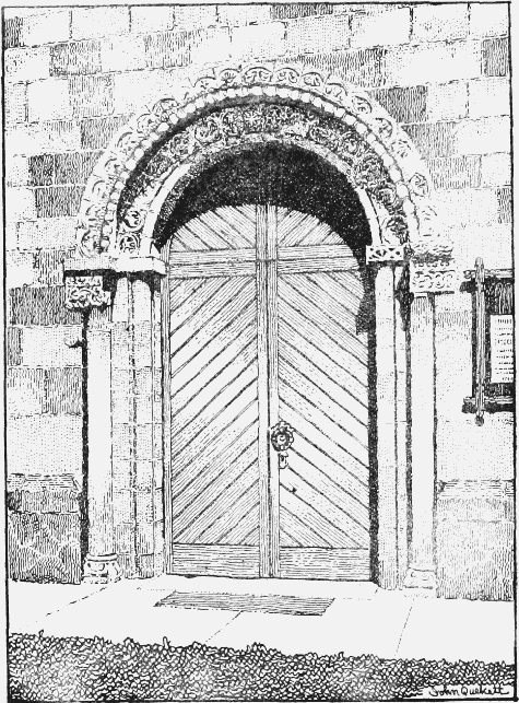
South Doorway of Alne Church
The chancel has a late 14th-century three-light east window, and in the wall are two stone brackets, the northern being foliated like a column capital. In the north wall is a deeply splayed 12th-century roundheaded window, now opening into the north chapel, between which and the quire, further west, is a large semicircular 14th-century arch of two continuous chamfered orders, without capitals or bases. In the south wall is an early 12th-century chancel door, the lintel of which is carved externally with grotesque beasts in low relief, now much weathered. Both side walls of the chancel have 12th-century corbel tables with grotesque heads; that on the north side now supports the sloping roof of the chapel. The chancel arch is plain and semicircular with square responds having an impost chamfered on the lower edge. To the north of it on the west or nave side is a plain niche. The north chapel was built in the 14th century and has a three-light east window of that date. In the south wall is a piscina and in the north an aumbry and a two-light window. A modern brick arch communicates with the north nave aisle.
The nave has a north arcade of three acutely pointed arches of 13th-century date resting on octagonal piers apparently altered in the early 15th century. The three 15th-century aisle windows are each of two lights, but the first and third have been restored. The brick parapet of the aisle is of 18thcentury date. In the south wall of the nave are two square-headed 15th-century windows of three lights. The south door is a very rich piece of mid-12th-century work. It is of two orders, the jambs having one attached and one free shaft on each side, both restored; the latter have richly carved bases and blocks as capitals tailed into the wall, and having chamfered abaci, plain on the west but carved to the east pier. The attached shafts of the inner order are carried up to the under side of their abaci without capitals. Of the two orders of the arch the outer has cone ornament along the edge, and each voussoir of both has a well-carved medallion; the outer series represents the following animals with their names above them: 'vulpis, panthna, ala, hiena, caladrius, draco (?), terebolan, aspido,' &c., and the inner Zodiacal signs, &c. The carvings are in excellent preservation and comparatively few have been restored. The south nave wall is built of finely jointed ashlar. The well-moulded semicircular tower arch is of 12th-century date, the jambs having each a half-round shaft with fluted capitals having voluted angles and square abaci. The tower is an 18th-century structure, the lower part being of stone and the upper of brick. The nave roof retains some massive oak tie-beams.
The ancient fittings of the church include a communion table with good turned legs dated 1628, a small octagonal pulpit dated 1626 on a modern base, and a 12th-century font. The latter has a hemispherical bowl with a band of carved foliage and fruit round the top and knot work and two socket holes on the upper surface. At the west end of the north aisle is an old parish chest dated 1697. Against the north wall of the chapel is a recumbent effigy in freestone of a lady dating from the early 14th century. On her head are a wimple and a jewelled band; beside it are angels and the feet rest on a dog.
There are three bells, the first inscribed 'Soli deo gloria, 1638'; the second 'Soli deo gloria pax hominibus, 1656'; and the third 'Te deum laudamus, 1765.'
The plate consists of a cup with cover (York, 1662), a paten (London, 1704) inscribed 'The Gift of Elizabeth Wrightson to the parish church of Allne, 1716,' and a pewter flagon and plate.
The registers begin in 1560.
The church of ST. STEPHEN at Aldwark was built in 1846 by the late Lady Frankland-Russell, and is a cruciform structure built of large pebbles and brick with stone dressings. The transepts have apsidal ends and the east window is wheel-shaped. In the angle between the nave and north transept is a small tower surmounted by a spire.
Advowson
The church of St. Mary at Alne was a peculiar of the treasurer of York. (fn. 123) After the Dissolution the advowson followed the descent of the rectory manor until after 1798, in which year Christopher Bethell presented to the living. (fn. 124) Before 1817 it was in the gift of the Earl Fauconberg, and in 1822 again in the Bethell family, W. J. Bethell presenting (fn. 125); from him it passed by 1829 to R. Bethell, and continued in the hands of Sir C. Bethell-Codrington from 1836 to 1873, when W. Bellhouse was the patron. (fn. 126) He and his trustees continued to hold it until 1905, when it was purchased by Mr. R. Kershaw of Crow Nest, Halifax. (fn. 127) Since 1911 the living has been in the gift of Mrs. J. Stott.
The patronage of the church of St. Stephen at Aldwark followed the descent of Alne. (fn. 128)
The chapel at Tollerton, endowed with lands in Alne called 'Ladyland,' was probably a domestic chapel belonging to the treasurer of York. A feoffment of its endowments was made in about 1544 to Anthony Ellerker and others for the purpose of maintaining a priest. (fn. 129) All trace of it has now disappeared.
Charities
By an order of the Charity Commissioners of 27 January 1882 a scheme was established for the administration of the following charities by one body of trustees, viz.:—
Charity of John Pearson, deed, 1695, endowment consisting of 28 a. at Tollerton, let at £27 a year, £133 North Eastern Railway £3 per cent. debenture stock arising from sale of land in 1872, and £85 14s. 4d. consols, from sale of timber in 1878;
Charity of John Wade, will, date unknown, consisting of 3 a. 3 r. in the Youlton Moor allotments, and 10 a. 2 r. in Alne Field, let at £14 10s. a year, and £19 12s. 10d. consols arising from sale in 1896 of a small piece of land to the North Eastern Railway Company;
Poor's Land, consisting of 1 a. 2 r. known as Pitt's Field, let at £2 15s. a year;
Unknown donor's charity, being an annuity of £2 payable out of land known as Rotten Croft, now belonging to Mr. J. Swainston-Strangwayes;
John Plummer's charity, an annuity of £1 paid out of property now belonging to Mr. Anthony Crosby, and 2s. 6d. a year received from the village of Flawith out of property belonging to Mr. Pinkney.
By the scheme above referred to the net income of Pearson and Wade's charities is applicable in certain specified proportions for the benefit of the necessitous poor of the townships of Alne, Tollerton, Flawith, Tholthorpe, Aldwark and Youlton. In 1904 money and coal were given to seven poor widows, and bread was distributed in church every Sunday.
In 1857 William Sadler, by will, bequeathed £100 to be invested and the income to be distributed in bread. The legacy is invested in £97 13s. 7d. consols.
In 1892 Ann Brotherton, by will, left £30 15s. 5d. consols, the dividends to be applied for the benefit of children of the Church Sunday schools.
The several sums of consols are held by the official trustees.