A History of the County of York North Riding: Volume 1. Originally published by Victoria County History, London, 1914.
This free content was digitised by double rekeying. All rights reserved.
'Parishes: Aysgarth', in A History of the County of York North Riding: Volume 1, ed. William Page (London, 1914), British History Online https://prod.british-history.ac.uk/vch/yorks/north/vol1/pp200-214 [accessed 19 April 2025].
'Parishes: Aysgarth', in A History of the County of York North Riding: Volume 1. Edited by William Page (London, 1914), British History Online, accessed April 19, 2025, https://prod.british-history.ac.uk/vch/yorks/north/vol1/pp200-214.
"Parishes: Aysgarth". A History of the County of York North Riding: Volume 1. Ed. William Page (London, 1914), British History Online. Web. 19 April 2025. https://prod.british-history.ac.uk/vch/yorks/north/vol1/pp200-214.
In this section
AYSGARTH
Echescard (xi cent.); Aykeskarth (xiii cent.).
This parish, which is now broken up into the four ecclesiastical parishes of Aysgarth, Askrigg, Hardraw, and Hawes, includes the whole valley of the Ure from a point just above Castle Bolton to the heights of Ure Head, and extends over 80,000 acres. A great part of this is mountainous and rugged land, and dairy-farming is the most flourishing department of agriculture. 'Wensedale and the Soile about is very Hilly, and berith little Corne, but norisith many Bestes,' said Leland, (fn. 1) and an inhabitant described it later as 'very mountainous with nothing to live on but the increase of cattle and sheep.' (fn. 2)
This description applies more particularly to that part of the valley above Bainbridge known for centuries as the Forest of Wensleydale, and a chase of the Earls of Richmond. (fn. 3) The bounds of the forest in the early 13th century (fn. 4) were thus set out: 'The rivulet called Merbek, flowing from little Staggeswell and falling into the Jor is the boundary between the land of my monks of Jorevall and my forest of Wendesleydale on the north side of the Jor towards the east, and a place called Husagh Morvill, as the rain water falls in the head of West Hell Gill and so by the course of the water to Yoresheved is the boundary between my forest and Westmoreland towards the west. . . . Blayngbek which comes from Grenescher and falls into Semar, and so as the water of Bayne falls into Jor is the boundary between their land and my forest on the south side of Jor towards the east, and from the east side of Swartfell in a right line to Stubbyngrig and so to Carkeld, and so to Jor, are the divisions between my forest of Wendesleydale and the forest of Mallerstang towards the west.' (fn. 5)
The abbey of Jervaulx had a grant of free pasture in Wensleydale with the rights of felling timber for building from the forest, working lead and iron mines, and taking game found killed by wolves. (fn. 6)
Convenience and the opposition of the lords of Middleham (fn. 7) seem to have confined the abbot and monks to the north side of the river. The whole of this was known as Abbotside, and at the Dissolution the abbey's manor of Wensleydale extended from the town of Askrigg westward to Hell Beck between the Ure on the south and the watershed dividing Swaledale from Wensleydale on the north. (fn. 8) They had vaccaries there in 1280 at 'Setebukste,' (fn. 9) 'Sundestand,' (fn. 10) 'Fossedale' and 'Cotterdale' by feoffment of John of Britanny, (fn. 11) and in 1301–2 paid subsidy for 'Skalgayl, Cambehous, Simondstane, Foresdale, Cotterdale, Holbeck lundes,' and other places besides Dale Grange. (fn. 12)
The 'Holbeck lundes' of 1301–2 is the highest part of the valley, where the Ure rises beside Hell Gill. (fn. 13) The hamlet of Lunds has a church dating from the middle of the 18th century, (fn. 14) and with Hardraw, a village lower down the valley, forms an ecclesiastical parish. High Abbotside, the westerly part of the old manor of Wensleydale, is co-extensive with this parish, and contains the hamlets of Fossdale, Cotterdale, and Hardraw, with Simonstone, Sedbusk, Litherskew, and Camshouse (fn. 15) lower down the valley. Only one of these, Sedbusk, contains a chapel, that of the Methodists. Hardraw Church, dedicated in honour of St. Mary and St. John, was rebuilt by the Earl of Wharncliffe between 1879 and 1881. It lies close to the Sedbergh road on the left bank of the stream. Just above this stone-built village is Hardraw Force, which falls quite clear of the rock below, so that it is possible to pass behind the waterfall and look through it as if it were a veil. Hardraw Bridge is modern, the older structure having been swept away with every other bridge on the stream by the great storm of July 1889, when great damage was done to the village and much stock lost. Hardraw Hall is old, but no distinctive architectural features remain.
In the township of Low Abbotside, separated from Askrigg on the east by Mill Gill Beck, is the old site of the abbey of Charity, whence the monks removed to Jervaulx in East Witton in 1156 because of the barrenness of the soil and the inclemency of the climate. (fn. 16)
The remains of the building, which took its first name of Fors Abbey from a waterfall on Meer Beck near by, are built into a barn. The beck is crossed near the site by a very old bridge called Bow Bridge. Just above it is Coleby Hall, built in 1633 by the Colebys of Bow Bridge, (fn. 17) and now occupied by Mr. James Scarr. It is constructed of rubble plastered over and the roofs are stone slated; though the house has been altered in modern times, the principal front is much as it was when first built. It is entered by a semicircular arched doorway in a gabled projecting porch three stories in height, and the central block is flanked by gabled wings. The windows are mullioned and transomed and all have labels, while at each end of the building are large chimney stacks; over the doorway are the initials J. C. 1633.
The forest of Wensleydale had as an alternative name the 'Forest of Bainbridge.' Bainbridge was the head quarters of forest government and for centuries the only place of importance south of the river. In the 15th century the inhabitants of Hawes were numerous enough to build themselves a chapel, (fn. 18) and in the 17th century that town obtained market rights (fn. 19) and became the centre of a flourishing agricultural district. But in the 12th and 13th centuries (fn. 20) the forest contained, except for Bainbridge, only 'vaccaries' scattered in wild and desolate country. These vaccaries were at 'Constansate,' 'Mouresgate,' 'Stalunbusk,' 'Beredale,' 'Bentresate,' 'Seldalegile,' 'Appeltresate,' 'Snaysum,' and 'Mussedale,' most of which can be identified in modern hamlets. (fn. 21)
The forest on this side of the Ure was lonely and dangerous for the traveller. Men living in 1609 still remembered that there had been a 'guide law' for those passing through the forest, obliging each to pay 'thre farthinges to some guyde to gyde them through the forrest by reason of the wyldnes of the said forrest and for that the same was not inhabyted in former tymes nor passable.' (fn. 22) The old custom of blowing the forest horn at Bainbridge at 10 every night from Holyrood to Shrovetide lingers to the present day. A new horn was inaugurated amid great rejoicings in 1864. (fn. 23)
The population of Bainbridge township is concentrated chiefly in the valleys of Widdale, Sleddale and Raydale. Widdale is the most westerly of these. Here Ralph Earl of Westmorland had licence to grant a messuage called Widdal House to the Abbot of Jervaulx in 1404. (fn. 24) At the point where the Widdale Beck joins the Ure is the hamlet of Appersett, containing a small Wesleyan chapel.
The market town of Hawes lies for the most part along one street at the foot of the next dale, close to the Ure. The houses are small and built of rough stone, and, although they are modern, two at least possess old doorways which have been reset, bearing the dates of 1668 and 1692 respectively. The church of St. Margaret is a modern building replacing an older chapel. There is a Wesleyan as well as a Congregational chapel in Hawes. Formerly the Sandemanians also had a chapel here. (fn. 25) In 1700 William III granted to Matthew Wetherald a weekly market on Tuesday and fairs on 28 and 29 April and 17 and 18 September in each year. (fn. 26) Since that time the town seems to have grown steadily, and its market is flourishing and important; there is a small coalmine here. Just south of Hawes is the hamlet of Gayle, a group of small stone houses, some with 17th-century doorways. One house, with the inscription '[A M W] 1695,' is apparently the original structure somewhat altered. The bridge over the stream is of one arch. Not far from this bridge and a little way below it is a water-mill.
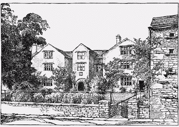
Coleby Hall, Askrigg: Entrance Front
Burtersett, a village on the road between Hawes and Bainbridge, has both a Wesleyan and a Congregational chapel. Here, again, a few houses have old door-heads, and in one house, dated 1729, there are old mullioned windows on the ground floor.
The valley of Raydale was a valuable appurtenance of Bainbridge Manor, and was leased out continually to the Metcalfes of Nappa. (fn. 27) In 1610 Thomas Metcalfe mortgaged it to William Robinson of Worton, who foreclosed in 1617. Sir Thomas then laid siege to the house of his supplanter with sixty men armed with 'guns, about half a score bills, picks, swords and other warlike provision'; one man was killed. (fn. 28)
The hamlet of Marsett, below Raydale House, has a Wesleyan chapel, erected in 1897. Just below Marsett is one of the largest Yorkshire lakes, Semerwater, where the Earls of Richmond had a fishery worth 40s. in 1280. (fn. 29) Out of it the River Bain flows 'with a strange murmur' (fn. 30) to join the Ure at Bainbridge. At the village of Stallingbusk, southeast of the lake, is a chapel successor of an earlier building mentioned in 1609. (fn. 31) It serves the whole valley of Raydale.
The town of Bainbridge stands just west of the Bain at the point where it joins the Ure. It is built round a fine green, and has Congregational and Wesleyan chapels, as well as a Friends' meeting-house. The Yorebridge Grammar School here was founded in 1601 by Anthony Besson. (fn. 32)
East of Bainbridge, on the other side of the beck, is the site of a Roman encampment on Brough Hill, (fn. 33) and various Roman remains have been found. From here a road runs east to the hamlet of Worton, and thence to Thornton Rust. This village derives part of its name from St. Restitutus, the patron saint of the mediaeval chapel erected here, of which remains existed until recently on the south-east side of the village. No traces, however, are now left beyond some masonry of uncertain date incorporated in the walls of a barn. In the village is preserved a small bell, possibly the sanctus (fn. 34) of this chapel, but with no marks beyond some slight lines on the waist, probably a founder's mark. The village is a straggling one; there are gardens in front of the cottages and stretches of grass on both sides of the way. It possesses a mission room and a Calvinist chapel. 'John the Miller' paid subsidy here in 1301–2. (fn. 35)
The next village to the east is Aysgarth itself, which consists of one street placed where the road, having risen from river level at Aysgarth Bridge, runs west along a stretch of high ground near the banks of the Ure. The church of St. Andrew is about half a mile east of the village in a fine situation on the river bank. A flight of steps leads down from the churchyard, past the mill to the narrow bridge (fn. 36) which crosses the stream; this structure, originally built in the 16th century for pack-horse traffic, was at one time not more than 10 ft. broad, but it has been modernized and widened. Above and below the bridge the Ure falls over flat terraces of rock in the fine series of waterfalls known as Aysgarth Force. A fair for sheep and cattle is held at Aysgarth on 30 October. It has a Wesleyan chapel, built in 1901.
Aysgarth is at the lower end of the valley of Bishopdale, which extends about 6 miles south-west into the hills, its highest point being the height of Kidstones, which was sold by the commissioners for the sale of the lordship of Middleham to William Norton in 1654. (fn. 37)
The village of Thoralby stands in the lower part of the valley. There has been a water-mill here since 1298, when there was a capital messuage in Thoralby. (fn. 38) On the high land west of the valley is Thoralby Common, probably that moorland mentioned in Domesday Book (fn. 39); on it are disused leadmines and quarries. Wesleyan and Primitive Methodist chapels have been built in the village.
The hamlet of Newbiggin is also in Bishopdale, south-east of Thoralby. There are several 18thcentury houses, and at the north end is a house with a doorway having a cambered lintel with a quatrefoil in each angle and moulded jambs. Above is an inscription almost illegible, but 'T. C. D. 1636' can still be deciphered. A moulded stringcourse ran round the house at the level of the first floor and an original three-light mullioned window still remains.
The largest village in the dale is West Burton, which stands on Walden Beck. In West Burton there are Congregational and Wesleyan chapels, and fairs are held on 10 March and 6 May.
Leland describes Bishopdale thus: 'Bishops Dale . . . lying by Ure in ripa citer., and conteining a sorte of greate Felles with Dere liyth South-west within a quarter of a mile of Nappa.' He adds that 'Bishopsdale longith to the king, and yn the Hilles about hit be Redde Deer. In faire winters the Deere kepe there, in sharp winters they forsake the extreme Colde and Barennes of them.' (fn. 40) Appointments to the office of bow-bearer or forester of Bishopdale were frequently made by the Crown. (fn. 41)
The north side of the river east of the forest of Wensleydale consists of the township of Askrigg and Carperby with Thoresby. The town of Askrigg is situated on irregular ground overlooking some lowlying meadows. The houses are of stone with a main road winding down hill towards the station half a mile to the west. The market-place, with a renovated cross, (fn. 42) is at the west end of the town with the church and churchyard on its western side.
The ground to the north of Askrigg rises to a height of 1,800 ft. on Askrigg Common, where there is good grouse shooting. Here were the lead-mines of Thomas Metcalfe of Nappa (fn. 43) (q.v.).
From the 16th until the late 19th century Askrigg was a market town. Its charter is said to date from the time of Queen Elizabeth, (fn. 44) and to provide for the election of officials called 'the four men,' who disposed of the issues and profits. In 1733 the money had been used for the repair of the town-house, marketcross and pavement, and the provision of a saddle, bridle and hat, to be run for once a year at Askrigg. (fn. 45) A custom had prevailed, however, called 'house-row,' by which the profits of the markets were distributed from house to house among the inhabitants. (fn. 46) It was probably the growing prosperity of Hawes which caused the Askrigg market to decay. Already in 1725 the inhabitants of Askrigg resented the appearance of a new market, and were carrying on a lawsuit out of the profits of their own. (fn. 47)
In 1768 Askrigg had fairs on 11 May and the first Sunday in June for woollen cloth, pewter, &c., and on 28 and 29 October for horned cattle, pewter, woollen cloth, &c. (fn. 48) At the present day a fair is held in the 'Fair Allotment,' a field north of the town, on 11 July, and others on the old days.
Clock-making and the knitting of hosiery once flourished here. 'Drunken Barnaby,' whose Journeyings appeared in 1638, (fn. 49) thus writes of it:—
'Thence to Askrigg, market noted, But no handsomeness about it. Neither magistrate nor mayor Ever were elected there. Here poor people live by knitting, To their trading, breeding fitting.'
The clock-making industry was introduced at the end of the 17th century. (fn. 50)
Near the market cross stands the Old Hall, built in 1678 by William Thornton, a member of a family which held land in Askrigg for many centuries. (fn. 51) It passed from the last of them to the family of Lightfoot, and Mr. W. Lightfoot Bankes was the owner in 1890. (fn. 52) The Hall is now the residence of Mrs. Bankes. It was obviously designed so that at any time it could be divided into two. It is built of regularly-coursed rubble with ashlar dressings and has two gables towards the market-place, between which are two entrance doorways, and two doorways in the second story leading on to a balcony which faces the bull-ring. The windows are mullioned and transomed, and have moulded strings over them; sunk panels are formed upon the lintels of the entrance doorways by the continuation upon them of the jamb-mouldings, a feature common in the district. The balcony doorways have architraves and curved pediments terminating close under the eaves of the stone roof. There is an inscription over the western of the two lower doorways: 'Gulielmus Thornton posuit hanc domum M.D.C.LXXVIII omnis enim domus apparatur a quopiam, qui vero construxit haec omnia est deus. Heb. 3, 4.'
The church of St. Oswald is the only other building of interest. There is a Wesleyan chapel.
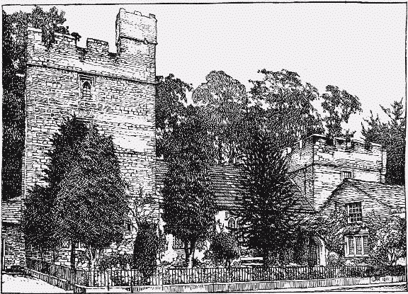
Nappa Hall, Askrigg, from the South-west
North-east of Askrigg is the hamlet of Newbiggin, which once belonged to Jervaulx Abbey, (fn. 53) and to the south-east is the more famous hamlet of Nappa, the old seat of the Metcalfe family.
Nappa Hall, the residence of Mr. Thomas Metcalfe, was described by Leland as a 'very goodly Howse,' 'in which 2 toures be very fair, beside other logginges.' (fn. 54) The house appears to have been built about 1450 by Thomas Metcalfe, there having been previously what Leland describes as 'but a cotage or litle better house' (fn. 55) on the present site, and the building immediately adjoining the eastern tower on the south side has been stated to be this original cottage.
The entrance front faces south-west and the plan consists of two rectangular embattled towers connected by a one-storied building, representing the original hall, with a projecting wing on the south-west side of the south-eastern tower. The north-west tower, which measures externally about 44 ft. by 27 ft., is the larger and higher of the two; in the south-west wall of the ground stage is a square-headed window of three cinquefoiled lights with a label and mask stops. The first floor has a two-light window of the same type, and the two floors above are lighted by single lights. On the north-west is a blocked threelight window and a plain doorway leading into the ground floor; the fireplace on the north-west and the large three-light window on the entrance front suggest that the ground stage of the tower constituted the 'great chamber,' a smaller room being divided off on the north-east. A plain doorway in the southeast wall leads into the hall. At the southern angle of the tower is the entrance to a newel stair leading to a room on the first floor which occupies the whole interior and measures 20 ft. by 35 ft. The floors of the two rooms above this have been removed.
The hall measures internally about 23 ft. and is 23 ft. in width. There are two two-light windows in the south wall of the same type as those in the tower, but with transoms. No traces of the original fittings remain, but at the east end a door in the middle of that wall opens into a passage representing the screens, with external doors to the north and south, and two doors opening into the ground floor of the east tower, where the kitchen and larder would have been. The doorway on the south side has a porch about 10 ft. square externally, with a pointed outer doorway which forms the main entrance to the house.
At the north-east end of the passage is a stone stair contained in a projecting portion of the southeast tower, which leads in two flights to the first floor. Opposite this stair is a doorway leading down several steps to the south-west wing. The first building extends about 18 ft. in this direction from the porch, beyond which the buildings are smaller and more modern.
From Nappa a road runs along near the river to Woodhall and Woodhall Park. The hamlet of Bear Park, in a curve of the stream opposite Aysgarth, belonged to Marrick Priory, (fn. 56) and was frequently leased to members of the family of Metcalfe. It was sold in 1544 to John Banastre, (fn. 57) who alienated it in the same year to Leonard Metcalfe. (fn. 58) On his attainder in 1570 the estate was forfeited and granted to Ambrose Earl of Warwick. (fn. 59) This grant was superseded, however, by a lease to Leonard Metcalfe, who was pardoned, and it remained in the possession of his family for some time. (fn. 60) Bear Park in 1570 consisted of the hall, built of stone and roofed with slate, and various closes bounded by a wall on three sides and the Ure on the fourth. The stony land on the river bank yielded nothing but thorns. (fn. 61) The present hall, which has been much altered, is probably of 17th-century date. The design is E-shaped with a later porch, and there are some 17th-century mullioned windows remaining. One room is completely panelled in oak. The joists and beams of the ceiling are curiously moulded with a succession of small rolls upon the soffit.
The village of Carperby, just north of Bear Park and three-quarters of a mile from Aysgarth Bridge, possesses a market cross placed on a lofty flight of steps at the end of a small green; on the west face is inscribed r b, on the opposite side the date 1674. Here are a Wesleyan Methodist chapel and a Friends' meeting-house.
Thoresby, a hamlet of scattered houses, is the birthplace of John Thoresby, Archbishop of York. (fn. 62) The farm of West Bolton, in the north-east of the township, is occupied by Mr. John Spensley. A railway from Layburn to Askrigg was opened in 1877, and in 1879 was continued to Hawes. (fn. 63)
Inclosure awards for this moorland parish are numerous. The dates are as follows: Abbotside Common 1881, Marsett and other lands in Bainbridge township 1859, Camshouse Pasture 1851, Cragg Common in Bainbridge 1849, and meadow land near Stallingbusk 1844; Green Scarr Pasture in Hawes 1859, pasture at Burtersett, Counterside, &c., 1816, Hackberry Brae in Thoralby 1863, Snaizholme 1847, and Thornton Rust 1855. (fn. 64)
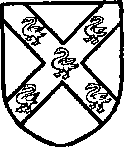
Burgh of Hackforth. Argent a saltire sable with five swans argent thereon.
Manors
At AYSGARTH a 'manor' and 3 carucates were held by Cnut before the Conquest; in 1086 they had passed to Count Alan and were held of him by Goisfrid. (fn. 65) Early in the 13th century Aysgarth was in the hands of the family of Burgh of Hackforth (q.v.). In 1202 Eva widow of Elias de Burgh claimed dower against Thomas de Burgh, (fn. 66) and in 1286–7 Thomas de Burgh was holding the whole vill. (fn. 67) These lands followed the descent of Hackforth (fn. 68) (q.v.) till 1480, when Thomas Mountford conveyed his right in Burton, Walden and Aysgarth to Richard Duke of Gloucester. (fn. 69) His demesne lands thus became Crown property and were among those for which Lord Scrope proposed to exchange his manor of Pishobury, Herts, (fn. 70) with Henry VIII. It is not clear whether this arrangement in regard to Aysgarth was actually carried out.
From the 13th century half the vill was held of Thomas de Burgh by the lords of Middleham. (fn. 71) The estate followed the descent of the manor of Thoralby (fn. 72) (q.v.), with which it has come into the hands of William Robinson Burrill-Robinson, the present lord of the manor.
Land in Aysgarth of this Burgh fee had been acquired by Richard Scrope of Bolton before 1421, (fn. 73) probably from the heirs of Roger Oysel and the Fitz Randalls. (fn. 74) This estate included six messuages with land in the reign of Henry VII, (fn. 75) and is generally described as a manor. (fn. 76) It followed the descent of the manor of Castle Bolton (fn. 77) till the beginning of the 19th century at least, and seems to have come later with Thornton Rust (q.v.) into the hands of the Tomlinson family, who still hold land in Aysgarth.
An estate in Aysgarth was granted in the late 15th century to Lord Fitz Hugh, (fn. 78) in exchange for land in Coverham. It had formerly belonged to Adam Lightfoot. (fn. 79) It passed to the Crown with the manor of Askrigg (fn. 80) (q.v.) in 1571 and presumably followed the same descent.
At ASKRIGG (Askric, xi cent.; Askerigg, xiii cent.) a 'manor' and 10 carucates were held by Archil before the Conquest; in 1086 they were held of Count Alan by Archil's son Gospatric. (fn. 81)
A mesne lordship over 5 carucates was held in 1286–7 by Sybil, lady of Thornton Steward (q.v.), whose tenant was the lord of Ravensworth. (fn. 82)
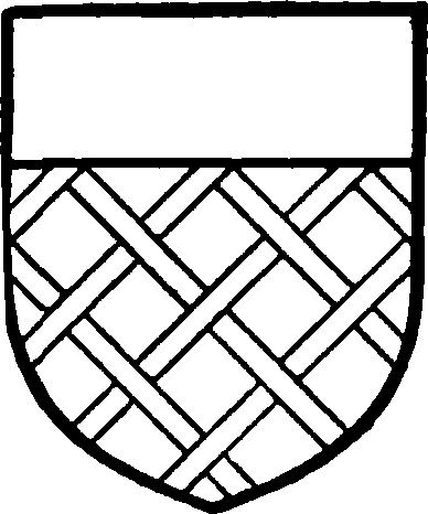
Fitz Hugh. Azure fretty and a chief or.
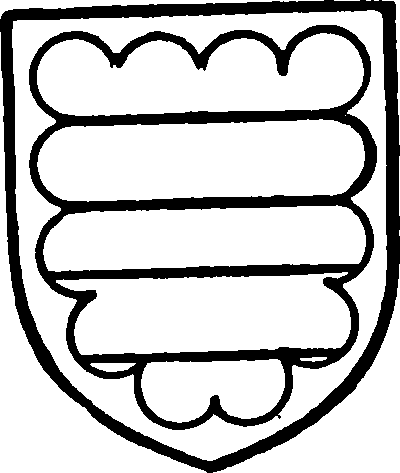
Parr. Argent two bars azure and a border sable engrailed.
The family of Fitz Hugh is first mentioned in connexion with Askrigg in 1251, when Henry son of Ranulph obtained a grant of free warren there. (fn. 83) In 1286–7 his son Hugh held part of the vill in demesne. (fn. 84) The manor followed the descent of his manor of Ravensworth (fn. 85) (q.v.) until the division of 1518, when Askrigg fell to Sir Thomas Parr. (fn. 86) It was inherited by his son William, (fn. 87) afterwards Marquess of Northampton, (fn. 88) and was forfeited at his attainder in 1553. (fn. 89) In 1560 this manor with others was restored to him, (fn. 90) but on his death without issue in 1571 (fn. 91) Askrigg passed to the queen, who in 1583 obtained a release from Gregory Fiennes Lord Dacre (fn. 92) of his claim on it as another heir of the Fitz Hughs.
From that date the Crown has retained the manorial rights, though they have been leased since 1664 by the lords of the manor of Nappa. (fn. 93) The present lessee is Mr. J. E. Riley.
Some land in Askrigg which was not surveyed in 1286–7 (fn. 94) seems to have belonged to William de Hebden. (fn. 95) In 1312 he conveyed to Henry Scrope rent and half a knight's fee with appurtenances in Askrigg with the homage and service of Stephen de Thornton. (fn. 96) This land, called from the late 16th century the 'manor of ASKRIGG,' followed the descent of that of Castle Bolton (fn. 97) (q.v.) until at least 1803. (fn. 98)
Ralph Fitz Randall, one of the under-tenants mentioned in 1286–7, obtained a grant of free warren in his demesne of Little Askrigg. (fn. 99)
The abbey of Jervaulx received half a carucate of land here from Adam Barn. (fn. 100) The lands of this house, given as 1½ carucates in 1286–7 (fn. 101) and I carucate in 1348, (fn. 102) were exchanged with Ralph Nevill in 1397 for the advowson of Aysgarth, (fn. 103) but are not subsequently mentioned. Possibly they passed into the hands of the Fitz Hughs with the grange of Newbiggin, (fn. 104) which had also belonged to Jervaulx. The abbey of Fountains acquired half a carucate here from Henry de Threshfield. (fn. 105)
The 'forest of BAINBRIDGE' (Baynbrigg, Beyntbrigg, xiii cent.; Baynebrigg, xiv cent.), as it was afterwards called—that is, the whole forest of Wensleydale south of the Ure—was probably in 1086 in the hands of Count Alan. (fn. 106)
Between 1146 and 1170 Conan Earl of Richmond granted the wardship of the forest to Robert son of Ralph, lord of Middleham (q.v.), and builder of the 'grange and vill' of Bainbridge. (fn. 107) In the reign of King John the Abbot of Jervaulx complained that Ranulph son of Robert had built twenty-nine 'domos focarios' in the pasture of the forest of Wensleydale; Ranulph replied that the town existed before he became lord. (fn. 108) In answer to Ralph Earl of Chester in 1229 Ranulph stated that 'the town of Beyntbrigg belonged to his ancestors by service of keeping the forest, so that they might have abiding there 12 foresters, and that every forester should have there one dwelling-house and 9 acres of land.' (fn. 109)
The lords of Middleham had ceased to hold the office of forester before 1280, when Peter of Savoy, Earl of Richmond, had farmed out the township to tenants to hold at will. (fn. 110) The manor included a capital messuage, a park of 17 acres, a water-mill, an oven and brewery, ten vaccaries in the forest, &c., and was valued at £282 5s. 6½d., or more than a third of the revenue of the earldom. (fn. 111)
Bainbridge followed the descent of the honour of Richmond till 1413, (fn. 112) when Henry IV released to Ralph Earl of Westmorland and his heirs all his right in the manor, town and bailiwick of Bainbridge. (fn. 113) Ralph was at the time life-tenant of the honour, and in the subsequent grant of the reversion of the honour to John Duke of Bedford his right in Bainbridge was specially reserved to him. (fn. 114)
The manor, thus again held by the lords of Middleham, followed the descent of that manor (fn. 115) (q.v.), with which it was granted in 1628 to the City of London. (fn. 116) The City sold it in 1663 to eleven of the principal inhabitants, who held the manor in trust for the freeholders. (fn. 117) The 'lords trustees' of the manor have continued to exercise the manorial rights. (fn. 118) Since 1767 their number has been maintained at twenty-four, with power to fill vacancies from the freeholders. (fn. 119)
At BURTON (Burton in Bishopdale till xvii cent., now West Burton) a 'manor' and 6 carucates were in the tenure of Count Alan's vassal Goisfrid in 1086; at Eshington (Ecinton) there was a berewick of 3 carucates. (fn. 120)
Here, as elsewhere, Goisfrid's lands passed to the lords of Hackforth (q.v.), and the manor was quitclaimed by Thomas Mountford to Richard Duke of Gloucester in 1480. (fn. 121) These demesne lands followed the descent of the Mountford lands in Aysgarth (fn. 122) (q.v.).
The lords of Middleham (fn. 123) (q.v.) were tenants of 1 carucate of this fee and 14 oxgangs of the Earl of Richmond. (fn. 124) This land was an appurtenance of the manor of Thoralby (fn. 125) (q.v.), which it has followed in descent. William Burrill-Robinson is the present lord.
The Scropes of Bolton before 1421 acquired lands in Burton, held partly of Thomas Mountford and partly of the Earl of Westmorland. (fn. 126) This manor of BURTON WALDEN (fn. 127) or BURTON IN BISHOPDALE followed the descent of Castle Bolton till the early 19th century. (fn. 128)
WALDEN is always coupled closely with Burton, and there seems to have been no separate manor here.
The 'manor' of CARPERBY (Chirprebi, xi cent.; Kerperby, xiv cent.) was in the hands of Tor before the Conquest. In 1086 its 9 carucates were held under Count Alan by Enisan, and were waste. (fn. 129)
Like other lands of Enisan, Carperby became part of the fee of the constables of Richmond. (fn. 130)
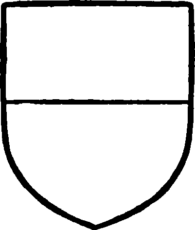
Wauton. Gules a chief argent.
The family of Lascelles held the manor, and the grant of a carucate here to Easby Abbey by Picot de Lascelles in the 12th century was confirmed by his son Roger. (fn. 131) In 1286–7 the whole vill, with the exception of 18 bovates in the hands of the Thoresby family, was held by Ellen 'lady of Carperby' of Roger de Lascelles. (fn. 132) Ellen was in all probability widow of a member of a younger branch of the family of Wauton (fn. 133) of Masham (q.v.). In 1301 Gilbert de Wauton paid subsidy in Carperby, (fn. 134) and he was lord of the manor in 1304–5. (fn. 135) John son and heir of Gilbert (fn. 136) was lord in 1316, (fn. 137) and paid subsidy in 1327; he made a settlement of the manor in January 1342–3 on himself with remainders in tailmale to his sons Gilbert, Roger and William. (fn. 138) Gilbert de Wauton, probably his son, settled the manor in 1374 on himself and his heirs male, with reversion to Richard Lord Scrope. (fn. 139) In 1411 a charter to the elder Gilbert of a market and two fairs was confirmed to his kinsman and heir John de Wauton, (fn. 140) doubtless the John who held the manor of Cliff (q.v.) and was grandson of Gilbert. (fn. 141) He died without male heirs, and Carperby passed to the Scropes of Bolton, tenants in 1421. (fn. 142) Henceforward the manor followed the descent of Castle Bolton (fn. 143) (q.v.), and is now in the possession of Lord Bolton.
The carucate of land which Roger de Lascelles gave to Easby Abbey was granted by the abbey in 1252 to Henry son of Ralph. (fn. 144) Henry gave all his lands in Carperby to the Prioress and nuns of Marrick, who had land here to the value of £1 18s. 3d. at the Dissolution. (fn. 145)
The manor of FORS, WENSLEYDALE, or DALE GRANGE, consisted of the possessions of the abbey of Jervaulx in the forest of Wensleydale north of the Ure. In 1086 4 carucates in the place known as Fors were held of Count Alan by Bodin. (fn. 146) His nephew Acharis son of Bardolf granted 1½ carucates here to found the abbey of Charity. (fn. 147) Hugh son of Gernagan, probably a tenant of Acharis, (fn. 148) granted a like amount. This was the nucleus of the abbot's possessions on this side of the river. The monks removed to East Witton in the time of Hervey son of Acharis, and founded there the abbey of Jervaulx. (fn. 149) The old building was known as Dale Grange, and in 1301–2 the abbot paid subsidy for it and for the hamlets of Skelgill, Camshouse, Simonstone, Cotterdale and others. (fn. 150) The whole estate now began to be known as the MANOR OF WENSLEYDALE, the alternative name being due to the fact that the courts were held by the steward of the abbey at Dale Grange. (fn. 151)
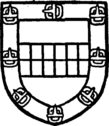
Stewart, Duke of Lennox. Or a fesse checky argent and azure and a border gules with eight buckles or thereon.
At the attainder of the Abbot of Jervaulx his manor of Wensleydale was worth £68 13s. 4d. (fn. 152) It was granted in fee by Henry VIII to Matthew Earl of Lennox and Margaret his wife, (fn. 153) and returned to the Crown in the person of James I, their grandson. (fn. 154) He granted it to Ludovic Stewart, Duke of Lennox, (fn. 155) who had considerable difficulty in getting himself accepted by the tenants of the manor. The very existence of a 'manor of Wensleydale' was disputed, and when the duke attempted to hold the customary courts at Dale Grange various tenants came to the house and there 'verie contemptuouslie and without any reverence and regard said, "Howe nowe, my Maisters, for whome do you kepe a courte here?" ' When the deputy-steward answered, 'For the Duke's grace,' one Richard Besson denied his authority to keep courts and said, 'They are fooles that doe appeare here at his tyme.' (fn. 156)
In 1618 the Duke of Lennox sold the manor in three parts. Of these one was acquired by Mary Coleby and two by George Cole, (fn. 157) who leased the share of Mary. In 1678 John Coleby son of Mary (fn. 158) sold his third of the manor to Alexander Smith. (fn. 159) His son Alexander Coleby tried to set aside the sale after his father's death, (fn. 160) but apparently without success.
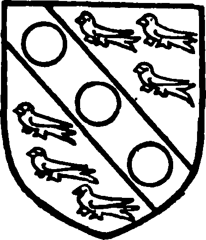
Wortley. Argent a bend between six martlets gules with three bezants on the bend.
In 1717 the whole manor was in the hands of Lord Lonsdale, (fn. 161) who sold it in 1723 to Edward Wortley. (fn. 162) It remained in the Wortley family, and appears among their estates under a new name, that of the manors of HIGH and LOW ABBOTSIDE. (fn. 163) The present Earl of Wharncliffe, a descendant of Edward Wortley, (fn. 164) is now lord of the manor.
A portion of the estate which had belonged to John Coleby was, however, purchased from the Earl of Wharncliffe in or about 1885 by the Hon. William Lowther. (fn. 165)
NAPPA (Nappay, xiii cent.; Nappey, xvi cent.) seems originally to have formed part of the manor of Askrigg, (fn. 166) of which it is said in one place to be held. (fn. 167) It is first mentioned in the grant of free warren to Henry son of Ranulph in his demesne lands in Askrigg and elsewhere (fn. 168); a mesne lordship here followed the descent of the manor of Ravensworth (fn. 169) (q.v.).
In 1316 the tenant appears to have been John del Hull. (fn. 170) Shortly afterwards it was in the possession of Henry le Scrope, who in 1331 settled it on himself and his sons in an elaborate entail. (fn. 171) Richard le Scrope, third son of Henry, (fn. 172) granted the estate to James Metcalfe of Worton. (fn. 173) He lived till about 1472, and was succeeded by his second but eldest surviving son Thomas Metcalfe. (fn. 174) Thomas, a Yorkist, sued Henry VII for a special pardon on his accession. (fn. 175) He became surveyor of the castle and lordship of Middleham, and by leasing estates in the lordship greatly increased his wealth. (fn. 176) He was succeeded by his son and heir James, (fn. 177) who held his father's offices in Wensleydale. (fn. 178) He died in 1539 after purchasing estates adjoining Nappa. His son Christopher succeeded him. (fn. 179) He was forester of Wensleydale, parker of Woodhall and Wanless, and supervisor of Middleham. (fn. 180) Soon after his succession John Lord Scrope of Bolton challenged the original grant to James Metcalfe. (fn. 181) After prolonged litigation, (fn. 182) including secondary proceedings against Christopher for bribing a jury, (fn. 183) the verdict seems to have been given in favour of Lord Scrope; he consented, however, to exchange the manor of Healey for Nappa. (fn. 184) As Sheriff of Yorkshire in 1555 Christopher received the justices attended by 300 horsemen of his name and kin. (fn. 185) From this date, however, his fortunes declined, and he was forced to sell various portions of his estates. He died in 1574, (fn. 186) and was succeeded by James, his eldest son, who died a few years later, leaving a son Thomas, only five months old. (fn. 187) During the minority Nappa was let to two 'principal and dangerous Recusants' who were purposed 'to live obscurely.' (fn. 188) Thomas when of age was forced to mortgage portions of his estate, (fn. 189) and finally Nappa itself (fn. 190); afterwards recovering the manor, he settled it on himself in tail-male. (fn. 191) He died in 1655, (fn. 192) and was succeeded by his eldest son James, (fn. 193) who divided Nappa Hall with his brother Thomas. (fn. 194) In 1663 James paid the tax for six hearths and Thomas for five. (fn. 195) James died in 1671 (fn. 196) without male issue, and Nappa was inherited by Thomas. (fn. 197) He lived till 1684 and was succeeded by his only surviving brother Henry. (fn. 198) Henry Metcalfe settled the manor in tail-male on his son Thomas, 'the hopeful heir to the old ruinous house at Nappa.' He died in 1705. (fn. 199)
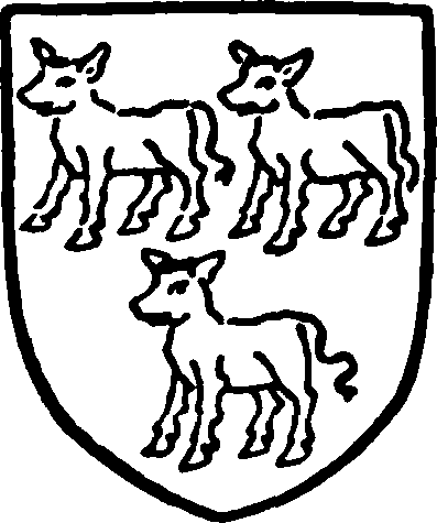
Metcalfe of Nappa. Argent three calves passant sable.
Thomas Metcalfe was forced by financial trouble to settle the reversion of Nappa on his kinsman, Thomas Weddell of Earswick, who left his right to his nephew Richard Elcock (afterwards Weddell), with a remainder to Thomas Robinson, afterwards second Lord Grantham. (fn. 200) His son Lord Grantham, afterwards Earl de Grey, (fn. 201) was in possession in 1809. (fn. 202) Lady Mary Vyner, daughter and one of the co-heirs of the second Earl de Grey, (fn. 203) was lady of the manor till 1892.
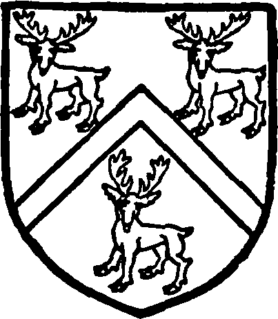
Robinson. Vert a cheveron between three harts or standing at gaze.
NEW BIGGIN was a parcel of Thoralby Manor (fn. 204) and followed its descent.
In THORALBY (Turoldesbi, xi cent.; Thoraldeby, xiii cent.) Bernulf retained under Count Alan in 1086 the 'manor' and 6 carucates which he had held before the Conquest. (fn. 205)
Thoralby was subsequently acquired by the lords of Middleham (q.v.). At the death of Ralph son of Ranulph this manor was assigned to his widow Anastasia in dower. (fn. 206) His daughter Joan, wife of Robert de Tateshall, inherited it, (fn. 207) and Robert was tenant in 1286–7. (fn. 208) He died in possession in 1298. (fn. 209) Joan held the manor in 1301–2, and died in 1310. (fn. 210) As her grandson Robert had died without issue (fn. 211) it reverted to her sister Mary Nevill, who had inherited Middleham (q.v.). Thoralby now followed the descent of Middleham (fn. 212) (q.v.), with which it was sold to the City of London by Charles I. (fn. 213)
The lordship of Middleham was sold in parcels by commissioners chiefly between 1654 and 1663. (fn. 214) The purchaser of Thoralby was possibly a member of the family of Norton. (fn. 215) In 1734 the manor was in the possession of Benjamin Purchas. (fn. 216) William Purchas held it in 1829, (fn. 217) and he or a son of the same name was in possession in 1857. Before 1872, however, the manor had been acquired by Henry Thomas Robinson. Mr. William Robinson Burrill-Robinson is now lord of the manor.
Robert de Tateshall claimed free warren in Thoralby in or about 1280 (fn. 218); a confirmatory grant of this privilege was obtained (fn. 219) in 1332.
THORESBY (Toresbi, xi cent.) was one of the 'manors' which Gospatric continued to hold under Count Alan after the Conquest; it was extended at 1 carucate in 1086 and was waste. (fn. 220)
The lords of the manor of Thornton Steward held a mesne lordship here. (fn. 221) Ranulph son of Henry held under them in right of his wife Alice, and granted 2 oxgangs of land here in 1226 to William de Hebden. (fn. 222)
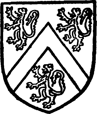
Thoresby. Argent a cheverson between three lions sable.
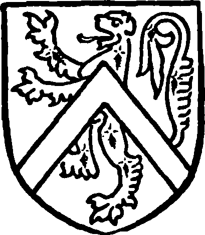
Hardres, baronet. Gules a lion ermine with a cheveron or over all.
William son of Peter held land of Ranulph son of Henry before 1226. (fn. 223) In 1286–7 Peter son of Hugh held 2 carucates 6 oxgangs of William de Hebden, and the rest of the vill was held by Hugh de Thoresby of Peter. (fn. 224) Probably both Peter and Hugh were sons of Hugh son of Adam de Thoresby, who granted two messuages to his daughter in 1299. (fn. 225) Peter was parson of the church of Aysgarth (fn. 226) and was lord of Thoresby in 1301–2, (fn. 227) and Hugh (fn. 228) had succeeded him before 1316. (fn. 229) Several generations of Thoresbys followed, though there is little evidence to support the traditional pedigree (fn. 230) till the time of Christopher Thoresby, who held the manor in the reign of Henry VII (fn. 231); his son and heir George was succeeded by his son William. (fn. 232) William died in 1528 and his son William inherited the manor. (fn. 233) Henry Thoresby, son of William, (fn. 234) was lord in 1584. (fn. 235) He had a daughter and heiress Eleanor, married to Sir Thomas Hardres, (fn. 236) and settled the manor on her for life with remainder in moieties to her two sons Richard and Thoresby, the first moiety to Richard and his heirs male with remainder to Thoresby and his issue bearing that name, and the second to Thoresby and his heirs male of that name with remainder to Richard's heirs called Thoresby. (fn. 237) A new deed was made before Eleanor's death settling the moieties of the manor in tail-male on Richard and Thoresby and their heirs. (fn. 238) Consequently, at the death of Thoresby son of Thoresby without issue in 1691, a long dispute followed between the claimants under the settlements. (fn. 239) Thoresby son of Richard secured the estate for a time, (fn. 240) but the ultimate result is somewhat obscure. The two moieties of the manor appear in possession of different members of the Hardres family for one or two generations. Sir William Hardres, bart., head of the family, held rent from one in 1716. (fn. 241) In 1720 Elizabeth Hardres, widow, and Henry Waller quitclaimed a moiety of the manor to John Waller, (fn. 242) and Thoresby Hardres and Sarah his wife quitclaimed what was probably the other moiety to Harry Waller in 1753. (fn. 243) Apparently the manor thus passed into the possession of the Waller family. Nothing more is heard of it, however, till 1857, when it was in the hands of Sir William Chaytor, whose descendant Sir William Chaytor, bart., is the present owner.
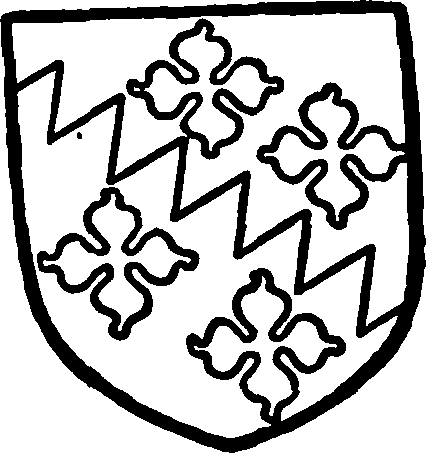
Chaytor, baronet. Party bendwise dancetty azure and argent with four quatrefoils countercoloured.
At THORNTON RUST (Toreton, xi cent.; Thornton Rust, xiii cent.) Turot had held a 'manor' and 6 carucates before the Conquest; in 1086 it was in the hands of Count Alan. (fn. 244)
Sybil of Thornton Steward had a mesne lordship in Thornton Rust in 1286–7. (fn. 245) Her chief tenant was Robert de Tateshall, whose lordship here followed the descent of his manor of Thoralby (fn. 246) (q.v.).
In 1389 Richard le Scrope was with others tenant under Sir John de Nevill of land in Thornton Rust. (fn. 247) His holding seems to have developed into a manor, which followed the descent of Castle Bolton (fn. 248) at least till 1803. (fn. 249) Before 1872 it had passed, presumably by purchase, into the hands of Mr. W. Tomlinson.
WEST BOLTON probably formed part of the 'Bodelton' which in 1086 was held of Count Alan by Ribald and was waste. (fn. 250) The descendants of Ribald, the lords of Middleham, held a mesne lordship here. (fn. 251) The family of Preston, of Preston in Wensley parish, held the manor at least from 1208. (fn. 252) It followed the descent of Preston (fn. 253) (q.v.) till it was sold to Stephen Scrope in 1318–19 by William de Playce and Alice his wife. (fn. 254) In 1320 Henry Scrope had a grant of free warren here. (fn. 255) From this date the manor followed the descent of Castle Bolton (q.v.).
A manor in WOODHALL was held in the 13th and 14th centuries by the family of Fitz Randall of Spennithorne. (fn. 256) It appears later among the lands in Middleham and elsewhere granted to Richard Duke of Gloucester, (fn. 257) which indicates its possession by the Nevills. The site of a manor in Woodhall is mentioned several times in the Ministers' Accounts of the honour of Richmond. (fn. 258) During its tenure by the Crown it was leased by the family of Metcalfe of Nappa, who purchased it in 1660–1 from the City of London. (fn. 259) Its subsequent history is obscure, but it probably came into the possession of the Thornton family of Askrigg, (fn. 260) and passed from them to the Lightfoots in 1748. The lord of the manor in 1890 was Mr. W. Lightfoot Bankes. (fn. 261)
WORTON, generally called the barony of Worton, (fn. 262) was a 'manor' in the hands of Bodin at the time of the Domesday Survey. (fn. 263) It was granted by his nephew Acharis son of Bardolf to the monks who settled at Fors, (fn. 264) and subsequently founded Jervaulx Abbey. In 1399 the abbey granted this 'barony' with all appurtenances to Ralph de Nevill in exchange for the advowson of the church of Aysgarth. (fn. 265) The manor followed the descent of Middleham. (fn. 266)
Worton was included in 1661 in the sale by the City of London of the manor of Bainbridge to the 'lords trustees' of that town (fn. 267) (q.v.). They had the manorial rights for a considerable time, but they are now held to have lapsed, as the freeholders of Worton divided their own common lands in 1809 without permission or interference of the lord trustee. (fn. 268)
Churches
The church of ST. ANDREW, Aysgarth, consists of a chancel measuring internally 43 ft. by 19 ft., a nave 75 ft. by 19 ft., north and south aisles prolonged eastwards and forming an organ chamber on the north side of the chancel and a chapel on the south, west tower and south porch.
With the exception of the west tower, the whole structure was rebuilt in 1866, some details from the former building being re-used. The five-light east window of the chancel is in 15th-century style, and arcades of two bays, opening into the northern and southern prolongations of the nave aisles, occupy the side walls. Against the south arcade stands a richly carved and painted wood screen of c. 1500 35 ft. in length, with a projecting canopy. The screen is in seven bays, the central bay being occupied by a doorway with double leaves. The canopy is supported by ribbed vaulting springing from small semi-octagonal shafts with moulded capitals and bases. The upper part of each side bay is divided into three ogee-headed lights, elaborately subfoliated, crocketed and pinnacled, with tracery above of a mixed vertical and flamboyant type. The cornice of the canopy is carved with running foliage of fruit and leaves, in which are animals, birds and monsters, with the initials 'HM' and a mitre and crozier in the middle.
Modern stalls have been constructed against the north face of the screen, two seats being arranged to each bay. The whole is richly gilt and painted with a blue-green ground decorated with stars, suns, &c.
Spanning the eastern bay of the arcade on the opposite side of the chancel is the carved head of an uncoloured oak screen. Along the upper beam is inscribed 'A. S. Abbas Anno Dñi 1536.' In the vestry are fragments of the tracery of a 15th-century screen; upon the door of a cupboard is the inscription 'C. I. 1672.' The reading desk, standing at the southwest end of the chancel, is an elaborate piece of carved work. The finials at either end are formed of rich and deeply-undercut foliage. The front is elaborately enriched; on the east side is carved the letter W over a hazel rising from a tun, and on the west side is a panel containing a shield with drops and the letters H. M. with crozier and mitre.
The east windows of the aisles are of 15th-century type, while those in the side walls have geometrical tracery of a nondescript character. On either side of the south-east doorway of the south aisle is a small piscina, preserved from the former building. That on the east has a trefoiled head; the western piscina has a pointed plain chamfered head and traces of a shell-shaped basin. The nave arcades are of five bays, and there is no opening to the tower in the west wall.
The west tower is in three stages, the upper, with battlements and pinnacles, having been rebuilt. The ground stage is entered by a modern door on the north side. The interior shows a recess where a doorway with two-centred head gave entrance to the nave. North of this is a pilaster buttress against the nave wall measuring 7 in. by 2 ft. 7 in. There is a similar buttress on the middle of the west external wall of the tower rising in two offsets. On the north external wall is a short pilaster buttress, and above it three lancet windows of different sizes, one above another; on the south wall is a similar arrangement of buttress and windows. Above the buttress on the west side is a two-light lancet window, and there is a similar window above the nave roof on the east wall. There are four large modern belfry lights. The walls of the tower on the ground level are nearly 4 ft. thick.
The font is modern.
Above the south-east door is a stone, apparently inverted when replaced in the wall, roughly engraved with a bugle on a baldric, a pear-shaped design in one corner and some illegible writing in the other.
The bells, six in number, were recast by Thomas Mears in 1829.
The plate consists of a set of two cups and one standing paten, presented in 1736.
The registers begin in 1709.
The church of ST. OSWALD, Askrigg, consists of a chancel and nave without break 75 ft. long by 17 ft. 3 in., north aisle 13 ft. 5 in., and south aisle 13 ft. 2 in. wide, south porch and western tower 9 ft. 9 in. by 9 ft. 6 in., all internal measurements.
Although the south arcade, the earliest architectural feature, dates from about 1460 or 1470, (fn. 269) there is little doubt that the remains of an earlier aisleless nave still remain in the walling. At the west end of the south aisle a straight joint with quoin stones can be seen a little above the ground. Measurements prove this to be 4½ in. outside the present south arcade wall; this wall is over 2 ft. 6 in. thick, and this with the 4½ in. makes it 2 ft. 10½ in., which is the exact thickness of the north wall. When the south arcade was put in the wall was made thinner. The church then stood with the chancel and nave in one and a south aisle only. It is probable that the tower was added very shortly afterwards.
About the year 1520 the north aisle and the clearstory were added. The north piers (fn. 270) differ from the others in section, being round instead of octagonal, and there is a slight variation in the section of the capitals and bases. As they are also higher, the arches which they carry were made of a different form, in order to keep down their crowns to the level of those of the arches of the south arcade. It will also be noticed that the wall above is too thick for the capitals, and that a rather clumsy treatment of corbelling out had to be resorted to accordingly. The section of the capitals is one that is common to every age, and differs little from those of the 15th century opposite. The south aisle was rebuilt towards the end of the 18th century, and in 1854 the church underwent a complete restoration, with the result that, excepting the clearstory windows and the south doorways and porch entrance, all the doorways and windows are modern. The church was re-cemented inside in 1877.
The east window of the chancel is of five transomed cinquefoiled lights with tracery in the head, those of the aisles are of two lights, all with traceried heads of 15th-century style. The arcades are each of five bays. The responds on the north side are halfrounds and the piers are circular. The bases are hollow chamfered, and the capitals have plain bells surmounted by abaci moulded with plain and hollow chamfers. The arches are slightly stilted, and are of the segmental two-centred form, stopped out above the capitals into one large splay; part of the outer face of the wall is also corbelled out in a roll mould over the capital. The stones immediately above the piers are newer than the rest of the arch. The south arcade has octagonal piers with plain chamfered bases; the capitals, which have hollow-chamfered abaci and shallow bells, are only 8½ in. deep, while those of the piers of the north arcade are 13 in. in depth. The arches are two-centred and of two chamfered orders. The east respond differs from the rest of the arcade in having a half-round shaft with a very crudely-shaped capital, a compromise in section between the shaft and the two chamfered orders of the arch; the whole is probably of later date. The clearstory is lighted by six windows in either wall, each with three four-centred uncusped lights of 16th-century date.
The north aisle has four traceried two-light windows in the north wall, and a west window of the same design, all modern; at the north-west is a doorway of two orders with a two-centred arch.
The windows of the south aisle are similar; between the first and second south windows is a small priest's doorway. The south entrance doorway is contemporary with the south arcade; it has a hollow-chamfered order and a two-centred arch with a moulded label and grotesque stops. The south porch apparently dates from the 16th century and has a two-centred arch; the mould is a continuous wide hollow in a chamfer, with a moulded label over.
The tower arch is two-centred and is square in section, with a modern label. The lowest stage of the tower is barrel vaulted with chamfered ribs. The west window is of two cinquefoiled lights with vertical tracery in the head. The second stage is lighted by a trefoiled ogee lancet in the west wall and a slit to the south side. The bell chamber or top story is lighted by a window of two trefoiled lights of late form in each wall; that to the east is partly blocked up to take a clock dial. The parapet is embattled and has corner pinnacles standing on the coping. The stair turret projects in the north-east angle and is lighted by slits.
The walling generally is of rubble. All the buttresses except that at the west end of the north wall are modern. The modern south wall has no buttresses. The aisle parapets are plain, that of the nave embattled. The low-pitched roofs of the nave and chancel appear to be 16th-century work; the timbers are moulded and the tie-beams have curved braces. The aisle roofs are modern.
The font is modern. In the vestry at the east end of the north aisle is a hexagonal cupboard of 18thcentury date.
The only monument of interest is a gravestone in the churchyard to Myles Alderson, who died in 1746, whose epitaph calls him 'an honest attorney.'
There are six bells, all cast or else recast in 1897. The fourth (a recast bell of 1657) has the inscription 'Jesus be our speed.'
The plate consists of a cup dated 1666, a chalice, paten, flagon and almsdish of 1854, all in silver, and two patens and flagons of pewter.
The registers begin in 1701.
The church of ST. MARGARET, Hawes, is an entirely modern building in the style of the 14th century. It consists of a chancel lighted by a fourlight east window and a three-light north window, both with traceried heads, a south vestry entered from the chancel as well as from the outside, a nave divided from aisles on both sides by arcades of five bays each, and a west tower opening into the nave with a twocentred drop arch. Each aisle is lighted by four traceried three-light windows in the side wall and a west window of a similar type; the north aisle has also a window in the east wall. The tower is of three stages; the lowest has a west window of three lights and a lancet in the north wall, the second stage has lancets on the north and west, and the third (or bell chamber) is lighted on all four sides by two-light windows with traceried heads. The parapet is embattled. There are eight tubular bells and a clock. The north and south doorways to the aisles both have porches. The roofs of nave and chancel are gabled. The octagonal stone font is modern.
The oldest monument is one of 1782 over the north doorway. Hanging in the chancel is an oak board, apparently once a desk top; on it is carved in Roman lettering of 17th-century type in four lines:—
'Brethren be at peace among your selves support the weak be patia nt toward all men and the very God of peace sanctifie you wholly.'
Standing in the vestry is an 18th-century black marble font on a square baluster stem containing a white earthenware basin inscribed with the names of the minister and churchwardens of the chapel in 1822.
The plate consists of a silver cup of 1706 given by William Whaley in 1760, a cup of 1710 given by Alice Allen in 1711, a salver of 1769 presented in 1772, and a flagon of 1772 given in 1851.
The registers begin in 1695.
The church of ST. MARY THE VIRGIN AND ST. JOHN at Hardraw consists of a chancel, north vestry and organ chamber, nave and south porch. The whole was built in 1879–81 in place of a church of 18th-century date, and is all in 12th and early 13thcentury style. The chancel is lighted by three lancets under one arch in its east wall, three trefoiled lancets on the south and one on the north. The vestry is entered by a small doorway, next to which is a large arch opening into the organ chamber. In the south wall are a small piscina and a small priest's doorway. An arch divides nave and chancel. The nave has in its north wall three single lancet windows, and at the west end a pair of trefoiled lancets beneath a quatrefoil. The south wall has three windows of the same type and an entrance doorway in 12th-century style. The west wall is pierced by a sexfoil above two trefoiled lancets. The bellcote over the west gable has three arched openings, but only one bell. The font, which is circular in plan, is modern.
The oldest monument is dated 1781. A great many gravestones in the churchyard were swept away during the memorable storm of 19 July 1889, when the village suffered extensive damage. Many were lost for ever, while others were recovered as far as three or four miles down the valley.
There are a plated cup, flagon and paten, presented in 1880, and a disused pewter cup and flagon.
The registers begin in 1749.
The church situated in the hamlet of LUNDS is a plain rectangular apartment measuring internally about 24 ft. by 14 ft. There is no chancel or vestry, and there are only two windows, one in the east, the other in the south, which are round-headed. There is a rude bellcote at the west end containing one bell.
The plate consists of an old pewter cup and a plated cup and paten dated 1895.
The registers begin in 1749.
STALLINGBUSK CHAPEL is a curious little late 18th-century building of stone standing in an isolated position above Semer Water. It consists of a nave and two aisles running north and south (or transversely), and is gabled at the east and west ends. The roof is covered with stone slates, and at the west end is a small roughly-made wood bellcote containing one bell. The entrance is on the south side, and has a small porch. The northern of the two east windows is a mullioned square of two lights, possibly a relic of an earlier building; all the others, eight in number, have wooden frames. The east and west arcades are of two bays with plastered arches of square section. The ceiling is plastered and the whole building whitewashed inside. The altar is in the middle of the east aisle behind the middle pier of the arcade, against which the pulpit is placed, and the box pews are arranged transversely to the arcades to face east. The furniture is all of deal of late 18th or early 19th-century date; high communion rails surround the altar. The stone font has a small octagonal bowl on a thin square stem. There are two mural monuments of 1808 and 1841. A graveyard surrounds the building.
Advowsons
The church of Aysgarth was held with the manor by the Burgh family until 1222, when Thomas de Burgh enfeoffed of it Ranulph son of Robert, lord of Middleham. (fn. 271) It followed the descent of this manor, and in 1397 Ralph Nevill Earl of Westmorland exchanged it with the abbey of Jervaulx for the manor of Worton and various lands in Askrigg, Newbiggin, Nappa and elsewhere (fn. 272); it was valued at £200 a year in 1285. (fn. 273) Licences for appropriation were granted, (fn. 274) and in 1400 the king confirmed the estate of the abbey in the church, on condition that a vicarage was ordained and a competent sum distributed yearly among the poor. (fn. 275) A vicarage was ordained about twenty years later, (fn. 276) and the church remained the possession of Jervaulx Abbey till the Dissolution. (fn. 277)
In 1537 Sir Arthur Darcy begged Lady Ughtred to secure him a Crown lease of the parsonage, offering her £100 and 'a fair bed of pirled velvet' as recompense. (fn. 278) He appears to have been unsuccessful, as a lease was granted in 1538 to Michael Wentworth at an annual rent of £160. (fn. 279) Queen Mary in 1554 granted the rectory and advowson to the Master and Fellows of Trinity College, Cambridge, (fn. 280) the present patrons. (fn. 281) The tithes in the 17th century were let out to farm. (fn. 282)
The 'great chapel of Thoralby,' in which Mary Nevill founded a chantry in 1316, (fn. 283) was possibly a domestic chapel. It was dedicated to All Hallows, and was still used in 1536. (fn. 284) It is not afterwards mentioned.
In 1609 there were four chapels of ease in the forest of Wensleydale, built by the inhabitants, and made necessary by the size of the parish and its mountainous and hilly roads. (fn. 285) Of these the chapel at Askrigg was probably in existence as early as 1301–2, when 'Robert the chaplain' paid subsidy for the tithes of Nappa and Askrigg. (fn. 286) It is mentioned in 1423. (fn. 287) James Metcalfe founded a chantry in the church of St. Oswald at Askrigg in 1467. (fn. 288) In 1610 Askrigg was described as 'a parochiall chapel, which hath weddings, christenings, burials,' &c. (fn. 289) The vicar of Aysgarth then paid the curate. (fn. 290) The living is now an augmented perpetual curacy, independent of Aysgarth, but the vicar of Aysgarth is patron.
The other three chapels referred to in 1609 were at Hardraw, Hawes and Stallingbusk, (fn. 291) all supported by the inhabitants. (fn. 292) The chapel at Hawes was in existence in the reign of Richard III. (fn. 293) The landowners of the vill presented down to the middle of the 19th century, (fn. 294) when the patronage seems to have been transferred to the vicar of Aysgarth. He also now presents to the chapelry of Stallingbusk.
The patronage of Hardraw has belonged to the lord of the manor of Low Abbotside since 1786 at least. (fn. 295) Hardraw with Lunds, the highest village in the valley, where a chapel seems to have been built at a later date than the rest, (fn. 296) now forms one parish, and the Earl of Wharncliffe, as patron of Hardraw, and the vicar of Aysgarth, as patron of Lunds, present alternately to the living.
There was a chantry at Dale Grange in 1536, (fn. 297) apparently supported by the monks of Jervaulx after their migration to East Witton.
Charities
The poor of the township of Aysgarth are entitled to the annual sum of 10s. charged by a donor unknown on a house and garth in Aysgarth.
In 1859 C. Tomlinson by deed conveyed 1 a. 1 r. 26 p. for the National school. The land is let at £5 a year.
The Wesleyan Chapel, founded by trust deed 1799, is regulated by a scheme of the Charity Commissioners, 1889, whereby the chapel and appurtenances are directed to be held upon the trusts of deeds, dated 3 July 1832, known as the 'Skircoat Wesleyan Model Deed.'
Township of Burton-with-Walden.—The following charities were by a scheme of the Charity Commissioners dated 2 February 1894 consolidated, namely: The Poor's Close, containing 3 a. 1 r. 28 p., let at £7 15s. a year; charity of Elizabeth Whiting, 1756, trust fund, £30 4s. 6d. consols with the official trustees, and the Poor's Land rent-charge, 1784, being £2 issuing out of land called Square Close belonging to Mr. John William Lodge. By the scheme the income of the stock is directed to be applied in apprenticing poor children of the township, or in prizes for children attending public elementary schools or in payment of their tuition fees; the net income of the remaining charities to be applied for the general benefit of the poor of the township by donations in aid of the funds of a hospital, convalescent home, or institution in which children suffering from any bodily infirmity are taught a trade, coal or clothing club, or contributions towards the provision of nurses. In 1905 tickets on tradesmen for groceries, coals and hosiery amounting in value to £12 were given to five recipients.
The Robinson Memorial School was erected in 1869 by Mr. H. T. Robinson and endowed by Mrs. Ann Hudson with £500 North Eastern Railway 4 per cent. preference stock, which is held by the official trustees. It is regulated by a scheme of the Court of Chancery dated 23 July 1889.
Township of Askrigg.—For the Grammar school see 'Schools.' (fn. 298)
John Wetherill alias Wetherald, by will, date unknown, left £50, the interest to be applied as to one moiety to the parson of Askrigg and the other moiety to necessitous families. The sum of £1 is retained by the vicar, by whom a sum of £1 is also distributed in sums of 2s. 6d. to eight poor persons.
An ancient rent-charge of 12s. a year, under the title of Alderson's Dole, is paid out of a meadow called Sater End by Mr. W. E. M. Winn, and distributed among six or seven poor people.
The Market Charity was created by charter of Queen Elizabeth. By an order of the Charity Commissioners of 1 February 1898 the parish council of Askrigg were appointed trustees, and the building (if not sold) was authorized to be used for the purposes of a public reading room or any other public purpose.
The almshouses, founded and endowed in 1807 by Christopher Alderson, are regulated by a scheme of the Charity Commissioners dated 11 January 1907. The trust property consists of three freehold messuages situate at Dale Grange, known as the Askrigg and Low Abbotside Almshouses, and £2,182 12s. 2d. India £3 per cent. stock held by the official trustees, producing £65 9s. 4d. a year. The scheme provides (inter alia) that the full number of almspeople shall be three, being poor widows or spinsters of not less than sixty years of age, of whom two shall be selected from the township of Askrigg and one from the township of Low Abbotside, the stipends to be at the rate of not less than 5s. and not more than 10s. a week for each inmate, any residue of income to be applied for the general benefit of deserving and necessitous old women resident in the said townships.
Township of Hawes.—The Free school, founded by deed of settlement by the inhabitants, 1764, is endowed with £410 stock and an annual rent-charge of 5s.
The Market House Charity is regulated by a scheme of the High Court of Justice, 1894, as varied by a scheme of the Charity Commissioners of 2 April 1897. The property formerly belonging to the charity in Burtrey Field was sold in 1898 and the proceeds invested in the purchase of half an acre situate in the Fair Field, the legal estate in which was by an order of 27 June 1899 vested in the Official Trustee of Charity Lands. In 1906 the income derived from rents of land, storehouse and tolls, &c., amounted to £37 4s., which was applied in repairs and in payment of dividends on shares.
The Congregational chapel, school and minister's house, trust deed 1851, is regulated by a scheme of the Charity Commissioners of 1876.
The Wesleyan chapel at Gaye, founded by deed 1833, is regulated by a scheme of the Charity Commissioners of 1890, whereby a sum of £1 2s. 6d. a year is distributable among the poor of the township.
Township of Thoralby and Newbiggin.—The Poor's Land, containing about 4 acres, given at a date unknown by one Butterfield, is let at £8 a year, which is distributed among six poor persons in sums varying from £1 to 30s.
Charles Robinson's Charity, will, 1790.—See parish of West Witton.
The Free school at Newbiggin, founded by Elizabeth Withay, deed, 1748, is endowed with 3 acres let at £7 a year.
The Wesleyan Chapel at Thoralby, founded by deed, 1825, is regulated by a scheme of the Charity Commissioners of 1890, whereby the chapel and appurtenances are directed to be held upon trusts of deed, dated 3 July 1832, known as the 'Skircoat Wesleyan Model Deed.'
Township of High Abbotside.—The Poor's Close, containing somewhat less than an acre, was settled by Mrs. Isabel Metcalfe upon trust for the poor of Sedbusk in this township by deed of bargain and sale of 18 December 1872 (enrolled). It is let at £6 5s. a year, which is divided among fifteen poor people in sums varying from 4s. to 5s. each.
Township of Thornton Rust.—Calvinist Free school and chapel. The trust property consists of schoolmaster's or minister's house, schoolroom and chapel, a cottage and 2 a. 2 r. of land, producing £10 15s. a year, conveyed by deeds of 1827 and 1831, and £2,105 7s. 8d. consols with the official trustees, producing £52 12s. 8d. a year. The net income is received by the schoolmaster, who is also the minister of the chapel.