A History of the County of Oxford: Volume 16. Originally published by Boydell & Brewer for the Institute of Historical Research, Woodbridge, Suffolk, 2011.
This free content was digitised by double rekeying. All rights reserved.
'Plate 6: Harpsden', in A History of the County of Oxford: Volume 16, ed. Simon Townley (Woodbridge, Suffolk, 2011), British History Online https://prod.british-history.ac.uk/vch/oxon/vol16/plate-6 [accessed 10 May 2025].
'Plate 6: Harpsden', in A History of the County of Oxford: Volume 16. Edited by Simon Townley (Woodbridge, Suffolk, 2011), British History Online, accessed May 10, 2025, https://prod.british-history.ac.uk/vch/oxon/vol16/plate-6.
"Plate 6: Harpsden". A History of the County of Oxford: Volume 16. Ed. Simon Townley (Woodbridge, Suffolk, 2011), British History Online. Web. 10 May 2025. https://prod.british-history.ac.uk/vch/oxon/vol16/plate-6.
Harpsden
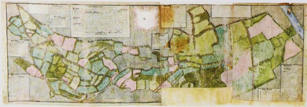
12a (top) The Harpsden estate map of 1586, showing the parish's northern part (by then fully inclosed). The river is on the extreme right, and Harpsden Court a little to its west.
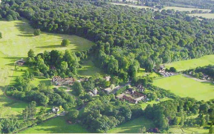
12b (below) Harpsden Court and Harpsden church (centre), looking south-west to Harpsden Wood. Henley Golf Club (opened 1907–8) adjoins the wood at centre right.