A History of the County of Lancaster: Volume 5. Originally published by Victoria County History, London, 1911.
This free content was digitised by double rekeying. All rights reserved.
'Townships: Tottington', in A History of the County of Lancaster: Volume 5, ed. William Farrer, J Brownbill (London, 1911), British History Online https://prod.british-history.ac.uk/vch/lancs/vol5/pp143-150 [accessed 19 April 2025].
'Townships: Tottington', in A History of the County of Lancaster: Volume 5. Edited by William Farrer, J Brownbill (London, 1911), British History Online, accessed April 19, 2025, https://prod.british-history.ac.uk/vch/lancs/vol5/pp143-150.
"Townships: Tottington". A History of the County of Lancaster: Volume 5. Ed. William Farrer, J Brownbill (London, 1911), British History Online. Web. 19 April 2025. https://prod.british-history.ac.uk/vch/lancs/vol5/pp143-150.
In this section
TOTTINGTON LOWER END
Totinton, 1212; Totington, 1233.
Tottington originally comprised all the northern part of the parish of Bury. Shuttleworth, as above, became incorporated with Walmersley through being given to the lord of Bury; Musbury and Cowpe Lench were placed in the hundred of Blackburn, and in the 17th or 18th century what remained of Tottington was divided into two parts—the Lower End and the Higher End, south and north respectively.
The Lower End contains the village of Tottington, with the hamlets of Woolfold, Bolholt, and Walshaw in the south; Affetside and Hawkshaw in the west; Green Mount, Holcombe Brook, Redisher, Hazelhurst, and Holcombe in the centre, and Brooksbottom, Nuttall, Nuttall Lane, and Ramsbottom (with Tanners and Carr to its west) in the north-east, along the Irwell, which there in general forms the boundary. The north is occupied by the flat-topped Harkles Hill; which rises steeply on three sides, the summit being 1,216 ft. high. To the north-west is Scholes Height, 1,350 ft. Magnificent views maybe obtained in clear weather over the surrounding country; Snowdon may sometimes be seen. On the south side of Holcombe Brook the surface again rises to the south-west, a height of 890 ft. being attained at Affetside on the border. The township has an area of 5,270½ acres. (fn. 1) The population of the present township of Tottington was 6,118 in 1901.
The principal road is that from Bury to Blackburn, passing through the village of Tottington. Along the south-west border runs another road, called Watling Street, (fn. 2) which meets the former within the township of Bradshaw, at a point from which a third road runs eastward through Hawkshaw to Holcombe Brook and then north-east and north to Ramsbottom and Haslingden. At Holcombe Brook it is joined by roads from the south. There are several bridges over the Irwell for roads into Walmersley and Shuttleworth. The Lancashire and Yorkshire Company's railway from Bury to Accrington runs along the eastern side of the township, crossing the Irwell several times, and having a station at Ramsbottom. A branch from Bury has stations at Woolfold, Tottington, Green Mount, and Holcombe Brook, which is the terminus.
At Holcombe are the remains of a bloomery, probably of the Tudor period. (fn. 3)
There is a local tradition that men slain in battle were buried at Holcombe, and weapons have been found there. (fn. 4)
On the hill above Holcombe is a lofty tower, erected in 1852 as a monument to Sir Robert Peel.
In 1666 there were as many as 178 hearths liable to the tax; the dwellings were small, (fn. 5) Thomas Nuttail's, with five hearths, being the largest.
James Wood, master of St. John's College, Cambridge, 1805 to 1839, and Dean of Ely, was born at Birchhey, Tottington. (fn. 6)
In 1831 an annual fair was said to be held on 12 October. (fn. 7)
Within the last century a manufacturing town has grown up at RAMSBOTTOM, (fn. 8) between the road from Bury to Haslingden, there called Bolton Street, and the River Irwell, with suburbs stretching south to Hazelhurst and north to Stubbins. The principal cross street is Bridge Street, leading from the bridge across the Irwell past the railway station to Bolton Street, and then to Carr and Tanners. The brothers William and Daniel Grant, whose story is told by Dr. Smiles in Self Help, were intimately associated with the rise of the town. (fn. 9) They were the originals of the Cheeryble Brothers. (fn. 10) There are here iron and brass foundries, machine-making works, and great cotton manufacturing and printing works. A local board of twelve members was established in 1864; (fn. 11) the area was enlarged in 1883, and now includes parts of Tottington Higher and Lower, Elton, Shuttleworth, and Walmersley. (fn. 12) The old township boundaries were finally obliterated in 1894, when the local board became an urban district council. The area is divided into four wards—Central, North, East, and West—each returning three members to the council. Water is supplied from the Bury Waterworks, and gas by a company. The Aitken Cottage Hospital, presented by Mrs. Aitken of Holcombe, was opened in 1900. The cemetery at Hazelhurst is under the management of a burial board. The Ramsbottom Observer is published every Friday. The population numbered 15,920 in 1901.
Parts of Tottington Lower End having been taken into Ramsbottom and Bury, the remainder has been constituted a township or civil parish, called Tottington simply. (fn. 13)
The fair at Tottington is held on the third Friday in August; those at Ramsbottom on 27 April and the Monday after 27 August. The wakes at the latter place begin on the second Saturday in August.
TOTTINGTON HIGHER END
The northern part of the old township stretches along the border of the hundred for over 4 miles. It is divided by the Irwell. On the west side of the river the ground rises quickly to Bull Hill on the west, 1,372 ft., from which fine views may be obtained; the valley on the northern slope of this hill was called Alden. Alden Brook is the boundary of the township and hundred. The hamlets of Stubbins and Lumb lie near the Irwell, with Red Lees and Buckden to the west. On the east side the ground also rises, though not so rapidly, the northern border of the township and hundred being formed by the crest of a hill, which on the boundary of Rochdale attains a height of 1,550 ft., being there known as Hailstorm Hill. The high lands are occupied by Dearden and Tottington Moors. On the western slope of this eminence is the village of Edenfield, with Newhall to the east, Chatterton to the west, Hardsough and Crow Woods to the north-west, and Balladen and Horncliffe to the north. The area of this part of the township is 3,545 acres.
The principal roads are those leading from Bury to Haslingden, on the west of the Irwell, and to Rawtenstall on the east side. The latter is joined at Edenfield by roads from Ramsbottom and from Rochdale. The Lancashire and Yorkshire Company's railway from Bury to Accrington runs north through the township, and has a station at Stubbins; here the Bacup branch separates, and it has a station called Ewood Bridge and Edenfield, at Ashen Bottom, on the northern boundary.
On Holcombe Moor, beside a footpath running south along the hillside, stood the base of Whowell Cross, or the Pilgrim's Cross, until 1901, when it was wilfully destroyed. A memorial stone has been placed on the spot. (fn. 14) 'Robin Hood's Well' is a mile to the north. (fn. 15) On Bull Hill are remains of an early neolithic floor. (fn. 16)
The hearths liable to the tax in 1666 numbered seventy-four; the only large house was Robert Holt's, New Hall, with ten hearths. (fn. 17)
Tottington Higher End has now ceased to exist as a township, having been divided between Ramsbottom, Rawtenstall, and Haslingden. (fn. 18)

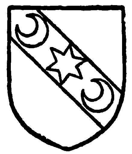
Montagu-Douglas-Scott, Duke of Buccleuch. Or on a bend azure a mullet of six points between two crescents of the field.
Manor
The manor or fee of TOTTINGTON was held by the Montbegon and Lacy families, and passed to the Crown in the manner described in the account of the Clitheroe barony. (fn. 19) The Duke of Buccleuch is the present lord of the manor. The service due from the whole fee seems to have been performed by the dependent manors of Bury, Middleton, and Chadderton, so that Tottington proper, including perhaps Shuttleworth, was free. In 1324, however, it was stated that the lords had been accustomed to pay 18d. to a service called Grayngall, (fn. 20) and in 1348 a payment of 16d. was made. (fn. 21) The service due from Tottington was about the same time called the fifth part of a knight's fee. (fn. 22)

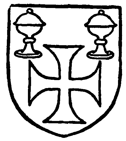
Monk Bretton Priory. Sable in chief two covered cups, in base a cross for my argent.
It appears to have been regarded as a free chase. (fn. 23) A grant of gallows was obtained by Henry de Lacy from Henry III. (fn. 24) Four oxgangs were granted by Adam de Montbegon to Ailward de Bury in free marriage with Alice daughter of the grantor. (fn. 25) A moiety of Shuttleworth was given to the Bury family, and some other grants were made; Cowpe, Lench, and Musbury were placed within the forest of Rossendale, and Holcombe was given to the monks of Monk Bretton, near Pontefract. (fn. 26) In the time of Richard III Holcombe had been annexed to the duchy of Lancaster, but the monks' claim seems to have been admitted, and they received the advowson of Darton as compensation. (fn. 27) The monks' lands were granted out at a rent of 13s. 4d. a year, (fn. 28) and after the Dissolution were in 1546 granted to John Braddyll of Whalley. (fn. 29)
The Compoti of 1296 and 1305 (fn. 30) and the inquisition of 1311 (fn. 31) give particulars of the receipts. There was a capital messuage; 100 acres of land were demised to tenants at will, as also were the eight oxgangs; the courts, water-mill, pasture, and Musbury Park also produced an income. (fn. 32) The free tenants seem to have been Henry de Bury for half the manor of Shuttleworth, (fn. 33) Richard de Radcliffe, (fn. 34) Robert de Bradshaw, (fn. 35) and Roger de Chadderton for Shillingbottom. (fn. 36) The court rolls of 1323 and 1324 contain many interesting particulars. (fn. 37)
The principal local families were the Nuttalls, (fn. 38) Rawstornes, (fn. 39) Ramsbottoms, (fn. 40) and Booths (fn. 41); but of these and others (fn. 42) only meagre accounts can be given. The Greenhalghs of Brandlesholme were hereditary bailiffs of the manor, (fn. 43) and one branch of them settled here. (fn. 44)

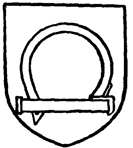
Nuttall. Argent a shack-bolt sable.

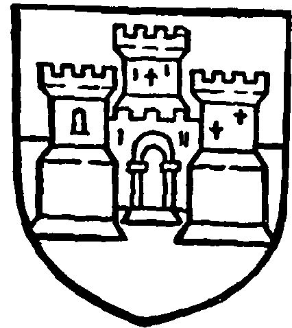
Rawstorne. Per pale azure and gules a castle triple-towered or.
Numerous disputes are on record concerning the wastes and commons. (fn. 45) In 1618 the tenants agreed to pay a composition of £1,420, and arrearages of £264 for a confirmation of their title as copyholders, but this was not fully carried out until 1669. (fn. 46)
The land tax returns show that the principal proprietors in Tottington Higher End in 1796 were the Rev. Mr. Formby and Lawrence Rawstorne; and in Lower End in 1797 William Lomax and Thomas Barcroft. (fn. 47)
Churches
Ancient chapels exist at Holcombe (fn. 48) and Edenfield. At HOLCOMBE there remained in 1552 two sets of vestments, some bells, and other 'ornaments.' (fn. 49) After this time Holcombe Chapel probably continued to be 'maintained by the inhabitants,' (fn. 50) there being no endowment, and in 1634 it had a curate of its own. (fn. 51) The steward of the king's courts for Tottington held the courts in this chapel in 1633; on finding the building locked against him he fined the wardens £40. The commissioners of 1650 found it vacant 'for want of maintenance,' and recommended that it be made a parish church. (fn. 52) From the Restoration to the beginning of last century this chapel and Edenfield appear to have been served by the same curate. (fn. 53) It was enlarged in 1714 and again in 1774, and rebuilt in 1853; it is now called Emmanuel Church. (fn. 54) A separate district was assigned to it in 1863. (fn. 55) The rector of Bury is patron.
The following have been curates and rectors:— (fn. 56)
| oc. 1609 | Thomas Scholefield (fn. 57) |
| oc. 1615 | William Rathbone |
| oc. 1620, 1624 | John Blagge (or Bragge) (fn. 58) |
| oc. 1634–41 | Edmond Brooks (fn. 59) |
| oc. 1645 | John Pollitt (fn. 60) |
| oc. 1645 | Nicholas Cudworth (fn. 61) |
| oc. 1647–48 | Robert Gilbody (fn. 62) |
| 1652 | Henry Pendlebury, M.A. (fn. 63) (Christ's Coll. Camb.) |
| oc. 1667–91 | John Warburton, M.A. (fn. 64) |
| oc. 1696 | William Richardson |
| oc. 1705 | James Murray |
| oc. 1712 | Richard Slater |
| oc. 1717 | C. Barrett (fn. 65) |
| 1722 | Thomas Ryder (fn. 66) |
| 1725 | John Boardman |
| 1738 | John Lowe, B.A. |
| 1757 | William Harrison |
| 1760 | Richard Thickstone |
| 1764 | John Smith (fn. 67) |
| 1810 | William Holt, (fn. 68) M.A. (Brasenose Coll. Oxf.) |
| 1849 | George Nightingale, (fn. 69) M.A. (St. Cath. Coll. Camb.) |
| 1875 | Henry Dowsett (fn. 70) |
| 1905 | George Lawson Merchant, M.A. (Worcester Coll. Oxf.) |
There was a chapel at EDENFIELD (fn. 71) as early as 1541; (fn. 72) this was perhaps the building described in 1546 as built by the tenants upon a piece of the king's waste, in which their chaplain celebrated daily for the souls of all the faithful departed. (fn. 73) An inquiry was made about it in 1552, (fn. 74) and it appears to have been sold to William Kenyon, who next year was in possession. (fn. 75) Possibly it was recovered or a new one was built, for the tradition in Bishop Gastrell's time was that the then-existing chapel had been consecrated in the time of Elizabeth. (fn. 76) In the next century it, like Holcombe, was kept up by the inhabitants, without endowment. (fn. 77) In 1634 it had a separate curate, (fn. 78) but was vacant in 1650, (fn. 79) and was usually served by the curate of Holcombe (fn. 80) down to the beginning of last century; down to 1733 service was held there once a month only, but afterwards on alternate Sundays. (fn. 81) It was rebuilt in 1778. No dedication is known. A separate district was assigned to it in 1865. (fn. 82) The rector of Bury is patron.
The curates and vicars since Edenfield became separate from Holcombe have been:—
| 1842 | Matthew Wilson (fn. 83) |
| 1870 | James Pearse Yeo (fn. 84) |
| 1902 | Alfred Dinley Studdy Studdy, B.A. (Lond.) |
In recent times the following have been erected for the worship of the Established Church:—St. Anne's, Tottington, in 1799—patron, the rector of Bury; (fn. 85) St. Paul's, Ramsbottom, 1850, rebuilt 1864 (fn. 86) —patron, the Crown and the Bishop of Manchester, alternately; and St. Andrew's, in the same town, 1875—patron, Sir John Grant Lawson; (fn. 87) St. Mary's, Hawkshaw Lane, 1892—patron, the Bishop of Manchester.
St. John's Free Church of England, Tottington, was built in 1867–8.
The Wesleyans have a church at Tottington built in 1820 and rebuilt in 1904; others at Walshaw, at Hawkshaw Lane, at Ramsbottom, built in 1873, and at Edenfield, built in 1832 and rebuilt in 1879. The Primitive Methodists have churches at Ramsbottom and Edenfield, built in 1889 and 1881 respectively. The United Methodist Church is represented at Ramsbottom, Holcombe Brook, and Hawkshaw Lane.
The Baptists have a church at Ramsbottom, built in 1851; the Particular Baptists also have one there.
Protestant Nonconformity since 1662 is represented by the chapel at Dundee. Henry Pendlebury, on being expelled from Holcombe, continued to minister in the district, principally at Bast House, on the other side of the Irwell. His successor, Edward Rothwell of Tunley, moved to Holcombe, and in 1712 there built a chapel within a stone's throw of the old chapel. Another chapel, still in use, was built nearer Ramsbottom. The English Presbyterians and Independents continued to occupy it until 1813, when it was acquired by the Scottish Presbyterians, who still retain it. (fn. 88) In 1832 a new church, St. Andrew's, now belonging to the English Establishment, was built for the congregation, but closed to them in 1869; they returned to the old chapel for a time, but in 1873 the new church of St. Andrew was built for them; it is connected with the Presbyterian Church of England. (fn. 89)
The Congregationalists, who thus lost Dundee Chapel, have a new church there and one at Stubbins, built in 1866–7; also one at Green Mount, with a lofty tower and spire, built in 1866. The lastnamed has a mission chapel at Affetside. (fn. 90)
The Swedenborgians erected a church at Ramsbottom in 1831; this was replaced by another in 1876.
The Roman Catholic Church of St. Joseph, Ramsbottom, was built in 1879, replacing one opened in 1862; the chapel of the Home for Orphans at Tottington is also available for the public.