A History of the County of Lancaster: Volume 4. Originally published by Victoria County History, London, 1911.
This free content was digitised by double rekeying. All rights reserved.
'The parish of Ashton-under-Lyne: Introduction, manor & boroughs', in A History of the County of Lancaster: Volume 4, ed. William Farrer, J Brownbill (London, 1911), British History Online https://prod.british-history.ac.uk/vch/lancs/vol4/pp338-347 [accessed 19 April 2025].
'The parish of Ashton-under-Lyne: Introduction, manor & boroughs', in A History of the County of Lancaster: Volume 4. Edited by William Farrer, J Brownbill (London, 1911), British History Online, accessed April 19, 2025, https://prod.british-history.ac.uk/vch/lancs/vol4/pp338-347.
"The parish of Ashton-under-Lyne: Introduction, manor & boroughs". A History of the County of Lancaster: Volume 4. Ed. William Farrer, J Brownbill (London, 1911), British History Online. Web. 19 April 2025. https://prod.british-history.ac.uk/vch/lancs/vol4/pp338-347.
In this section
ASHTON-UNDER-LYNE
Eston, 1212; Ashton, 1277; Aston, 1278; Asshton, Asheton, Assheton, 1292; Ashton-under-Lyme, 1307; Assheton-under-Lyme, 1345. Lyne, for Lyme or Lime, seems to be modern.
This single-township parish (fn. 1) occupies the southeastern corner of the county, and has an area of 9,494 acres. The surface is hilly, particularly in the east; a long ridge, attaining a height of 1,000 ft., stretches from north to south near the eastern border, various spurs shooting out to the west. These spurs are separated from each other by the Medlock and its tributaries, and by other streams flowing into the River Tame, which forms the eastern and southern boundary of the parish. (fn. 2) There are numerous bridges over this river. The Millstone Grit series occurs in the valley of the Tame and northward to Lees. Westward the Lower and Upper Coal Measures follow in sequence until on the western side of the parish the Lower Red Sandstone of the Permian Rocks occurs at Audenshaw and extends towards Droylsden and the Manchester Waterworks.
The population was thus returned in 1901: Ashton Town, 43,890; Audenshaw, 7,216; Little Moss, 595; Woodhouses, 832—8,643; Knott Lanes, including Alt, 1,037; Bardsley, 2,194; Crossbank, 1,077; Lees, 3,621; Waterloo (with Taunton), 3,858— 11,787; Hartshead (with Hazelhurst), 745; Hurst, 7,145; Mossley, 13,452; Stalybridge, 27,673— 49,015; making a total of 113,335; but some places outside Lancashire are herein included.
The town of Ashton stands on an eminence overhanging the Tame, near the centre of the southern boundary, and having Stalybridge (fn. 3) immediately to the east. From Ashton itself the principal roads branch out, to Oldham on the north, Manchester on the west, Stalybridge on the east, and Mossley and Yorkshire on the north-east. The town is for the most part laid out in streets crossing each other at right angles, the Oldham and Manchester roads giving the lines; the older portion, at the eastern end, where there is a bridge over the Tame, shows less regularity.
The first railway in the parish was that from Manchester to Sheffield, authorized in 1831. This is now part of the Great Central system. It crosses Audenshaw from west to east, and there are now two stations, Fairfield and Guide Bridge; at the former is a junction with the company's line from Central Station, Manchester, and from Guide Bridge one branch runs east to Ashton (Park Parade) and Stalybridge, with stations, while another branch goes north to Oldham, with stations called Ashton (Oldham Road) and Park Bridge; and a third connects with the London and North Western Railway Company's lines. This company opened a line from Manchester to Ashton in 1842, with stations at Droylsden (on the border of Ashton and Droylsden), Ashton (Charlestown), and Stalybridge; and a branch goes south to the Stockport line, with a station at Audenshaw. The same company's line from Stockport to Huddersfield runs through Hooley Hill, Stalybridge, and Mossley, where there are stations; while the line from Oldham to Delph crosses the northern corner of the parish, with a station called Lees.
The Manchester and Ashton Canal, begun in 1792, goes east through Audenshaw, and passing along the south side of the town of Ashton crosses into Cheshire at Stalybridge. There are branches northward to Oldham.
The parish was formerly divided by custom into four 'divisions,' (fn. 4) which were often styled townships, viz. (i) Ashton Town, 1,373½ acres, bounded on the east by Cock Brook, and on the west by Ashton Moss, with the hamlets or suburbs of Chamber Hills, Over-steads, Lees Fields, Charlestown, Ryecroft, Moss Side, and Guide Bridge; (ii) Audenshaw, 2,589½ acres, in the west, containing, beside Audenshaw proper with North Street, Hooley Hill, High Ash, Shepley, Little Moss, Waterhouses, Woodhouses, Sunderland, Medlock Vale, and Buckley Hill; (iii) Knott Lanes, on the north, 2,417 acres, with Wood Park, Cross Bank, Alt Edge, Taunton, Waterloo, Bardsley, Lees or Hey, Mill Bottom, Birks, Rhodes Hill, Lanehead, High Knolls, Alt, and Alt Hill; (iv) Hartshead, on the east, 3,114 acres, with Stalybridge, Mossley, Hurst and Higher Hurst, Smallshaw, Greenhurst, Hazelhurst, Heyrod, Luzley, Souracre, and Ridge Hill. In 1894, Stalybridge being added to Cheshire, the remainder of the parish of Ashton was divided into the existing townships of Ashton-under-Lyne, Audenshaw, Little Moss, Waterloo, Hurst, Woodhouses, Bardsley, Alt, Lees, (fn. 5) Hartshead, Cross Bank, and (part of) Mossley.
Of these Ashton and Mossley are boroughs; Audenshaw, Hurst, and Lees obtained local boards in 1874, (fn. 6) 1861, (fn. 7) and 1859, (fn. 8) respectively, and became urban districts in 1894, with councils of twelve members each; the rest of the townships, forming the rural district of Limehurst, are governed by parish councils. Waterhouses, described by Ben Brierley as 'Daisy Nook,' has become a summer afternoon resort.
In Audenshaw is a large reservoir belonging to the Manchester Water Works. At Hartshead is the Twarl Hill tithe-stone, where it is said tithes were formerly paid. (fn. 9) On Hartshead Pike was a conical pillar, built 1751, surmounted by a hart's head; it fell down about 1820, but was partly rebuilt in 1863 to commemorate the marriage of King Edward VII and Queen Alexandra. (fn. 10) Near Lees was a noted chalybeate spring called Lees Spa; there are other similar ones in the parish. In the bed of the Medlock are the so-called Druidical basins.
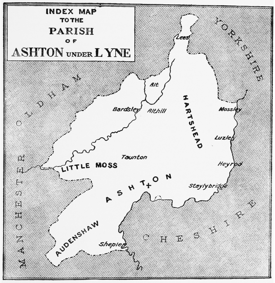
INDEX MAP TO THE PARISH OF ASHTON UNDER LYNE
The public buildings include a mechanics' institute founded in 1825, clubs, and a theatre. The infirmary was built in 1859–60, and a children's hospital in 1893; a nurses' home has been added.
A Volunteer regiment was raised in 1803. (fn. 11) Ashton is the headquarters of the 3rd V. B. Manchester Regiment; the drill hall was built in 1887. There are barracks at Hurst, built in 1843.
There are two weekly newspapers and an evening daily paper.
The market cross was taken down in 1829. (fn. 12)
The ceremony of 'riding the Black Lad,' still to some extent kept up, was performed on Easter Monday; the effigy of a knight in black armour was paraded through the streets on horseback in derision, afterwards hung up on the old market cross and used as a target, being finally plunged in a stagnant pool. There are contradictory accounts of the origin and intention of the ceremony. (fn. 13) The 'gyst ale' was another Ashton custom. (fn. 14) The annual wake, formerly kept on the third Sunday in September, is now held on the Sunday next after 15 August.
In Ashton Moss red fir trees used to be dug up, and split up for light for the poor; large oaks were also found.
Copper tokens were issued in Ashton in the middle of the 17th century. (fn. 15)
A cotton mill was established at Stalybridge in 1776, (fn. 16) and the manufacture rapidly grew under the favourable conditions of easy water carriage and abundant coal supply. The modern industries of the district, in addition to this staple trade, include hatmaking, brewing, and silk-weaving; there are also iron foundries, engineering works, machine factories, and collieries. At Ashton Moss are market gardens. Audenshaw has cotton factories and engineering works, and some hat factories; Hurst also has great cotton mills and some hat-making, together with collieries; at Lees, again, are cotton mills, as also at Mossley. Stalybridge has much the same industries as Ashton itself; also nail-making, and some woollen manufacture. (fn. 17)
The agricultural land is now apportioned thus: arable land, 173 acres; permanent grass, 5,574; woods and plantations, nil. (fn. 18)
The history of the place, apart from its modern manufacturing progress, has been quite uneventful save for the political and industrial riots which have broken out from time to time. To the 'fifteenth' Ashton paid £2 14s. out of £41 14s. 4d. charged on the hundred of Salford, and to the county lay of 1624 it paid £5 16s. out of £100. (fn. 19)
In addition to some of the lords of the manor and one or two of the rectors, the local worthies include John Chetham, psalmodist, who died in 1746; William Quarmby of Hurst, a poet, who died in 1872; Thomas Earnshaw, watchmaker, 1749–1829; (fn. 20) James Butterworth, the topographer, born in 1771 at a place called Pitses; (fn. 21) the Rev. John Louis Petit, artist, 1801–68; (fn. 22) Evan Leigh, inventor and manufacturer of cotton-spinning machinery, 1811– 76 (fn. 23); and John Dean Blythe, miscellaneous writer, 1842–69. (fn. 24)
The above were natives of Ashton. Joseph Rayner Stephens, brother of George Stephens the runic archaeologist, at first a Methodist preacher, caused a schism in the body at Ashton as mentioned later, and as an agitator and journalist exercised great influence in the town and district for many years from 1840 onwards. He died in 1879. (fn. 25)
MANOR
Originally ASHTON appears to have been rated as three plough-lands, of which two became part of the estates of the lords of Penwortham, and the third, together with the advowson of the church, was attached to the barony of Manchester. (fn. 26) The former portion, Ashton proper, is probably the two plough-lands held by one Warin in 1086, by grant of Roger of Poitou. (fn. 27) It also was granted to the lords of Manchester, and in 1212 Robert Grelley held the two plough-lands and should render 20s. or a goshawk; (fn. 28) but Albert Grelley, the father, or perhaps the grandfather of Robert, had given to Roger son of Orm 'the whole land of Ashton, with all its appurtenances,' with other lands, just as the said Roger had held them of Albert's father, at the rent of 20s. or a hawk. (fn. 29) This Roger was the ancestor of the Kirkbys of Kirkby Ireleth, and the lordship of Ashton descended in this family till the 17th century.
In the reign of Henry II William de Kirkby granted Ashton to one Orm, probably a relative, who thus became the immediate lord, and whose descendants assumed the local surname. (fn. 30) A later Orm de Ashton, who is described as the 'son of Roger' in a fine of 1195, (fn. 31) was living in 1201. (fn. 32) He was succeeded by his son Thomas, (fn. 33) and Robert de Ashton occurs in 1254, (fn. 34) but the descent in the absence of evidence cannot be made out quite clearly. In 1274 Thomas de Ashton defended his title to the manor of Ashton against John de Kirkby, (fn. 35) and in 1284 an agreement was made between them by which Thomas's right was acknowledged, a rent of 1d. being due from him. (fn. 36) It is perhaps the same Thomas who occurs a number of times to 1307, (fn. 37) while in 1320 John de Ashton held the manor of the lord of Manchester, rendering 20s. at the four terms and a hawk or 40s. at Michaelmas. (fn. 38) In 1335 he procured from the king a grant of free warren in the demesne lands of Ashton. (fn. 39) John de Ashton, apparently the same person, died about 1360, leaving a son and heir under age, his wardship and marriage being claimed by Sir John de Kirkby. (fn. 40) The claim no doubt succeeded, for Margaret the widow of John de Ashton sought dower against Kirkby in 1366, (fn. 41) and in 1375 John son of John de Ashton called upon him to give account of the issues of his lands in Ashton. (fn. 42)
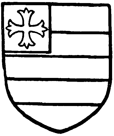
Kirkby of Kirkby. Argent two bars gules, on a canton of the second a cross patonce or.
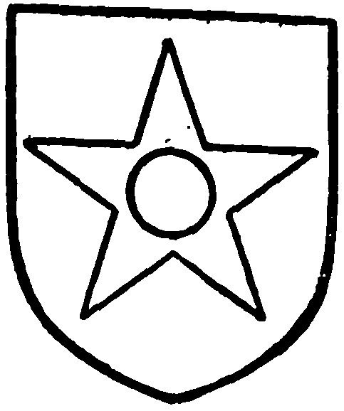
Ashton of Ashton. Argent a pierced mullet sable.
John de Ashton is said to have distinguished himself at the siege of Noyon in 1370, (fn. 43) and represented the county in Parliament in 1382, 1388, and 1390. (fn. 44) He was apparently father of Sir John de Ashton his successor, (fn. 45) prominent in the French wars of Henry V, and Seneschal of Bayeux in 1416. (fn. 46) In 1413 Sir John obtained a release of the service due from the manor. After reciting that he held it of Sir Richard de Kirkby by the rent of 1d., and that Sir Richard held it of Thomas La Warre, lord of Manchester, by the rent of 22s. and a hawk or 40s., which services Sir John de Ashton had to render on behalf of Sir Richard, the feoffees of Thomas La Warre granted that Sir John, Sir Richard, and their heirs should be free from the said service after the death of Thomas. (fn. 47) This Sir John died in 1428, holding the manor of Ashton of Robert de Ogle (in right of his wife Isabel, granddaughter and heir of Sir Richard Kirkby), and other manors and lands. Thomas, his son and heir, then twenty-five years of age, (fn. 48) came to be known as 'the Alchemist'; (fn. 49) he left a son John, (fn. 50) made a knight in 1460. (fn. 51) Sir John died in 1484, holding the manor of Ashton, with the advowson of the church, lands in Manchester, Oldham, and Wardle; and the manor of Alt. Sir Thomas, his son and heir, was sixty years of age in 1507, when the inquisition was taken. (fn. 52)
In 1513 Sir Thomas Ashton made a feoffment of his manors of Ashton and Alt, and his lands and rents there and in Oldham, Hundersfield, and Manchester, for the fulfilment of his will; and died a year later, on 21 July 1514, leaving as heirs George Booth, son of his daughter Margaret, who had been the wife of Sir William Booth, and his other daughters Elizabeth Ashton, and Alice wife of Richard Hoghton, all of full age. (fn. 53) In accordance with Sir Thomas's will the estate was held for the use of the three heirs, a division being sought in 1537. (fn. 54) Elizabeth Ashton died on 31 December 1553, without issue, (fn. 55) so that afterwards the manor and lands were held equally by the Booths (fn. 56) and Hoghtons. (fn. 57) Before the close of the 16th century, however, the whole had come into the possession of the former family, (fn. 58) and descended to George Harry Grey, seventh Earl of Stamford and Warrington, who died in 1883. (fn. 59) Under his will, it is stated, the Lancashire estates are to pass to his wife's grandniece, Katherine Sarah, wife of Sir Henry Foley Lambert, baronet. (fn. 60) Trustees are in possession.
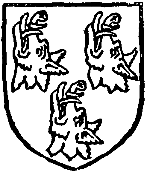
Booth. Argent three boars' heads erect and erased sable.
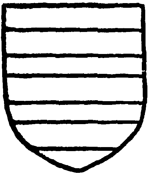
Hoghton. Sable three bars argent.
Ashton Old Hall stood on the south side of the church on elevated ground about 200 yds. north of the River Tame and overlooking its valley. Dr. Aikin described it in 1795 (fn. 61) as a building of great antiquity, and attributed its erection to about the year 1483, but there seems to have been no particular reason for his assigning this date to the structure.
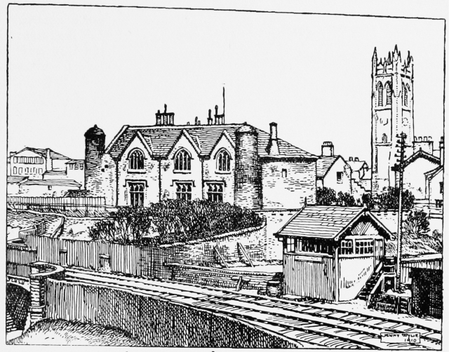
Ashton-under-Lyne Old Hall
Adjoining to it (he wrote) is an edifice which has the appearance of a prison, and till of late years has been used as such. It is a strong rather small building with two round towers overgrown with ivy, called the dungeons. The prison is now occupied by different poor families. It has two courtyards, an inner and an outer, with strong walls. Over the outer gate was a square room ascended to from the inside by a flight of stone steps and very ancient. It has always gone by the name of the Gaoler's Chapel . . . [but] was taken down in 1793. The house to the inner court is still standing, and in tolerable repair. . . . The front of the old hall adjoining the prison overlooking the gardens and the River Tame [has] a beautiful prospect. On this side of the building are strong parts of immense thickness with numbers of loopholes. (fn. 62)
The main building was repaired and modernized in 1838 for the occasional residence of the Earl of Stamford, thereby no doubt losing a good deal of its ancient appearance. By the middle of the last century it was L-shaped on plan, but an earlier plan of the town published in 1824 shows it possessing a short east wing running northward from the south-east corner. This, however, must have disappeared before 1862, when an account of the building was written by John Higson, a local antiquary. (fn. 63) The long west wing overlooking the valley had then two small bays and projecting chimney-shafts in its west front, but was covered with rough-cast coloured black. On its east side the greater part was also rough-cast, but a portion at the south end near the 'dungeons' was of timber and plaster. The roofs were covered with stone slates. The east inner elevation had doors and windows with semicircular heads, and over the door was an escutcheon with the arms, crest, and supporters of the Earl of Stamford, all this work being probably part of the 1838 reconstruction. Before that date the hall had long been divided into several tenements with separate entrances, having passed into non-resident possession as far back as the 16th century, at which time probably a floor was introduced into the great hall. A portion of the roof in 1862 is said to have had shaped braces forming quatrefoils in the spaces between the principals and purlins, showing that it was originally intended to be seen. The rooms, however, had been so much modernized that every trace of antiquity had been removed or concealed, though in the second story there were mullioned and transomed windows with diamond glazing. (fn. 64)
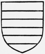
Grey, Earl of Stamford. Barry of six argent and azure.
The south wing was thought by Higson to be not o'der than about 1500, or probably later. It had three square-headed windows on each floor of two trefoiled lights, and was flanked at each end by a round tower standing a little in advance of the main wall, and rising considerably higher than the roof. The walls of the towers were about 2 ft. 6 in. thick at the bottom, and the interior was square to the height of two stories, above which it finished off as a circular tower. The roofs were of stone with a central finial, and the towers had evidently served the purpose of garderobes.
At this time there was no trace of the two courtyards mentioned by Aikin. 'The gaoler's chapel was probably an offshoot or irregular continuation to the dungeon wing and some old buildings since removed, (fn. 65) but then seeming to form a third side, and probably there had been a fourth, rendering the building quadrangular.' (fn. 66)
Still later the front of the south wing appears to have had new and longer windows of three lights inserted, those on the first floor having pointed heads. The building, whose original appearance had long been marred not only by alterations to the structure, but by the change in its surroundings, was pulled down in 1890 by the Manchester, Sheffield, and Lincolnshire Railway Company, who had purchased it prior to extensions and improvements of the Park Parade Station. With so little trustworthy evidence to go upon, it is difficult to assign any date to the erection of the hall or to convey any but a vague idea of its plan and disposition. Mr. Higson inclined to about the year 1480 for the west wing, with portions, perhaps, a little older, but there was some work belonging apparently to alterations in the 17th century.
A Gallows Meadow adjoined the hall.
The manor mills were closed in 1884, and have since been removed.
The manor of ALT has been mentioned above as part of the holding of the lords of Ashton. The tenure is uncertain, it being sometimes stated to be held of the barony of Manchester, (fn. 67) but more usually of the king as Duke of Lancaster as of his manor of Salford. (fn. 68) It seems at one time to have been held by a local family, (fn. 69) and there is no record of its acquisition by the Ashtons. (fn. 70) It disappears from notice as a manor in the 16th century.
The custom roll of the manor of Ashton for 1422 has been printed. (fn. 71) The lord gave a dinner to his tenants and their wives on Yule day, the tenants at will making regulated 'presents' to him at the same time. A tenant was to plough one or two days, according as he had half a plough or a plough; to harrow one day, to cart ten loads of turf from Doneam Moss, 'shear' four days in harvest, and cart corn for one day; at death each paid a 'principal,' i.e., the best beast he had after the due of holy kirk. The tenants were to grind at the lord's mill to the sixteenth measure; if they bought corn they should 'muller' to the Love sucken, i.e. to the twenty-fourth measure. (fn. 72) The names of the tenants at will, with their services and rents, follow: John of the Edge farmed both corn mills at 16s. 4d., 'the lord to hold up the mills at his costs, as it has been customed.' The 'gyst ale' of the town of Ashton amounted to 20s. in all; the tolls of fairs and markets 2 marks; (fn. 73) the courts and fines, 40s. There were a few tenants for life, but the list of free tenants is a long one. The tenants at will took their farms, &c., from Martinmas to Martinmas, and were bound to leave everything in as good condition as they found it. The free tenants took part in the business of the hallmote and assisted in preserving order. By an agreement made in 1379–80 the tenants' swine, if ringed, were allowed to range over the demesne from the end of harvest until sowing-time.
A manor court is still held every six months, its jurisdiction extending over the whole parish.
In the absence of records no account can be given of the descent of the various free tenancies in Audenshaw, (fn. 74) Alt, Asps, Alston (fn. 75) lands, Bardsley, (fn. 76) Beckington Field, (fn. 77) Heyrod, (fn. 78) Hurst, (fn. 79) Knolls, (fn. 80) Light Birches, (fn. 81) Lees, (fn. 82) Mossley, (fn. 83) Palden, (fn. 84) Rasbotham, (fn. 85) Rougheyes, (fn. 86) Rhodesfield, (fn. 87) Shepley, (fn. 88) Sherwind, (fn. 89) Sunderland, (fn. 90) Taunton or Tongton, (fn. 91) Three Houses, (fn. 92) Waterhouses, (fn. 93) Woodhouses, (fn. 94) and Williamfield. (fn. 95)
The Hospitallers (fn. 96) and the priory of Lenton (fn. 97) had lands in the township.
The freeholders in 1600 (fn. 98) were Miles Ashton of Heyrod, (fn. 99) Robert Ashton of Shepley, (fn. 100) Randle Hulton of Sunderland, (fn. 101) and Richard Shalcross of Limehurst. (fn. 102) A few other names can be gathered from the fines and inquisitions. (fn. 103) At Alt Hill in the 18th century were seated the Pickfords, ancestors of the Radcliffes of Royton. (fn. 104)
BOROUGHS
With the growth of the town on the introduction of the cotton manufacture, the manorial government soon became inadequate, and in 1827 and 1828 Police Acts were obtained for the regulation of ASHTON. (fn. 105) The market, which had fallen into decay, was revived in 1828, Saturday being the day chosen. A market place was in 1829 presented to the town by the lord of the manor; a covered market was built on the site in 1867, and was enlarged in 1881. (fn. 106) This is now open daily. The old fairs were replaced by others on 23 March, 29 April, 25 July, and 21 November. There was a local tradition that Ashton had been a borough, (fn. 107) and though the election of a mayor had become obsolete a revival was made in 1831. In the following year, under the Reform Act, Ashton—the parliamentary borough consisting merely of the division called Ashton town (fn. 108) —was privileged to return a member of Parliament; but a municipal charter was not granted until 1847, when the council was constituted of a mayor, eight aldermen, and twentyfour councillors. The borough was divided into four wards—Market, St. Michael's, St. Peter's, and Portland Place. (fn. 109) The town hall, (fn. 110) built in 1840, was enlarged in 1878. Gas is supplied by a company established in 1825, (fn. 111) water is under public control, (fn. 112) and the corporation has established electricity works. Baths were opened in 1870. The cemetery, formed in 1866, is in Dukinfield in Cheshire. The town has a commission of the peace and a police force; it has also its own fire brigade. Stamford Park at Highfield, opened in 1873, is managed by the corporations of Ashton and Stalybridge jointly. The West-end Pleasure Grounds near St. Peter's Church were opened in 1893. The Libraries Act was adopted in 1880, and a library was opened in the town hall a year later; in 1893–4 this was removed to the new technical school, presented to the town by the trustees of the late George Heginbottom. The arms used by the corporation are those of the Ashton family differenced by a crescent gules. (fn. 113) The plate includes the mace, mayor's chain and badge, and silver lovingcup. (fn. 114)
STALYBRIDGE
STALYBRIDGE, chiefly in Cheshire, though taking its name from a former hamlet in Ashton, obtained a Police Act in 1830, (fn. 115) and was incorporated in 1857. The boundaries were extended in 1881 to include Millbrook in Stayley and Heyrod in Ashton. It has a council composed of mayor, eight aldermen, and twenty-four councillors. The whole was included in Cheshire in 1898. (fn. 116)
MOSSLEY
MOSSLEY, (fn. 117) formed from the three counties of Lancaster, York, and Chester, has since 1888 been included in Lancashire for administrative purposes. A local board was formed in 1864, (fn. 118) and a charter of incorporation was granted in 1885; the council consists of mayor, six aldermen, and eighteen councillors.