A History of the County of Lancaster: Volume 4. Originally published by Victoria County History, London, 1911.
This free content was digitised by double rekeying. All rights reserved.
'Townships: Newton in Makerfield', in A History of the County of Lancaster: Volume 4, ed. William Farrer, J Brownbill (London, 1911), British History Online https://prod.british-history.ac.uk/vch/lancs/vol4/pp132-137 [accessed 19 April 2025].
'Townships: Newton in Makerfield', in A History of the County of Lancaster: Volume 4. Edited by William Farrer, J Brownbill (London, 1911), British History Online, accessed April 19, 2025, https://prod.british-history.ac.uk/vch/lancs/vol4/pp132-137.
"Townships: Newton in Makerfield". A History of the County of Lancaster: Volume 4. Ed. William Farrer, J Brownbill (London, 1911), British History Online. Web. 19 April 2025. https://prod.british-history.ac.uk/vch/lancs/vol4/pp132-137.
In this section
NEWTON IN MAKERFIELD
Neweton, Dom. Bk.
Makeresfeld, 1205, 1351; Makefeld, 1206; Makerefeld, 1213; Makerfeld, 1242; the last is the prevailing form. (fn. 1)
This township is usually called Newton in Makerfield or Newton le Willows, to distinguish it from other places of the name. It has an area of 3,103 acres, (fn. 2) and the population in 1901 numbered 16,699. Sankey Brook and its tributary Newton Brook form the greater part of the southern boundary; the latter is joined by the Millingford Brook, which crosses the township from north to south.
The surface of the country is generally flat, only slightly undulating in the south and west, where the ground is 142 ft. above sea level. The pebble beds of the Bunter series of the New Red Sandstone underlie the greater part of the township. The Coal Measures fringe the western and north-western borders. The town of Newton is pleasantly situated; by it is a large lake surrounded by willows.
Earlestown has the less pleasant surroundings of bare open country and few trees. The open country consists of arable fields and pasture land, the former yielding crops of potatoes and corn, with occasional turnip fields. In the west there are still a few patches of mossland, gradually becoming invaded by factories and railways.
The northern road through Warrington and Wigan, here somewhat to the east of the ancient Roman road, passes through the village. From this point roads lead eastward to Leigh and westward to St. Helens and Haydock. The St. Helens Canal goes by the side of the Sankey Brook. The Liverpool and Manchester line of the London and North Western Railway crosses the centre of the township, having stations at Earlestown and Newton. (fn. 3) The same company's main line from London to the North also passes through the township, and has a junction with the former line.
Newton, from its position on a great road, half way between Warrington and Wigan, and from its feudal dignity as the head of a hundred and then of the fee of Makerfield, has long been a place of importance. A borough was formed and a market and fairs were granted. Leland thus describes its condition about 1536: 'Newton on a brook; a little poor market, whereof Mr. Langton hath the name of his barony.' (fn. 4) Soon afterwards it returned two members to Parliament.
The borough returned two members to Parliament in the 17th century. (fn. 5)
A gathering of the gentry at Newton in 1748, ostensibly for hunting, was regarded by the populace as a Jacobite meeting, and considerable rioting ensued. (fn. 6)
In 1824 the market had fallen into disuse; but the court baron and court leet were still held in April, May, and October by the steward of the borough and the bailiff of the manor. A race-course and cockpit existed, but the sports had been discontinued; the race-meeting was revived and is still held. The fairs were held on 17 and 18 May and 11 and 12 August. There were daily coaches to Liverpool and Bolton, and a market coach from Wigan to Warrington passed through on Wednesdays. (fn. 7)
Manufactures sprang up, cotton-spinning, crown glass, iron founding, and vitriol works existing in 1840. A large iron foundry and printing and stationery works are among the chief industries at present; there are also paper mills, glass works, and collieries.
In addition to these EARLESTOWN has grown up in recent years around the great wagon works of the London and North Western Railway Company at the Sankey Viaduct; it has also engineering works and a sugar refinery. A market is held on Friday. Two newspapers are published weekly. The railway company have erected a mechanics' institute. The Vulcan Foundry has given its name to the village which has grown up round it. Wargrave is another village in the same part of the township, and Hey, by the Sankey, is near.
A local board was established in 1863. (fn. 8) Newton is now governed by an urban district council of fifteen members, the township being divided into five wards.
There is an ancient barrow called Castle Hill about half a mile north of the village. There is another at the western end of the township. St. Oswald's Well is near the junction of the boundaries of Newton, Winwick, and Southworth. (fn. 9)
There is a town hall in High Street. The Liverpool Farm Reformatory School was established in 1859. (fn. 10) The old market cross was taken down in 1819. (fn. 11) The stone uprights of the stocks remain outside the churchyard. The village wake was falling into disuse in 1836, (fn. 12) and no wakes have been held in the district for the last half-century.
Among the place names in 1824 were Pepper Alley, Wagry Moss, and Ruff House.
HUNDRED
Before the Conquest NEWTON was the head of a hundred assessed at five hides. One of the hides, including Newton itself, was held in demesne by Edward the Confessor, as lord of the manor. In 1086 the demesne was valued at £4. (fn. 13)
BARONY
Afterwards the fee or barony of MAKERFIELD was formed, embracing much the same area as the older hundred, and Newton became the head of the barony. The story of this fee and its successive lords—Banastre, Langton, Fleetwood, and Legh—has been told elsewhere. (fn. 14)

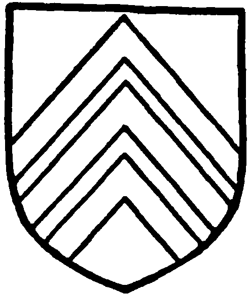
Langton. Argent three cheverons gules.
MANOR
In 1346 it was found that Sir Robert de Langton held the plough-lands in NEWTON by the service of one knight's fee, paying 10s. for ward of Lancaster Castle, and doing suit at the wapentake court at West Derby every three weeks. (fn. 15) The manor of Newton, with its members, Lowton, Kenyon, Arbury, a moiety of Golborne, and the advowson of Wigan Church, was so held; the other manors of Newton fee—Southworth, Wigan, Ince, Hindley, Abram, Ashton, Pemberton, Billinge, Winstanley, Haydock, Orrell, Winwick-with-Hulme, Woolston, Poulton, Middleton, Houghton, and the other moiety of Golborne—were held by fealty only. (fn. 16) At Newton a three-weeks court was kept for the barony. (fn. 17) A grant of free warren was obtained by Robert Banastre in 1257, (fn. 18) and licence to crenellate his mansion by Robert de Langton in 1341. (fn. 19) Manorial rights are still claimed, but no court has been held for many years.

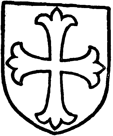
Banastre. Argent a cross patonce sable.
A number of grants by the Banastres and Langtons (fn. 20) have been preserved.
A resident family or families took the local name; one of them in the time of Edward III was known as Richard the Receiver, from the office he held under the lord of the fee. (fn. 21) Another also had an official name—Serjeant; the family remained here down to the end of the 17th century. (fn. 22) Among the other families were those of Bingley (fn. 23) and Pierpoint. (fn. 24) Neighbouring lords, as those of Haydock, (fn. 25) also acquired lands in Newton; the Leghs, besides inheriting the Haydock estate, went on adding to it, so that in 1660, when Richard Legh purchased the barony, he already owned a large part of the township. (fn. 26)
The Blackburnes, afterwards of Orford and Hale, acquired lands here in the latter part of the 16th century. (fn. 27) Their house, known more recently as Newton Hall, was built by Thomas Blackburne in 1634. (fn. 28) About a century ago John Blackburne, M.P., sold it to the Leghs. (fn. 29)
Newton le Willows Hall is a small H-shaped house standing north and south, with hall between living rooms and kitchen. The front is towards the east, the entrance being by a two-story timber porch opening to a lobby between the hall and kitchen. The hall is also of timber construction, with a line of windows on the east, and has a large fireplace at the north end with the royal arms of Elizabeth. The staircase starts from the middle of the west side of the hall, and a panel above it. There are rooms over the hall, it has a flat plaster ceiling, with simply moulded beams. The north wing, containing the kitchen with a large fireplace adjoining that of the hall, is of brick, with low mullioned windows and plain round-headed lights. The heads and mullions are of brick plastered, ornamented with raised lozenges and fleurs-de-lys. The wall surfaces are relieved with raised patterns in brick-work of a simple character. The south wing has similar details, but is modernized.

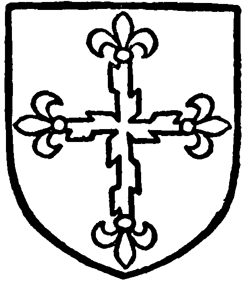
Bretherton of the Hey. Argent a cross patonce raguled sable.
The little estate of HEY, sometimes called a manor, appears to have been held by a family so surnamed, (fn. 30) who were succeeded by the Brethertons or Brothertons, the tenants from the 16th century to the beginning of the 19th. (fn. 31) A pedigree was recorded in 1664. (fn. 32) The landowners contributing to the subsidy about 1556 were William Bretherton, John Maddock, William Serjeant, and Richard Wood. (fn. 33) In 1600 the resident freeholders were given as William Green, John Maddock, Philip Mainwaring, George Sorocold, John Tunstall, and Roger Wood. (fn. 34) The landowning contributors to the subsidy of 1628 were John Bretherton, the wife of James Eden, William Morris, James Maddock, and Thomas Serjeant. (fn. 35) To the land tax in 1787 the chief contributors were Peter Legh, — Brotherton, William Bankes, and — Blackburne.
Some of the inhabitants had their estates sequestered by the Commonwealth authorities. (fn. 36)
Among various place-names occurring in the charters may be recorded Apshaw, Heald, Kirkacre, and Pipersfield.
BOROUGH
At an early date a borough was created, but the charter does not seem to have been preserved. The typical burgage consisted of a house with its toft, and an acre of land; a small rent was payable. (fn. 37) From 1559 to 1832 it returned two members of Parliament; the electors, according to a decision in 1797, were the freemen or burgesses, that is any persons 'seised of a corporeal estate of freehold in any house, building or lands within the borough of the value of 40s. a year and upwards'; in the case of a joint tenancy only one person could vote. (fn. 38) In practice Newton was a close borough, the members being nominees of the lord of the manor.
A market and two fairs were in 1301 granted by Edward I to John de Langton; the market was to be held every Saturday, and the fairs on the eve, day, and morrow of St. John ante Portam Latinam (6 May) and of St. Germain (31 July). (fn. 39)
CHURCH
Although in 1066 'the church of the manor' was at Wigan, about 6 miles to the north, there may have been also a domestic chapel at the royal manor house. In the early part of the reign of Edward I, Robert Banastre, lord of Makerfield, granted a rent of 12d. a year for the maintenance of the lamp of St. Mary in Winwick Church, as an acknowledgement of the permission he had received to endow a chantry in his chapel of Rokeden. This permission was granted by the prior and canons of Nostell, as patrons of Winwick, in 1285; the usual stipulation was made—that nothing should be done to the injury of the parish church. (fn. 40) Licence was granted or renewed by the Bishop of Lichfield in 1405 for service in the chapel at Rokeden. (fn. 41) In 1534 John Dunster was chaplain. (fn. 42) He was in 1548 celebrating for the souls of his founders. (fn. 43)
After the suppression of the chantry Dunster was allowed a pension and continued to reside. He appears to have conformed in 1562, but next year was absent from the visitation; (fn. 44) he was buried at Winwick in 1571. Ten years later there was a curate at Newton of scandalous character; (fn. 45) in 1590 the curate was 'no preacher,' (fn. 46) and two years afterwards there was no surplice for the minister. (fn. 47) About 1610 it was stated that there was seldom a curate, the stipend being but small. (fn. 48) It is probable that here, as in other chapelries, the legal services were more or less regularly conducted by a 'reading minister.' (fn. 49)
An improvement took place in the 17th century. A regular curate seems to have been appointed; the Commonwealth Surveyors in 1650 found that Richard Blackburne had given £20 a year for a 'preaching minister,' and recommended that Newton should be made a separate parish; the tithes of the township, worth £60 a year, had been appropriated to the minister's use. (fn. 50) This arrangement would cease at the Restoration, but Bishop Gastrell in 1718 found the curate's income to be over £38. (fn. 51) The chapel, now called St. Peter's, was rebuilt in 1684, consecrated in 1735, and enlarged in 1819 and 1835. The township became a separate rectory in 1841, the Earl of Derby being patron; but Emmanuel Church, Wargrave, built in that year, was made the parish church instead of the old chapel. (fn. 52) The latter had a district assigned to it in 1845; (fn. 53) Lord Newton is patron.
ST. PETER'S CHURCH
ST. PETER'S CHURCH stands at the east end of the long and wide village street, and is a modern building with chancel, north and south chapels and north vestry, nave and aisles with porches at the west ends of the aisles, and a west tower. A few mural tablets from the old church are preserved, and the wrought-iron altar-rails are of 18th-century style, but otherwise, all the fittings, oak screens and seats and alabaster pulpit, &c., are modern.
The following is a list of curates and vicars:—
| oc. | 1622 | — Gee (fn. 54) |
| ? | 1635 | William Thompson (fn. 55) |
| oc. | 1645 | Thomas Norman (fn. 56) |
| oc. | 1650 | Thomas Blackburne (fn. 57) |
| oc. | 1684 | Samuel Needham, B.A. (fn. 58) (St. John's Coll. Camb.) |
| 1686 | Edward Allanson, M.A. (fn. 59) (Magdalene Coll. Camb.) | |
| 1735 | Philip Naylor, B.A. (fn. 60) (Trinity Coll. Camb.) | |
| — | Ashburnham Legh, M.A. (fn. 61) (Brasenose Coll. and All Souls, Oxf.) | |
| 1775 | John Garton, M.A. (Brasenose Coll. Oxf.) | |
| oc. | 1806–13 | Francis Bryan (fn. 62) |
| — | Robert Barlow | |
| 1823 | Peter Legh, B.A. (fn. 63) (Trinity Coll. Camb.) | |
| 1864 | Thomas Whitley, M.A. (Emman. Coll. Camb.) | |
| 1871 | Herbert Monk, M.A. (Trin. Coll. Camb.) | |
| 1898 | James Ryder | |
The church of St. John the Baptist at Earlestown was built in 1878, and had a district assigned to it in 1879. (fn. 64) The rector of Newton is patron.
A school, called Dean School, was built in 1646 by John Stirrup. (fn. 65)
The Wesleyan Methodists have a church, Brunswick, at Earlestown; and the Primitive Methodists also have one there. The Welsh Calvinistic Methodists have a place of worship at Earlestown; as also have the Welsh Baptists. The English Baptists have a chapel in Newton, where there is also a Free Gospel mission room.
Occasional preaching by Congregational ministers began in 1806, the steps of the town cross being the pulpit till the constable interfered, but there was no chapel till 1842. A new church was built in 1878, largely through the benefactions of the family of Richard Evans, the great colliery proprietors. (fn. 66) In the churchyard is a fine monument of Mr. Evans erected by his workpeople.
The Roman Catholic church of St. Mary and St. John, built in 1864, originated about three years earlier. (fn. 67)