Survey of London: Volumes 43 and 44, Poplar, Blackwall and Isle of Dogs. Originally published by London County Council, London, 1994.
This free content was digitised by double rekeying. All rights reserved.
'Plate 62: East India Docks', in Survey of London: Volumes 43 and 44, Poplar, Blackwall and Isle of Dogs, ed. Hermione Hobhouse (London, 1994), British History Online https://prod.british-history.ac.uk/survey-london/vols43-4/plate-62 [accessed 16 April 2025].
'Plate 62: East India Docks', in Survey of London: Volumes 43 and 44, Poplar, Blackwall and Isle of Dogs. Edited by Hermione Hobhouse (London, 1994), British History Online, accessed April 16, 2025, https://prod.british-history.ac.uk/survey-london/vols43-4/plate-62.
"Plate 62: East India Docks". Survey of London: Volumes 43 and 44, Poplar, Blackwall and Isle of Dogs. Ed. Hermione Hobhouse (London, 1994), British History Online. Web. 16 April 2025. https://prod.british-history.ac.uk/survey-london/vols43-4/plate-62.
In this section
East India Docks
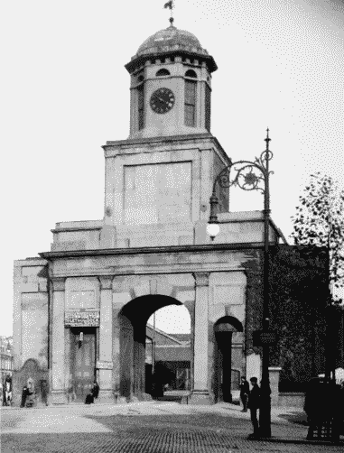
a. Main Gateway in c1912: east (rear) elevation to the left, west (front) elevation to the right.

East India Docks
Main Gateway in c1912: east (rear) elevation to the left, west (front) elevation to the right.
Ralph Walker, architect, 1805–7 (p. 592). Demolished
b. Main Gateway in c1912: east (rear) elevation to the left, west (front) elevation to the right.
East India Docks
Main Gateway in c1912: east (rear) elevation to the left, west (front) elevation to the right.
Ralph Walker, architect, 1805–7 (p. 592). Demolished
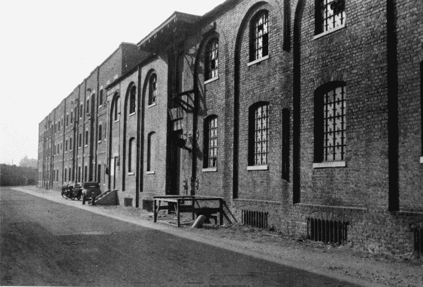
c. Nos 6 & 7 and 8 & 9 Warehouses, right to left, on the South Quay of the Import Dock, looking north-west in 1956 (pp. 586–7).
East India Docks
Nos 6 & 7 and 8 & 9 Warehouses, right to left, on the South Quay of the Import Dock, looking north-west in 1956 (pp. 586–7).
Demolished