Survey of London: Volumes 43 and 44, Poplar, Blackwall and Isle of Dogs. Originally published by London County Council, London, 1994.
This free content was digitised by double rekeying. All rights reserved.
'Plate 59: Millwall Docks', in Survey of London: Volumes 43 and 44, Poplar, Blackwall and Isle of Dogs, ed. Hermione Hobhouse (London, 1994), British History Online https://prod.british-history.ac.uk/survey-london/vols43-4/plate-59 [accessed 16 April 2025].
'Plate 59: Millwall Docks', in Survey of London: Volumes 43 and 44, Poplar, Blackwall and Isle of Dogs. Edited by Hermione Hobhouse (London, 1994), British History Online, accessed April 16, 2025, https://prod.british-history.ac.uk/survey-london/vols43-4/plate-59.
"Plate 59: Millwall Docks". Survey of London: Volumes 43 and 44, Poplar, Blackwall and Isle of Dogs. Ed. Hermione Hobhouse (London, 1994), British History Online. Web. 16 April 2025. https://prod.british-history.ac.uk/survey-london/vols43-4/plate-59.
In this section
Millwall Docks
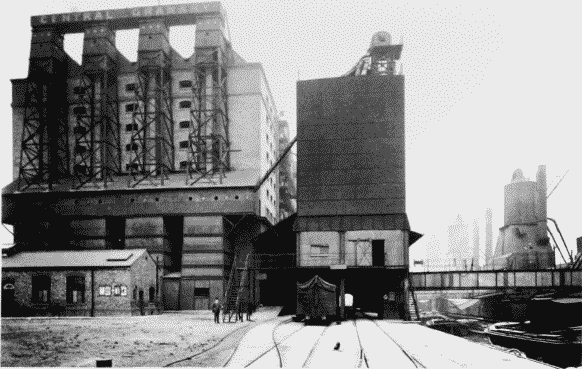
a. The Central Granary, 1900–3, looking north (pp. 362–3).
Millwall Docks
The Central Granary, 1900–3, looking north (pp. 362–3).
Demolished
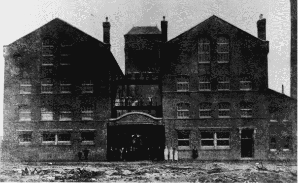
b. McDougall's Mill, 1899–1900, looking east (pp. 367–8).
Millwall Docks
McDougall's Mill, 1899–1900, looking east (pp. 367–8).
Demolished
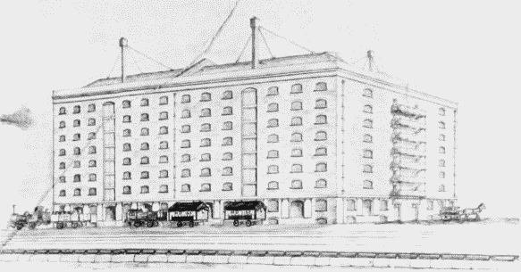
c. The Eastern Granary, 1883, perspective drawing as built (pp. 361–2).
Millwall Docks
The Eastern Granary, 1883, perspective drawing as built (pp. 361–2).
Demolished
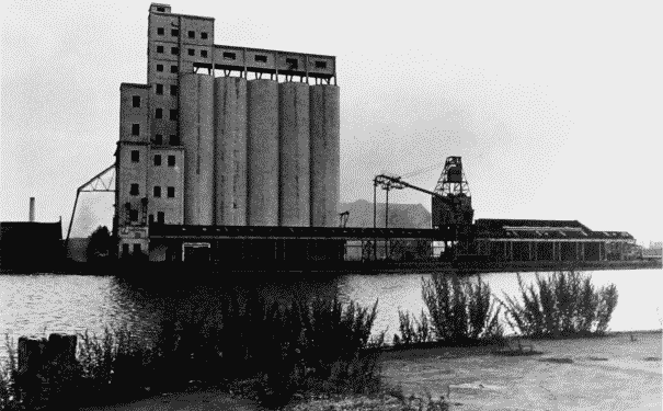
d (right). Quay-side silo at McDougall's Mill, 1934, looking south in 1984 (p. 368).
Millwall Docks
(right). Quay-side silo at McDougall's Mill, 1934, looking south in 1984 (p. 368).
Demolished