Survey of London: Volumes 43 and 44, Poplar, Blackwall and Isle of Dogs. Originally published by London County Council, London, 1994.
This free content was digitised by double rekeying. All rights reserved.
'Plate 2: Poplar High Street in c1890', in Survey of London: Volumes 43 and 44, Poplar, Blackwall and Isle of Dogs, ed. Hermione Hobhouse (London, 1994), British History Online https://prod.british-history.ac.uk/survey-london/vols43-4/plate-2 [accessed 6 May 2025].
'Plate 2: Poplar High Street in c1890', in Survey of London: Volumes 43 and 44, Poplar, Blackwall and Isle of Dogs. Edited by Hermione Hobhouse (London, 1994), British History Online, accessed May 6, 2025, https://prod.british-history.ac.uk/survey-london/vols43-4/plate-2.
"Plate 2: Poplar High Street in c1890". Survey of London: Volumes 43 and 44, Poplar, Blackwall and Isle of Dogs. Ed. Hermione Hobhouse (London, 1994), British History Online. Web. 6 May 2025. https://prod.british-history.ac.uk/survey-london/vols43-4/plate-2.
In this section
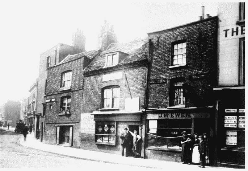
Poplar High Street in c1890
a. Nos 1 and 3 and the north side of Pennyfields.
Poplar High Street in c1890
Nos 1 and 3 and the north side of Pennyfields.
No. 1 is in the centre, No. 3 to the right and Pennyfields to the left (p. 61).Demolished
b. Nos 97–101 (odd), left to right (pp. 59–60).
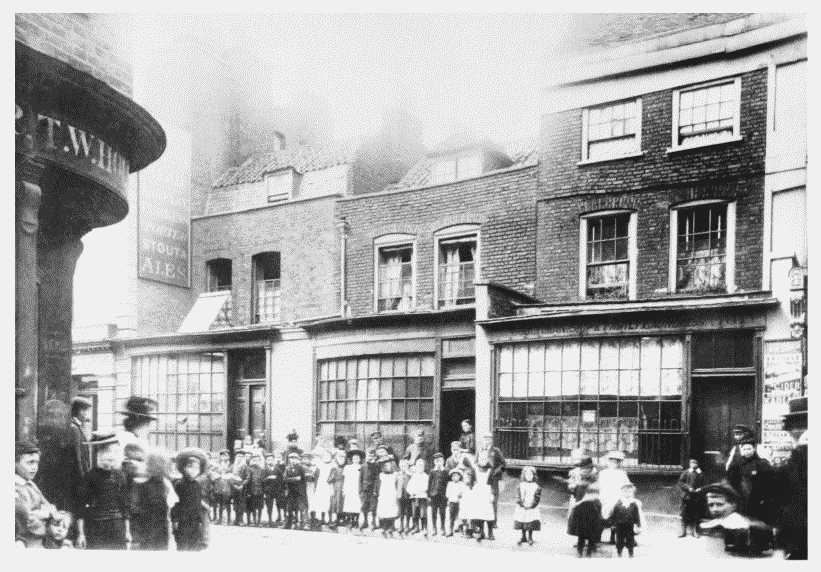
Poplar High Street in c1890
Nos 97–101 (odd), left to right (pp. 59–60).
Demolished