Survey of London: Volumes 43 and 44, Poplar, Blackwall and Isle of Dogs. Originally published by London County Council, London, 1994.
This free content was digitised by double rekeying. All rights reserved.
'Plate 19: East India Dock Road', in Survey of London: Volumes 43 and 44, Poplar, Blackwall and Isle of Dogs, ed. Hermione Hobhouse (London, 1994), British History Online https://prod.british-history.ac.uk/survey-london/vols43-4/plate-19 [accessed 10 May 2025].
'Plate 19: East India Dock Road', in Survey of London: Volumes 43 and 44, Poplar, Blackwall and Isle of Dogs. Edited by Hermione Hobhouse (London, 1994), British History Online, accessed May 10, 2025, https://prod.british-history.ac.uk/survey-london/vols43-4/plate-19.
"Plate 19: East India Dock Road". Survey of London: Volumes 43 and 44, Poplar, Blackwall and Isle of Dogs. Ed. Hermione Hobhouse (London, 1994), British History Online. Web. 10 May 2025. https://prod.british-history.ac.uk/survey-london/vols43-4/plate-19.
In this section
East India Dock Road (pp. 120–70)
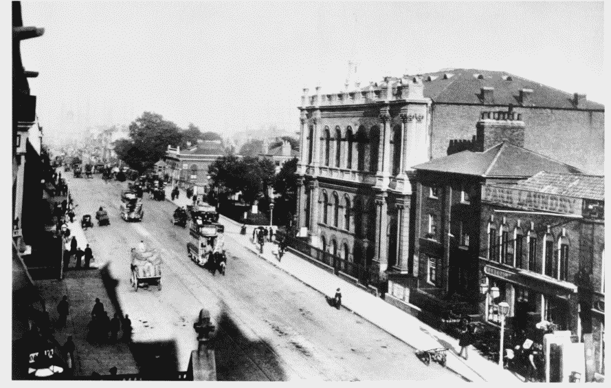
a. Looking east from George Green's School in c1904.
East India Dock Road
Looking east from George Green's School in c1904.
United Methodist Free Church, 1855, in centre (pp. 162–4). Nos 166–170 (even) to right (p. 162), and Poplar Station in distance to left (p. 167)
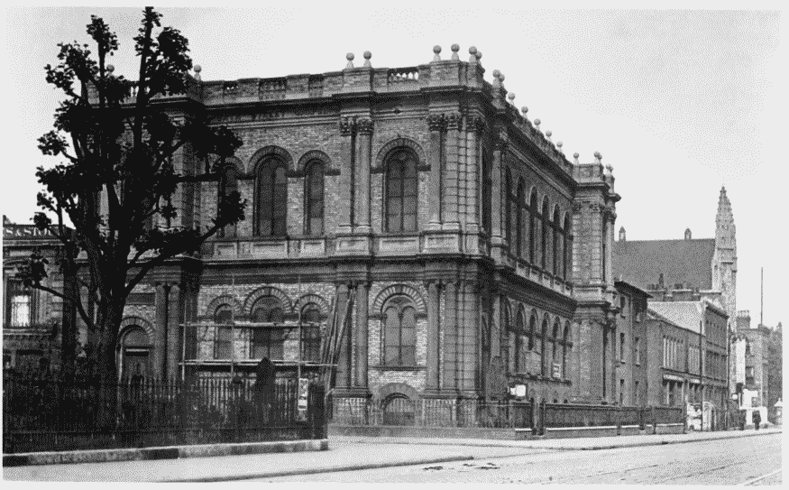
b. South side looking west from the corner with Poplar Bath Street in 1930.
East India Dock Road
South side looking west from the corner with Poplar Bath Street in 1930.
United Methodist Free Church, 1855, in foreground (pp. 162–4), and Wesleyan Chapel, 1847–8, in distance (pp. 160–1)