Survey of London: Volumes 43 and 44, Poplar, Blackwall and Isle of Dogs. Originally published by London County Council, London, 1994.
This free content was digitised by double rekeying. All rights reserved.
'Plate 150', in Survey of London: Volumes 43 and 44, Poplar, Blackwall and Isle of Dogs, ed. Hermione Hobhouse (London, 1994), British History Online https://prod.british-history.ac.uk/survey-london/vols43-4/plate-150 [accessed 16 April 2025].
'Plate 150', in Survey of London: Volumes 43 and 44, Poplar, Blackwall and Isle of Dogs. Edited by Hermione Hobhouse (London, 1994), British History Online, accessed April 16, 2025, https://prod.british-history.ac.uk/survey-london/vols43-4/plate-150.
"Plate 150". Survey of London: Volumes 43 and 44, Poplar, Blackwall and Isle of Dogs. Ed. Hermione Hobhouse (London, 1994), British History Online. Web. 16 April 2025. https://prod.british-history.ac.uk/survey-london/vols43-4/plate-150.
In this section
a. Views of Poplar Chapel (St Matthias's Church) in 1799, looking southeast (left) and north-west (pp. 98–107)
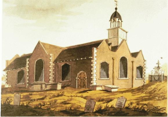
Poplar Chapel (St Matthias's Church) in 1799.
Views of Poplar Chapel (St Matthias's Church) in 1799, looking southeast (left) and north-west (pp. 98–107)
b. Views of Poplar Chapel (St Matthias's Church) in 1799, looking southeast (left) and north-west (pp. 98–107)
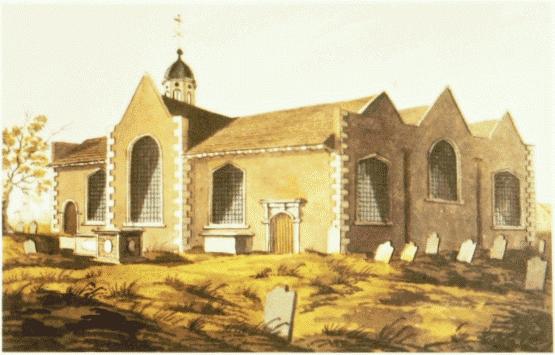
Poplar Chapel (St Matthias's Church) in 1799.
Views of Poplar Chapel (St Matthias's Church) in 1799, looking southeast (left) and north-west (pp. 98–107)
c. East India Dock Road, north side in the 1840s, showing (from left to right) Trinity Terrace, Trinity Chapel, No. 119, Wade's Terrace and the Sailor's Home (pp. 135–9).
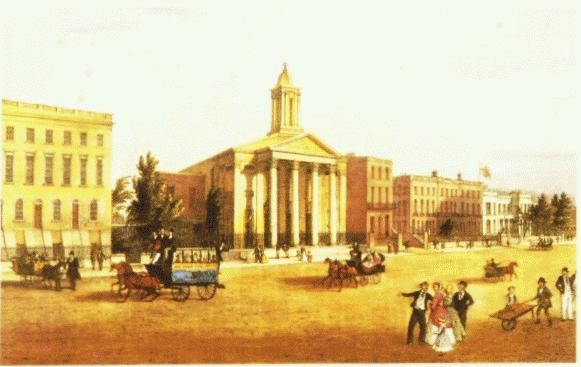
East India Dock Road, north side in the 1840s.
East India Dock Road, north side in the 1840s, showing (from left to right) Trinity Terrace, Trinity Chapel, No. 119, Wade's Terrace and the Sailor's Home (pp. 135–9).
Mostly demolished
d. Sailors' Home, No. 133 East India Dock Road, erected 1839–41, in the 1840s (p. 139)
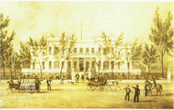
Sailors' Home, East India Dock Road, in the 1840s.
Sailors' Home, No. 133 East India Dock Road, erected 1839–41, in the 1840s (p. 139)