Survey of London: Volumes 43 and 44, Poplar, Blackwall and Isle of Dogs. Originally published by London County Council, London, 1994.
This free content was digitised by double rekeying. All rights reserved.
'Plate 142', in Survey of London: Volumes 43 and 44, Poplar, Blackwall and Isle of Dogs, ed. Hermione Hobhouse (London, 1994), British History Online https://prod.british-history.ac.uk/survey-london/vols43-4/plate-142 [accessed 16 April 2025].
'Plate 142', in Survey of London: Volumes 43 and 44, Poplar, Blackwall and Isle of Dogs. Edited by Hermione Hobhouse (London, 1994), British History Online, accessed April 16, 2025, https://prod.british-history.ac.uk/survey-london/vols43-4/plate-142.
"Plate 142". Survey of London: Volumes 43 and 44, Poplar, Blackwall and Isle of Dogs. Ed. Hermione Hobhouse (London, 1994), British History Online. Web. 16 April 2025. https://prod.british-history.ac.uk/survey-london/vols43-4/plate-142.
In this section
a. Compass Point in 1993.
Compass Point in 1993.
Compass Point in 1993.
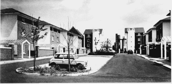
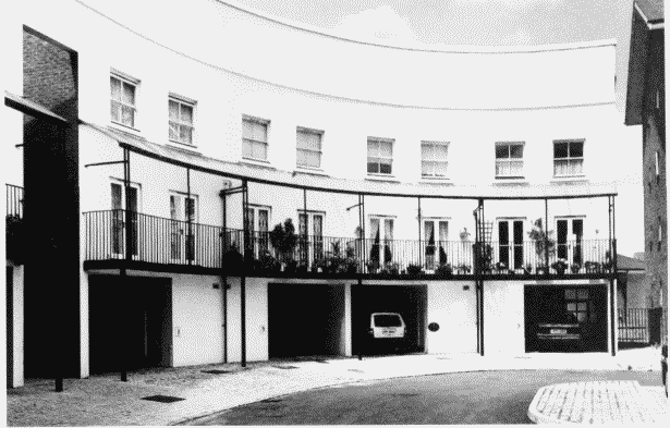
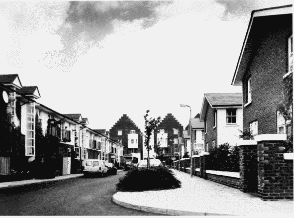
Jeremy Dixon, design architect, Costain Homes, developers, 1985–8 (pp. 698–9). Sextant Avenue looking east (above) and west (right): Chichester Way looking east (below)
b. Compass Point in 1993.
Compass Point in 1993.
Compass Point in 1993.
Jeremy Dixon, design architect, Costain Homes, developers, 1985–8 (pp. 698–9). Sextant Avenue looking east (above) and west (right): Chichester Way looking east (below)
c. Compass Point in 1993.
Compass Point in 1993.
Compass Point in 1993.
Jeremy Dixon, design architect, Costain Homes, developers, 1985–8 (pp. 698–9). Sextant Avenue looking east (above) and west (right): Chichester Way looking east (below)
d. (below right). Lockes Field, looking south-west in 1993.
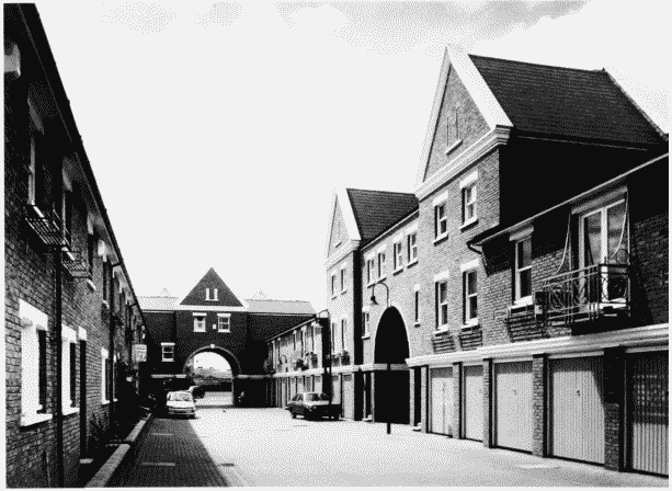
Lockes Field in 1993.
(below right). Lockes Field, looking south-west in 1993.
Groveside Homes, developers, 1988–9 (p. 701)