Survey of London: Volumes 43 and 44, Poplar, Blackwall and Isle of Dogs. Originally published by London County Council, London, 1994.
This free content was digitised by double rekeying. All rights reserved.
'Plate 13', in Survey of London: Volumes 43 and 44, Poplar, Blackwall and Isle of Dogs, ed. Hermione Hobhouse (London, 1994), British History Online https://prod.british-history.ac.uk/survey-london/vols43-4/plate-13 [accessed 16 April 2025].
'Plate 13', in Survey of London: Volumes 43 and 44, Poplar, Blackwall and Isle of Dogs. Edited by Hermione Hobhouse (London, 1994), British History Online, accessed April 16, 2025, https://prod.british-history.ac.uk/survey-london/vols43-4/plate-13.
"Plate 13". Survey of London: Volumes 43 and 44, Poplar, Blackwall and Isle of Dogs. Ed. Hermione Hobhouse (London, 1994), British History Online. Web. 16 April 2025. https://prod.british-history.ac.uk/survey-london/vols43-4/plate-13.
In this section
Plate 13
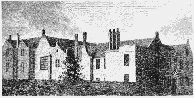
a. The East India Company's Almshouse, Poplar High Street, view from south-west in 1798.
The East India Company's Almshouse, Poplar High Street.
The East India Company's Almshouse, Poplar High Street, view from south-west in 1798.
Front range (right) erected 1627-8, Edward Carter, surveyor (pp. 107-9). Demolished
b. The Church of St. Matthias (Poplar Chapel), view from the north-east in 1755.

The Church of St Matthias (Poplar Chapel).
The Church of St. Matthias (Poplar Chapel), view from the north-east in 1755.
Erected 1652–4 (pp. 98–104)
c. Broadway Chapel, Westminster, view from south-west in 1817.

Broadway Chapel, Westminster.
Broadway Chapel, Westminster, view from south-west in 1817.
Erected 1635–8 (p. 99). Demolished