Survey of London: Volumes 43 and 44, Poplar, Blackwall and Isle of Dogs. Originally published by London County Council, London, 1994.
This free content was digitised by double rekeying. All rights reserved.
'Plate 111: Leamouth Road', in Survey of London: Volumes 43 and 44, Poplar, Blackwall and Isle of Dogs, ed. Hermione Hobhouse (London, 1994), British History Online https://prod.british-history.ac.uk/survey-london/vols43-4/plate-111 [accessed 16 April 2025].
'Plate 111: Leamouth Road', in Survey of London: Volumes 43 and 44, Poplar, Blackwall and Isle of Dogs. Edited by Hermione Hobhouse (London, 1994), British History Online, accessed April 16, 2025, https://prod.british-history.ac.uk/survey-london/vols43-4/plate-111.
"Plate 111: Leamouth Road". Survey of London: Volumes 43 and 44, Poplar, Blackwall and Isle of Dogs. Ed. Hermione Hobhouse (London, 1994), British History Online. Web. 16 April 2025. https://prod.british-history.ac.uk/survey-london/vols43-4/plate-111.
In this section
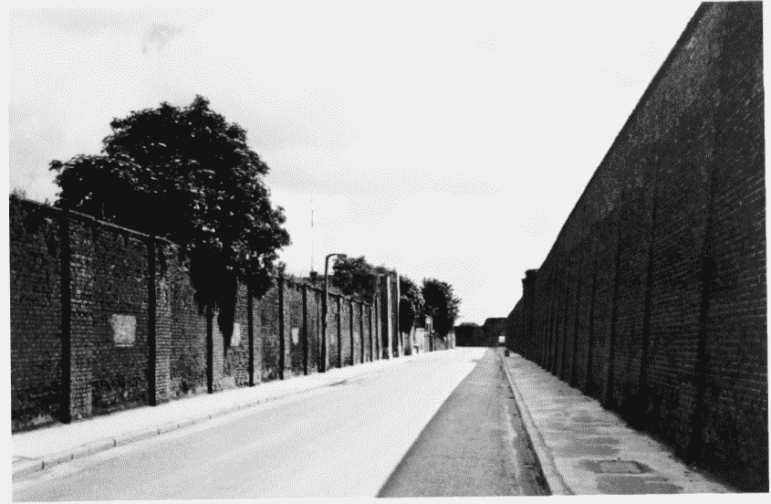
Leamouth Road
a. Looking south near the north end in 1986.
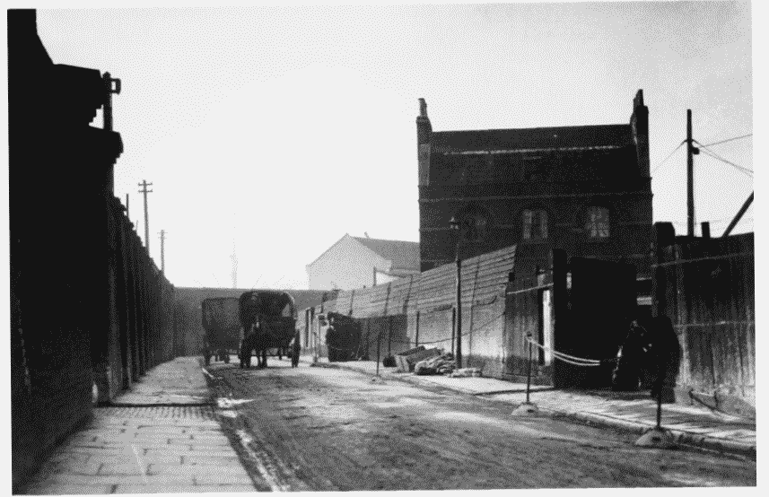
Leamouth Road
Looking south near the north end in 1986.
Boundary wall of the East India Docks right (p. 591) and the boundary wall of Blackwall Goods Yard (former Pepper Warehouses) left (p. 656)
b. Looking northwards near Silvocea Wharf in 1925.
Leamouth Road
Looking northwards near Silvocea Wharf in 1925.
Boundary wall of the East India Docks left, and former dockmaster's house built in 1815–16 right (p. 662)