Survey of London: Volumes 33 and 34, St Anne Soho. Originally published by London County Council, London, 1966.
This free content was digitised by double rekeying. All rights reserved.
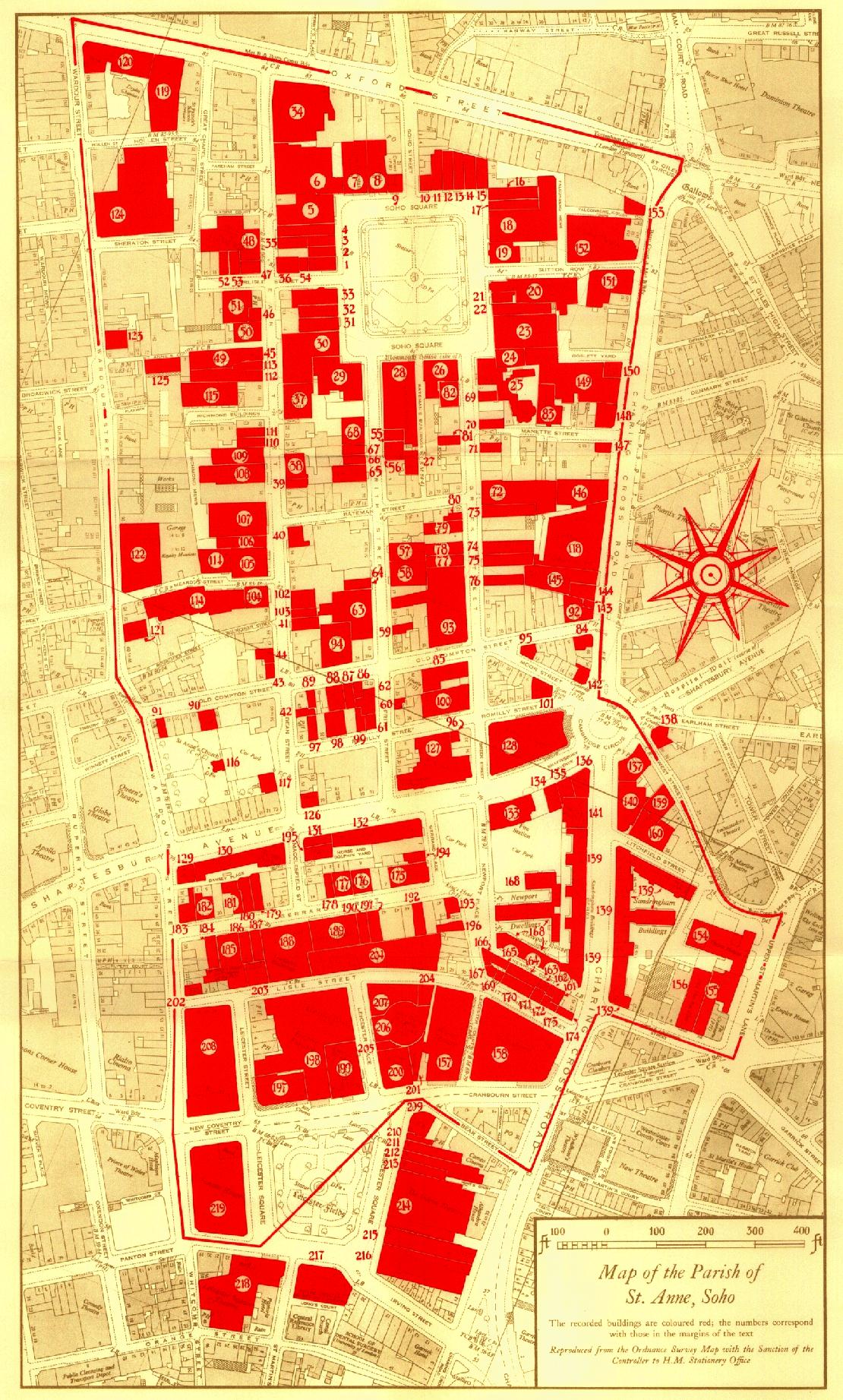
'Map of the Parish of St. Anne, Soho', in Survey of London: Volumes 33 and 34, St Anne Soho, ed. F H W Sheppard (London, 1966), British History Online https://prod.british-history.ac.uk/survey-london/vols33-4/map-of-st-anne-soho [accessed 22 April 2025].
'Map of the Parish of St. Anne, Soho', in Survey of London: Volumes 33 and 34, St Anne Soho. Edited by F H W Sheppard (London, 1966), British History Online, accessed April 22, 2025, https://prod.british-history.ac.uk/survey-london/vols33-4/map-of-st-anne-soho.
"Map of the Parish of St. Anne, Soho". Survey of London: Volumes 33 and 34, St Anne Soho. Ed. F H W Sheppard (London, 1966), British History Online. Web. 22 April 2025. https://prod.british-history.ac.uk/survey-london/vols33-4/map-of-st-anne-soho.
Map of the Parish of St. Anne, Soho
Map of the Parish of St. Anne, Soho