Survey of London: Volumes 31 and 32, St James Westminster, Part 2. Originally published by London County Council, London, 1963.
This free content was digitised by double rekeying. All rights reserved.
'Plate 102: SAVILE ROW', in Survey of London: Volumes 31 and 32, St James Westminster, Part 2, ed. F H W Sheppard (London, 1963), British History Online https://prod.british-history.ac.uk/survey-london/vols31-2/pt2/plate-102 [accessed 10 May 2025].
'Plate 102: SAVILE ROW', in Survey of London: Volumes 31 and 32, St James Westminster, Part 2. Edited by F H W Sheppard (London, 1963), British History Online, accessed May 10, 2025, https://prod.british-history.ac.uk/survey-london/vols31-2/pt2/plate-102.
"Plate 102: SAVILE ROW". Survey of London: Volumes 31 and 32, St James Westminster, Part 2. Ed. F H W Sheppard (London, 1963), British History Online. Web. 10 May 2025. https://prod.british-history.ac.uk/survey-london/vols31-2/pt2/plate-102.
In this section
Savile Row
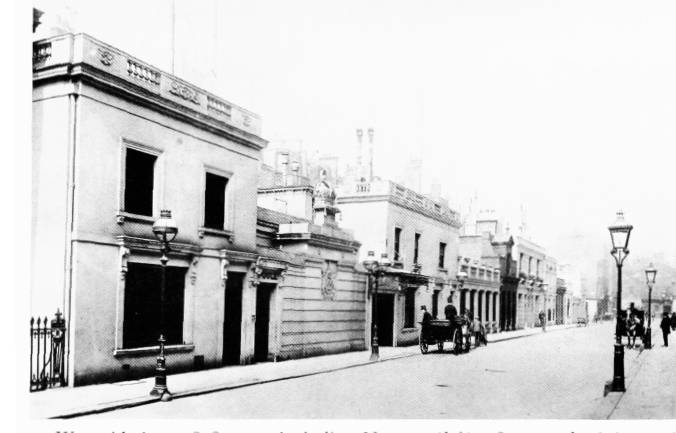
a. West side in c. 1898–1903, including Nos. 39 (left), 38, 37 and 36 (p. 537)

West side in c. 1898–1903, including Nos. 39 (left), 38, 37 and 36 (p. 537)
b. No. 1, elevation prescribed in lease, 1732 (p. 519)
No. 1, elevation prescribed in lease, 1732 (p. 519)
c. View northward in 1957 (p. 524).
View northward in 1957 (p. 524).
Nos. 4 and 5 (second and third from right) demolished
d. No. 1, front in 1912–13 (pp. 521–2)
No. 1, front in 1912–13 (pp. 521–2)