Survey of London: Volumes 29 and 30, St James Westminster, Part 1. Originally published by London County Council, London, 1960.
This free content was digitised by double rekeying. All rights reserved.
'Plate 270: Nos. 10 St. James's Street and 20–21 King Street', in Survey of London: Volumes 29 and 30, St James Westminster, Part 1, ed. F H W Sheppard( London, 1960), British History Online https://prod.british-history.ac.uk/survey-london/vols29-30/pt1/plate-270 [accessed 23 November 2024].
'Plate 270: Nos. 10 St. James's Street and 20–21 King Street', in Survey of London: Volumes 29 and 30, St James Westminster, Part 1. Edited by F H W Sheppard( London, 1960), British History Online, accessed November 23, 2024, https://prod.british-history.ac.uk/survey-london/vols29-30/pt1/plate-270.
"Plate 270: Nos. 10 St. James's Street and 20–21 King Street". Survey of London: Volumes 29 and 30, St James Westminster, Part 1. Ed. F H W Sheppard(London, 1960), , British History Online. Web. 23 November 2024. https://prod.british-history.ac.uk/survey-london/vols29-30/pt1/plate-270.
In this section
Nos. 10 St. James's Street and 20–21 King Street (formerly St. James's Bazaar), 1830–2.
(Sir) James Pennethorne, architect (p. 438). Much altered
a. King Street elevation in 1847

Nos. 10 St. James's Street and 20–21 King Street
King Street elevation in 1847
b. Ground-floor plan in 1847
Nos. 10 St. James's Street and 20–21 King Street
Ground-floor plan in 1847
c.View from north-west
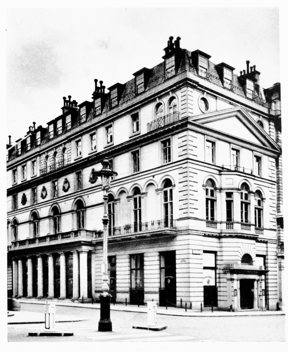
Nos. 10 St. James's Street and 20–21 King Street
View from north-west