Survey of London: Volume 46, South and East Clerkenwell. Originally published by London County Council, London, 2008.
This free content was digitised by double rekeying. All rights reserved.
'South and east Clerkenwell: volume map', in Survey of London: Volume 46, South and East Clerkenwell, ed. Philip Temple (London, 2008), British History Online https://prod.british-history.ac.uk/survey-london/vol46/p2 [accessed 15 April 2025].
'South and east Clerkenwell: volume map', in Survey of London: Volume 46, South and East Clerkenwell. Edited by Philip Temple (London, 2008), British History Online, accessed April 15, 2025, https://prod.british-history.ac.uk/survey-london/vol46/p2.
"South and east Clerkenwell: volume map". Survey of London: Volume 46, South and East Clerkenwell. Ed. Philip Temple (London, 2008), British History Online. Web. 15 April 2025. https://prod.british-history.ac.uk/survey-london/vol46/p2.
SURVEY OF LONDON VOLUME XLVI
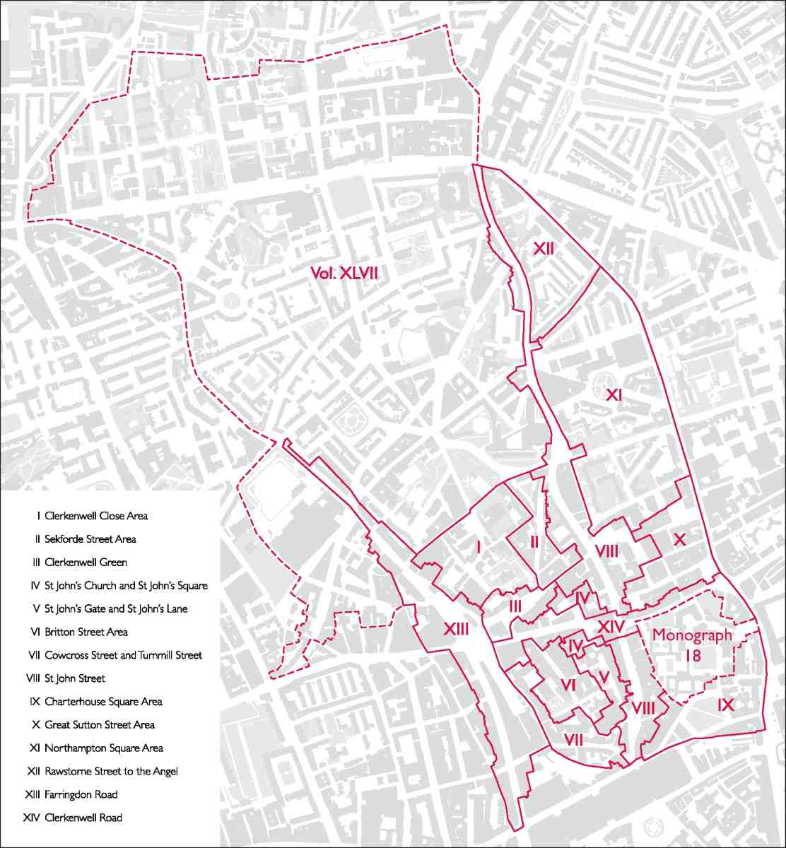
1. South and East Clerkenwell. The red lines and numerals show the area described in this volume and its constituent chapters. Adjacent areas covered in volume xlvii and Monograph 18 are also indicated