Survey of London: Volume 45, Knightsbridge. Originally published by London County Council, London, 2000.
This free content was digitised by double rekeying. All rights reserved.
'Plate 56: Trevor Square area in 1992.', in Survey of London: Volume 45, Knightsbridge, ed. John Greenacombe (London, 2000), British History Online https://prod.british-history.ac.uk/survey-london/vol45/plate-56 [accessed 16 April 2025].
'Plate 56: Trevor Square area in 1992.', in Survey of London: Volume 45, Knightsbridge. Edited by John Greenacombe (London, 2000), British History Online, accessed April 16, 2025, https://prod.british-history.ac.uk/survey-london/vol45/plate-56.
"Plate 56: Trevor Square area in 1992.". Survey of London: Volume 45, Knightsbridge. Ed. John Greenacombe (London, 2000), British History Online. Web. 16 April 2025. https://prod.british-history.ac.uk/survey-london/vol45/plate-56.
In this section
Trevor Square Area in 1992
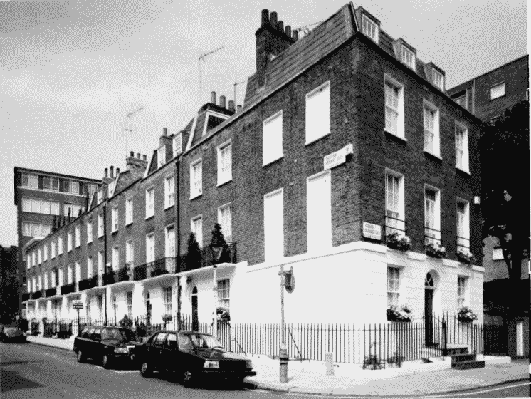
a. No. 1 Trevor Square (right) and the east side of Trevor Street.
Trevor Square area in 1992.
No. 1 Trevor Square (right) and the east side of Trevor Street.
Developed c. 1823 (p.99)
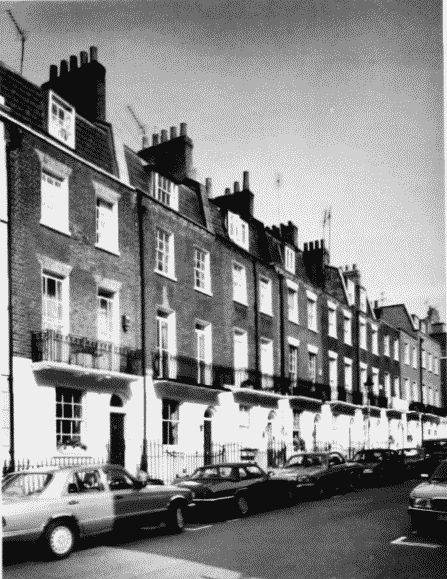
b. Trevor Street, west side.
Trevor Square area in 1992.
Trevor Street, west side.
Developed c. 1819 23 (p.99)
c. Trevor Place, south-western side.

Trevor Square area in 1992.
Trevor Place, south-western side.
Developed c. 1847 52 (p.101)