Survey of London: Volume 45, Knightsbridge. Originally published by London County Council, London, 2000.
This free content was digitised by double rekeying. All rights reserved.
'Plate 52: Raphael Street', in Survey of London: Volume 45, Knightsbridge, ed. John Greenacombe (London, 2000), British History Online https://prod.british-history.ac.uk/survey-london/vol45/plate-52 [accessed 16 April 2025].
'Plate 52: Raphael Street', in Survey of London: Volume 45, Knightsbridge. Edited by John Greenacombe (London, 2000), British History Online, accessed April 16, 2025, https://prod.british-history.ac.uk/survey-london/vol45/plate-52.
"Plate 52: Raphael Street". Survey of London: Volume 45, Knightsbridge. Ed. John Greenacombe (London, 2000), British History Online. Web. 16 April 2025. https://prod.british-history.ac.uk/survey-london/vol45/plate-52.
In this section
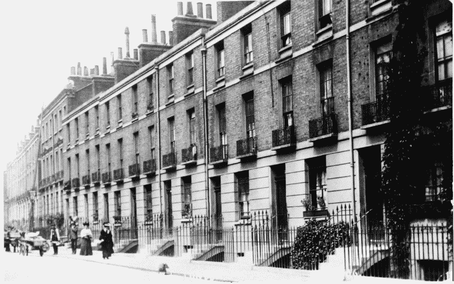
Raphael Street before Redevelopment (p. 91)
a (above). North side, Nos 2–11 (right to left ), in the early 1900s
Raphael Street
(above). North side, Nos 2–11 (right to left ), in the early 1900s
b. South side, corner with Knightsbridge Green in 1902
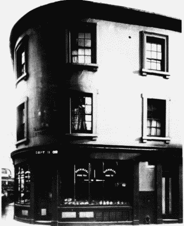
Raphael Street
South side, corner with Knightsbridge Green in 1902
c. Pakenham Tavern in c. 1875 (p.91)
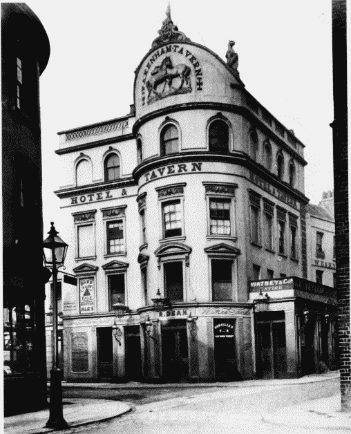
Raphael Street
Pakenham Tavern in c. 1875 (p.91)