Survey of London: Volume 45, Knightsbridge. Originally published by London County Council, London, 2000.
This free content was digitised by double rekeying. All rights reserved.
'Plate 10: Knightsbridge, c. 1910.', in Survey of London: Volume 45, Knightsbridge, ed. John Greenacombe (London, 2000), British History Online https://prod.british-history.ac.uk/survey-london/vol45/plate-10 [accessed 9 May 2025].
'Plate 10: Knightsbridge, c. 1910.', in Survey of London: Volume 45, Knightsbridge. Edited by John Greenacombe (London, 2000), British History Online, accessed May 9, 2025, https://prod.british-history.ac.uk/survey-london/vol45/plate-10.
"Plate 10: Knightsbridge, c. 1910.". Survey of London: Volume 45, Knightsbridge. Ed. John Greenacombe (London, 2000), British History Online. Web. 9 May 2025. https://prod.british-history.ac.uk/survey-london/vol45/plate-10.
In this section
Knightsbridge: South Side
a. Looking west from near the Alexandra Hotel (p. 23) in c. 1910

Knightsbridge, c. 1910.
Looking west from near the Alexandra Hotel (p. 23) in c. 1910
b. Nos 11–13 Knightsbridge in c. 1914 (p. 26)
Nos 11–13 Knightsbridge, c. 1914.
Nos 11–13 Knightsbridge in c. 1914 (p. 26)
c. Agriculture House (far left) and Nos 33–45 Knightsbridge in 1963 (pp. 22, 27).
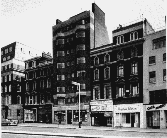
Nos 33–45 Knightsbridge in 1963.
Agriculture House (far left) and Nos 33–45 Knightsbridge in 1963 (pp. 22, 27).
Mostly demolished