Survey of London: Volume 42, Kensington Square To Earl's Court. Originally published by London County Council, London, 1986.
This free content was digitised by double rekeying. All rights reserved.
'Plate 133: Stations on Metropolitan and District railways', in Survey of London: Volume 42, Kensington Square To Earl's Court, ed. Hermione Hobhouse( London, 1986), British History Online https://prod.british-history.ac.uk/survey-london/vol42/plate-133 [accessed 23 November 2024].
'Plate 133: Stations on Metropolitan and District railways', in Survey of London: Volume 42, Kensington Square To Earl's Court. Edited by Hermione Hobhouse( London, 1986), British History Online, accessed November 23, 2024, https://prod.british-history.ac.uk/survey-london/vol42/plate-133.
"Plate 133: Stations on Metropolitan and District railways". Survey of London: Volume 42, Kensington Square To Earl's Court. Ed. Hermione Hobhouse(London, 1986), , British History Online. Web. 23 November 2024. https://prod.british-history.ac.uk/survey-london/vol42/plate-133.
In this section
a.(above). Earl's Court Station, entrance from Warwick Road in c. 1907 (p. 331). Demolished
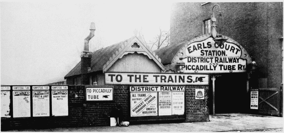
Earl's Court Station, Warwick Road entrance in c. 1907.
Earl's Court Station, entrance from Warwick Road in c. 1907 (p. 331). Demolished
b. (right). Earl's Court Station, entrance from Warwick Road in 1937 seen from Earl's Court Exhibition (p. 331)

Earl's Court Station, Warwick Road entrance in c. 1907.
Earl's Court Station, entrance from Warwick Road in 1937 seen from Earl's Court Exhibition (p. 331)
c. (below). West Brompton Station in c. 1907 Metropolitan District station on left, 1868-9 (p. 329); West London Extension station on right (demolished), 1866 (p. 326)
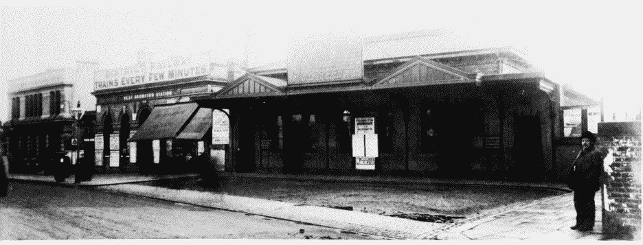
West Brompton Station in c. Metropolitan District station on left, 1868-9 (p. 329); West London Extension station on right (demolished), 1866 (p. 326)