Survey of London: Volume 42, Kensington Square To Earl's Court. Originally published by London County Council, London, 1986.
This free content was digitised by double rekeying. All rights reserved.
'Plate 113: Edwardes estate.', in Survey of London: Volume 42, Kensington Square To Earl's Court, ed. Hermione Hobhouse (London, 1986), British History Online https://prod.british-history.ac.uk/survey-london/vol42/plate-113 [accessed 16 April 2025].
'Plate 113: Edwardes estate.', in Survey of London: Volume 42, Kensington Square To Earl's Court. Edited by Hermione Hobhouse (London, 1986), British History Online, accessed April 16, 2025, https://prod.british-history.ac.uk/survey-london/vol42/plate-113.
"Plate 113: Edwardes estate.". Survey of London: Volume 42, Kensington Square To Earl's Court. Ed. Hermione Hobhouse (London, 1986), British History Online. Web. 16 April 2025. https://prod.british-history.ac.uk/survey-london/vol42/plate-113.
In this section
The Edwards Estate
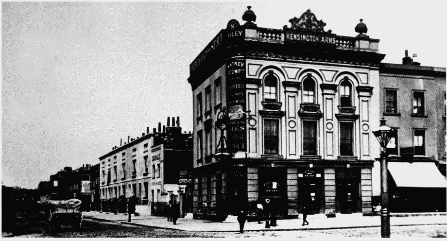
a (above). The junction of Warwick Road and Pembroke Road in c. 1905. Partly demolished. The Kensington Arms, James and Samuel William, builders, 1852 (p. 283)
Edwardes estate in c. 1905.
The junction of Warwick Road and Pembroke Road in c. 1905. Partly demolished. The Kensington Arms, James and Samuel William, builders, 1852 (p. 283)
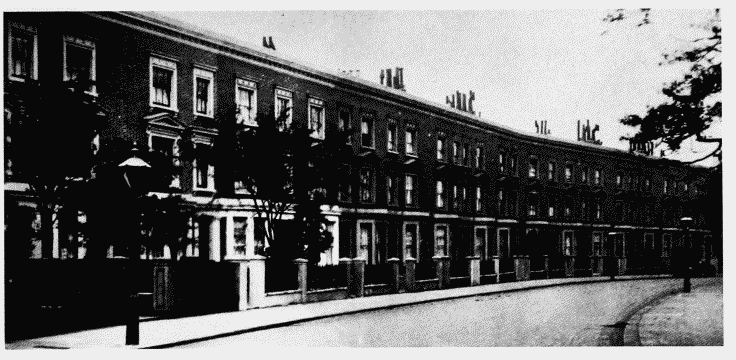
b (left). Nos. 50-76 (even) Warwick Gardens (right to left) in c. 1905. James Hall, builder, 1859-66 (p. 267)
Edwardes estate in c. 1905.
Nos. 50-76 (even) Warwick Gardens (right to left) in c. 1905. James Hall, builder, 1859-66 (p. 267)
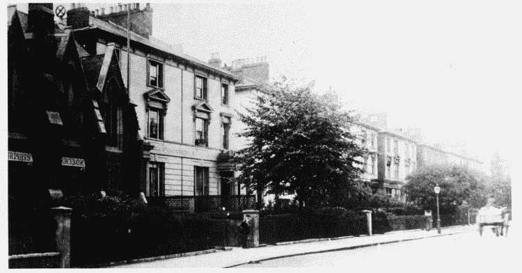
c (right). Nos. 20-46 (even) Warwick Gardens (right to left, demolished) and St. Barnabas's Church House in c. 1905. Nos. 20-46, Samuel Johns, bulder, 1860-2 (p. 266)
Edwardes estate in c. 1905.
Nos. 20-46 (even) Warwick Gardens (right to left, demolished) and St. Barnabas's Church House in c. 1905. Nos. 20-46, Samuel Johns, bulder, 1860-2 (p. 266)