Survey of London: Volume 41, Brompton. Originally published by London County Council, London, 1983.
This free content was digitised by double rekeying. All rights reserved.
'Plate 8', in Survey of London: Volume 41, Brompton, ed. F H W Sheppard (London, 1983), British History Online https://prod.british-history.ac.uk/survey-london/vol41/plate-8 [accessed 15 April 2025].
'Plate 8', in Survey of London: Volume 41, Brompton. Edited by F H W Sheppard (London, 1983), British History Online, accessed April 15, 2025, https://prod.british-history.ac.uk/survey-london/vol41/plate-8.
"Plate 8". Survey of London: Volume 41, Brompton. Ed. F H W Sheppard (London, 1983), British History Online. Web. 15 April 2025. https://prod.british-history.ac.uk/survey-london/vol41/plate-8.
In this section
a. Nos. 84-120. (even) Brompton Road (right to left) in c. 1905 (pp. 36-8).
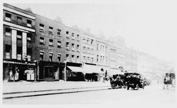
Nos. 84–120 (even) Brompton Road in c. 1905.
Nos. 84-120. (even) Brompton Road (right to left) in c. 1905 (pp. 36-8).
Mostly demolished
b. Brompton Road looking north-east towards Knightsbridge Green in c. 1905. Nos. 60-86 (even) on left, Harrods on right
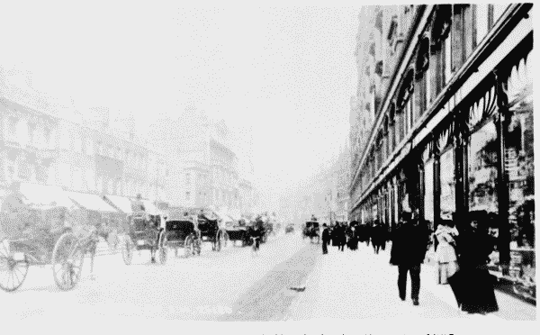
Brompton Road looking towards Knightsbridge Green inc. 1905.
Brompton Road looking north-east towards Knightsbridge Green in c. 1905. Nos. 60-86 (even) on left, Harrods on right
c. (left). Nos. 1-10. Brompton Place (left to right) in 1975.
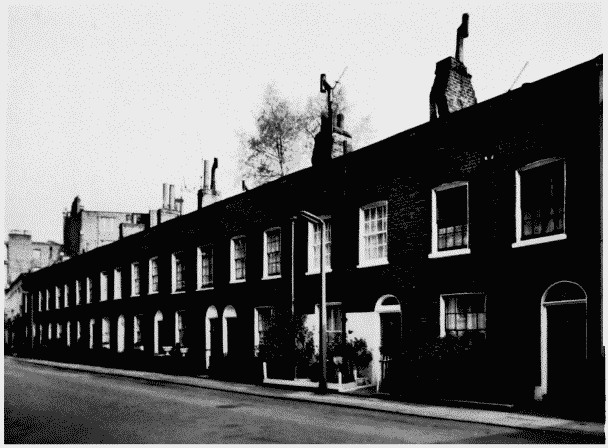
Nos. 1–10 Brompton Place in 1975.
(left). Nos. 1-10. Brompton Place (left to right) in 1975.
William Paul. plumber, building lessee, 1825-32 (p. 23)
d. Brompton Road in 1980.
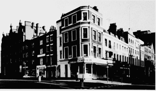
Brompton Road in 1980, with Nos. 2–14 (even) Montpelier Street.
Brompton Road in 1980.
No. 130 at corner, Nos.2-14 (even) Montpelier street on left (pp. 36-8, 39-40)