Survey of London: Volume 41, Brompton. Originally published by London County Council, London, 1983.
This free content was digitised by double rekeying. All rights reserved.
'Plate 47', in Survey of London: Volume 41, Brompton, ed. F H W Sheppard (London, 1983), British History Online https://prod.british-history.ac.uk/survey-london/vol41/plate-47 [accessed 15 April 2025].
'Plate 47', in Survey of London: Volume 41, Brompton. Edited by F H W Sheppard (London, 1983), British History Online, accessed April 15, 2025, https://prod.british-history.ac.uk/survey-london/vol41/plate-47.
"Plate 47". Survey of London: Volume 41, Brompton. Ed. F H W Sheppard (London, 1983), British History Online. Web. 15 April 2025. https://prod.british-history.ac.uk/survey-london/vol41/plate-47.
In this section
a. Harrington Road looking east to the junction of Thurloe and Pelham Streets (site of South Kensington Station) in c. 1867, during the construction of the underground railway

Harrington Road, during construction of underground railway in c. 1867.
Harrington Road looking east to the junction of Thurloe and Pelham Streets (site of South Kensington Station) in c. 1867, during the construction of the underground railway
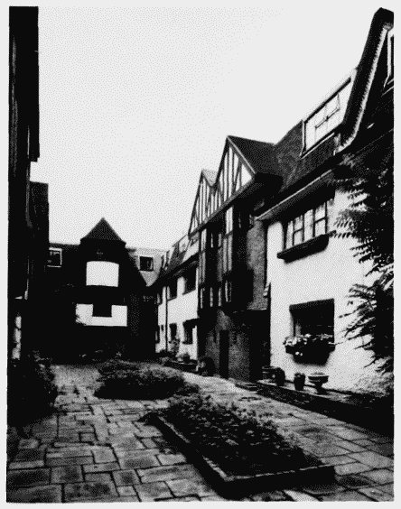
b. Thurloe Close in 1980. E. G. Selby, architect, 1927-30 (p. 84)

Thurloe Close in 1980.
Thurloe Close in 1980. E. G. Selby, architect, 1927-30 (p. 84)
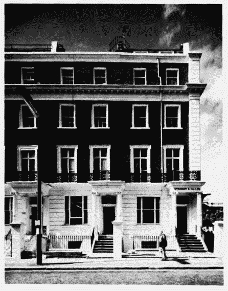
c. Nos. 25-29 (odd) Thurloe Street in 1974 John Blore, architect, 1846-50 (p .78)

Nos. 25–29 (odd) Thurloe Street in 1974.
Nos. 25-29 (odd) Thurloe Street in 1974 John Blore, architect, 1846-50 (p .78)