Survey of London: Volume 41, Brompton. Originally published by London County Council, London, 1983.
This free content was digitised by double rekeying. All rights reserved.
'Plate 19: Brompton Road in 1959.', in Survey of London: Volume 41, Brompton, ed. F H W Sheppard (London, 1983), British History Online https://prod.british-history.ac.uk/survey-london/vol41/plate-19 [accessed 15 April 2025].
'Plate 19: Brompton Road in 1959.', in Survey of London: Volume 41, Brompton. Edited by F H W Sheppard (London, 1983), British History Online, accessed April 15, 2025, https://prod.british-history.ac.uk/survey-london/vol41/plate-19.
"Plate 19: Brompton Road in 1959.". Survey of London: Volume 41, Brompton. Ed. F H W Sheppard (London, 1983), British History Online. Web. 15 April 2025. https://prod.british-history.ac.uk/survey-london/vol41/plate-19.
In this section
Brompton Road in 1959
a. Intersection of Sloane Street (left), Brompton Road (center right) and Knightsbridge (right)
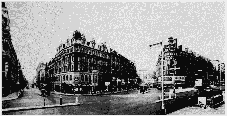
Intersection of Sloane Street (left), Brompton Road (center right) and Knightsbridge (right)
b. Nos. 1-31 (odd) Brompton Road.
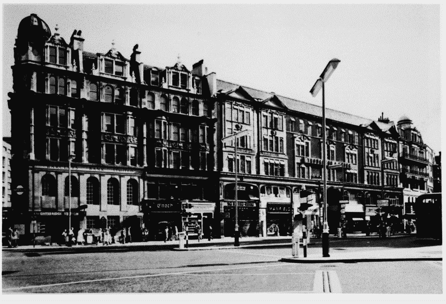
Nos. 1-31 (odd) Brompton Road.
Nos. 1-9 (left), W. Duvall Goodwin, architect, 1903-4; Nos. 13-27 (center right), G. D. Martin and W. F. Harber, architects, 1903-10; Nos. Nos. 29-31 (far right), Delissa Joseph, architect, 1910-11 (pp. 13-14)