Survey of London: Volume 39, the Grosvenor Estate in Mayfair, Part 1 (General History). Originally published by London County Council, London, 1977.
This free content was digitised by double rekeying. All rights reserved.
'Plate 13: Park Lane and Park Street', in Survey of London: Volume 39, the Grosvenor Estate in Mayfair, Part 1 (General History), ed. F H W Sheppard (London, 1977), British History Online https://prod.british-history.ac.uk/survey-london/vol39/pt1/plate-13 [accessed 25 April 2025].
'Plate 13: Park Lane and Park Street', in Survey of London: Volume 39, the Grosvenor Estate in Mayfair, Part 1 (General History). Edited by F H W Sheppard (London, 1977), British History Online, accessed April 25, 2025, https://prod.british-history.ac.uk/survey-london/vol39/pt1/plate-13.
"Plate 13: Park Lane and Park Street". Survey of London: Volume 39, the Grosvenor Estate in Mayfair, Part 1 (General History). Ed. F H W Sheppard (London, 1977), British History Online. Web. 25 April 2025. https://prod.british-history.ac.uk/survey-london/vol39/pt1/plate-13.
In this section
a. Park Lane, northern end from Hyde Park in 1799, showing King's Row (extreme right), the old Dudley House (right of centre with projecting porch), the end of Upper Brook Street (centre) and in the middle distance to left, the junction with Oxford Street.
Park Lane, northern end from Hyde Park in 1799, showing King's Row (extreme right), the old Dudley House (right of centre with projecting porch), the end of Upper Brook Street (centre) and in the middle distance to left, the junction with Oxford Street.
Mostly demolished
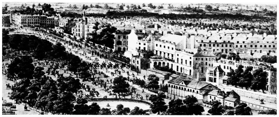
b. Park Lane, view looking south-east in c. 1807, showing houses in King's Row (left, behind trees), the south corner with Upper Grosvenor Street, and Breadalbane House (right).
Park Lane, view looking south-east in c. 1807, showing houses in King's Row (left, behind trees), the south corner with Upper Grosvenor Street, and Breadalbane House (right).
Grosvenor Gate lodge in foreground. All demolished
c. Park Street, elevational drawing of 1820 showing houses on west side between Hereford Street and North Row.
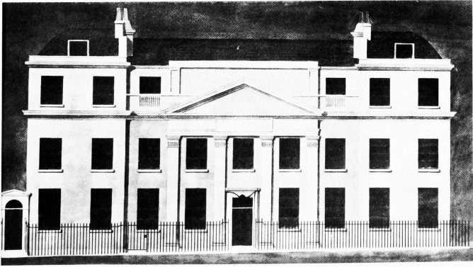
Park Street, elevational drawing of 1820 showing houses on west side between Hereford Street and North Row.
John Crunden, architect, 1778. Demolished