Survey of London: Volume 39, the Grosvenor Estate in Mayfair, Part 1 (General History). Originally published by London County Council, London, 1977.
This free content was digitised by double rekeying. All rights reserved.
'Plate 1: Proposed layout of the estate for building, c. 1720', in Survey of London: Volume 39, the Grosvenor Estate in Mayfair, Part 1 (General History), ed. F H W Sheppard (London, 1977), British History Online https://prod.british-history.ac.uk/survey-london/vol39/pt1/plate-1 [accessed 25 April 2025].
'Plate 1: Proposed layout of the estate for building, c. 1720', in Survey of London: Volume 39, the Grosvenor Estate in Mayfair, Part 1 (General History). Edited by F H W Sheppard (London, 1977), British History Online, accessed April 25, 2025, https://prod.british-history.ac.uk/survey-london/vol39/pt1/plate-1.
"Plate 1: Proposed layout of the estate for building, c. 1720". Survey of London: Volume 39, the Grosvenor Estate in Mayfair, Part 1 (General History). Ed. F H W Sheppard (London, 1977), British History Online. Web. 25 April 2025. https://prod.british-history.ac.uk/survey-london/vol39/pt1/plate-1.
The intended layout of the estate as shown on John Mackay's map of 1723
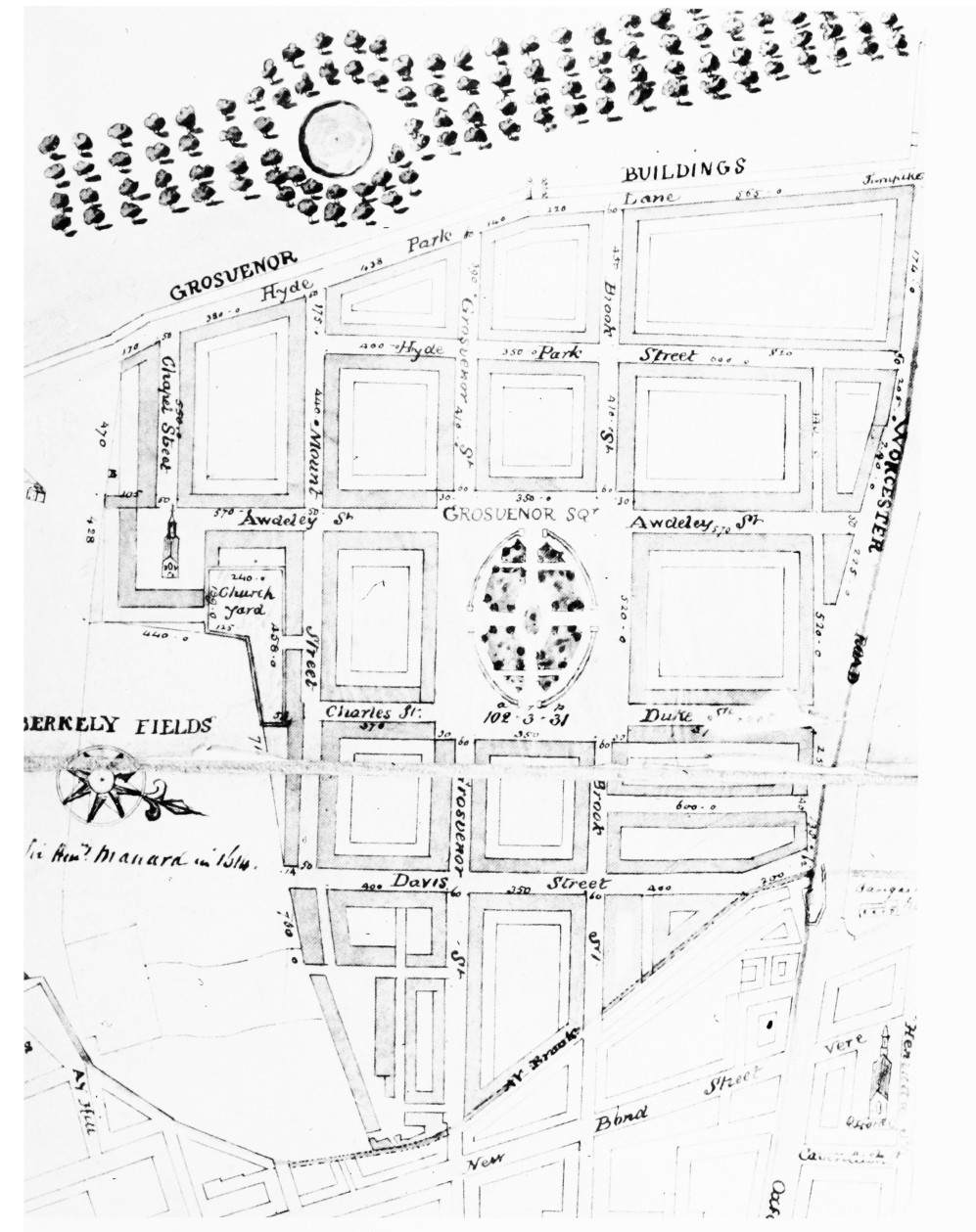
Proposed layout of the estate for building, c. 1720.
The intended layout of the estate as shown on John Mackay's map of 1723