Survey of London: Volume 38, South Kensington Museums Area. Originally published by London County Council, London, 1975.
This free content was digitised by double rekeying. All rights reserved.
'Plan sheet B: The area illustrated in this volume', in Survey of London: Volume 38, South Kensington Museums Area, ed. F H W Sheppard (London, 1975), British History Online https://prod.british-history.ac.uk/survey-london/vol38/plan-sheet-b [accessed 15 April 2025].
'Plan sheet B: The area illustrated in this volume', in Survey of London: Volume 38, South Kensington Museums Area. Edited by F H W Sheppard (London, 1975), British History Online, accessed April 15, 2025, https://prod.british-history.ac.uk/survey-london/vol38/plan-sheet-b.
"Plan sheet B: The area illustrated in this volume". Survey of London: Volume 38, South Kensington Museums Area. Ed. F H W Sheppard (London, 1975), British History Online. Web. 15 April 2025. https://prod.british-history.ac.uk/survey-london/vol38/plan-sheet-b.
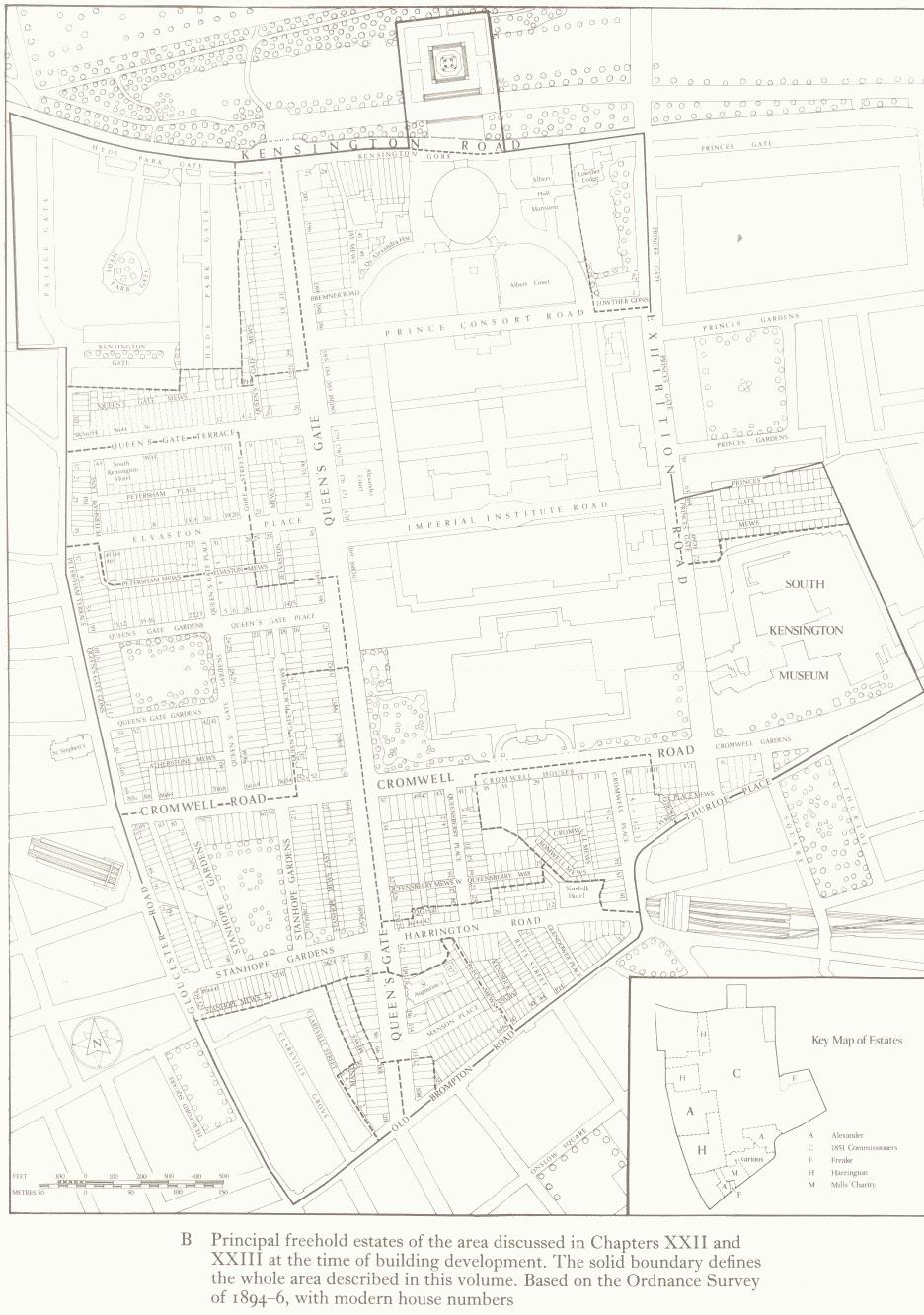
B Principal freehold estates of the area discussed in Chapters XXII and XXIII at the time of building development.

Principal freehold estates of the area discussed in Chapters XXII and XXIII at the time of building development.
The solid boundary defines the whole area described in this volume. Based on the Ordnance Survey of 1894–6, with modern house numbers