Survey of London: Volume 28, Brooke House, Hackney. Originally published by London County Council, London, 1960.
This free content was digitised by double rekeying. All rights reserved.
W A Eden, Marie P G Draper, W F Grimes, Audrey Williams, 'Plate 1: Extract from Ordnance Survey map, 1868-72', in Survey of London: Volume 28, Brooke House, Hackney(London, 1960), British History Online https://prod.british-history.ac.uk/survey-london/vol28/plate-1 [accessed 26 April 2025].
W A Eden, Marie P G Draper, W F Grimes, Audrey Williams, 'Plate 1: Extract from Ordnance Survey map, 1868-72', in Survey of London: Volume 28, Brooke House, Hackney(London, 1960), British History Online, accessed April 26, 2025, https://prod.british-history.ac.uk/survey-london/vol28/plate-1.
W A Eden, Marie P G Draper, W F Grimes, Audrey Williams. "Plate 1: Extract from Ordnance Survey map, 1868-72". Survey of London: Volume 28, Brooke House, Hackney. (London, 1960), British History Online. Web. 26 April 2025. https://prod.british-history.ac.uk/survey-london/vol28/plate-1.
Extract from Ordnance Survey map
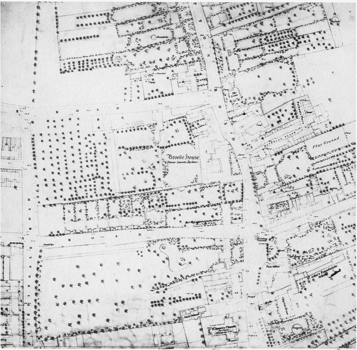
Extract from Ordnance Survey map 1868-72, showing Brooke House and the surrounding area.