Survey of London: Volume 27, Spitalfields and Mile End New Town. Originally published by London County Council, London, 1957.
This free content was digitised by double rekeying. All rights reserved.
'Plate 74', in Survey of London: Volume 27, Spitalfields and Mile End New Town, ed. F H W Sheppard (London, 1957), British History Online https://prod.british-history.ac.uk/survey-london/vol27/plate-74 [accessed 4 April 2025].
'Plate 74', in Survey of London: Volume 27, Spitalfields and Mile End New Town. Edited by F H W Sheppard (London, 1957), British History Online, accessed April 4, 2025, https://prod.british-history.ac.uk/survey-london/vol27/plate-74.
"Plate 74". Survey of London: Volume 27, Spitalfields and Mile End New Town. Ed. F H W Sheppard (London, 1957), British History Online. Web. 4 April 2025. https://prod.british-history.ac.uk/survey-london/vol27/plate-74.
In this section
a. Shepherd's Place archway (c. 1810), and Tenter Street (c. 1820) in 1909 (p. 243) Demol.
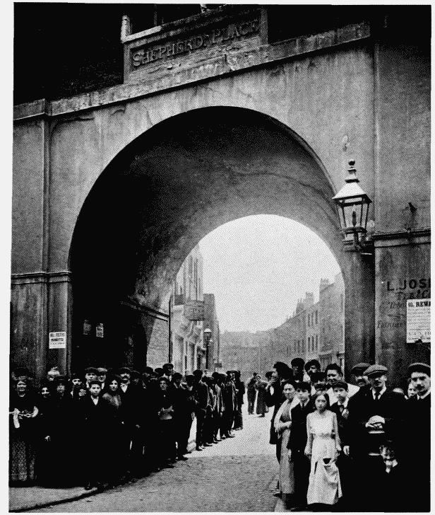
Shepherd's Place (now Tenter Ground) from White's Row.
Shepherd's Place archway (c. 1810), and Tenter Street (c. 1820) in 1909 (p. 243) Demol.
b. Nos. 6-7 Spring Walk (1813-19) (p. 288)
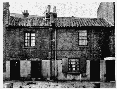
Nos. 6–7 Spring Walk
Nos. 6-7 Spring Walk (1813-19) (p. 288)
c. Loom Court, Blossom Street (c. 1812) (p. 88)
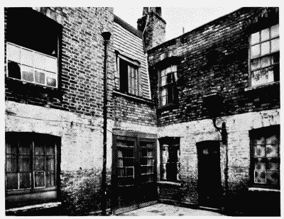
Loom Court, Blossom Street
Loom Court, Blossom Street (c. 1812) (p. 88)