Survey of London: Volume 27, Spitalfields and Mile End New Town. Originally published by London County Council, London, 1957.
This free content was digitised by double rekeying. All rights reserved.
'Plate 69: Fournier Street', in Survey of London: Volume 27, Spitalfields and Mile End New Town, ed. F H W Sheppard (London, 1957), British History Online https://prod.british-history.ac.uk/survey-london/vol27/plate-69 [accessed 4 April 2025].
'Plate 69: Fournier Street', in Survey of London: Volume 27, Spitalfields and Mile End New Town. Edited by F H W Sheppard (London, 1957), British History Online, accessed April 4, 2025, https://prod.british-history.ac.uk/survey-london/vol27/plate-69.
"Plate 69: Fournier Street". Survey of London: Volume 27, Spitalfields and Mile End New Town. Ed. F H W Sheppard (London, 1957), British History Online. Web. 4 April 2025. https://prod.british-history.ac.uk/survey-london/vol27/plate-69.
In this section
Fournier Street
a. Nos. 31-37 (1725), 39 (1743).
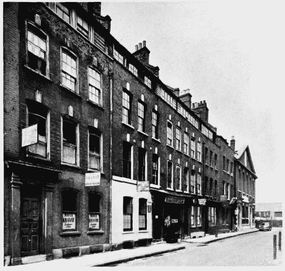
Nos. 29–39 Fournier Street
Nos. 31-37 (1725), 39 (1743).
Various lessees. Entrance formerly leading to Samuel Worrall's house between Nos. 33 and 35 (pp. 220-1)
b. Nos. 1-3 (c. 1755, built by Joseph Drew, carpenter), 5-7 (carcase 1722, lessee, William Tayler, joiner) (pp. 216-17)
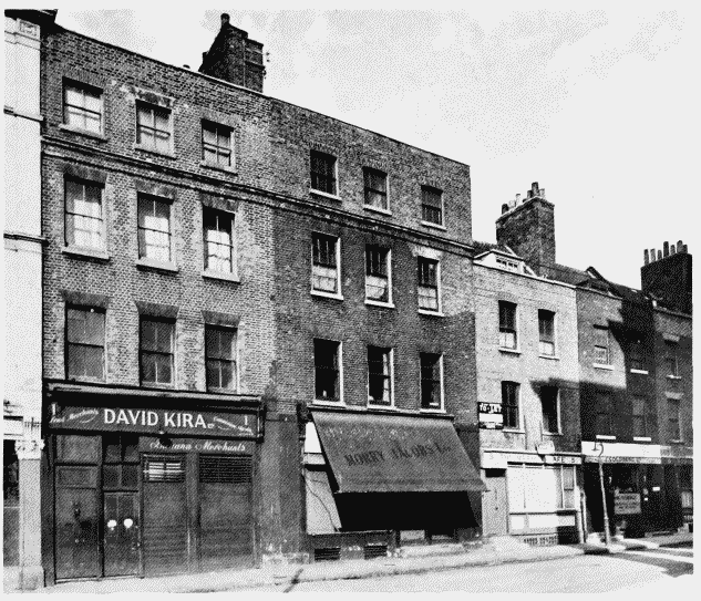
Nos. 1–7 Fournier Street
Nos. 1-3 (c. 1755, built by Joseph Drew, carpenter), 5-7 (carcase 1722, lessee, William Tayler, joiner) (pp. 216-17)