Survey of London: Volume 27, Spitalfields and Mile End New Town. Originally published by London County Council, London, 1957.
This free content was digitised by double rekeying. All rights reserved.
'Plate 51', in Survey of London: Volume 27, Spitalfields and Mile End New Town, ed. F H W Sheppard (London, 1957), British History Online https://prod.british-history.ac.uk/survey-london/vol27/plate-51 [accessed 24 April 2025].
'Plate 51', in Survey of London: Volume 27, Spitalfields and Mile End New Town. Edited by F H W Sheppard (London, 1957), British History Online, accessed April 24, 2025, https://prod.british-history.ac.uk/survey-london/vol27/plate-51.
"Plate 51". Survey of London: Volume 27, Spitalfields and Mile End New Town. Ed. F H W Sheppard (London, 1957), British History Online. Web. 24 April 2025. https://prod.british-history.ac.uk/survey-london/vol27/plate-51.
In this section
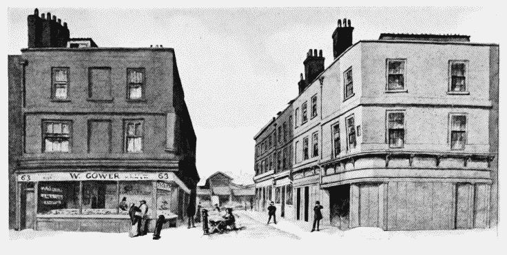
a. Brushfield Street and South Street in 1879, looking towards Market.
Brushfield Street and South Street, looking towards Spitalfields Market.
Brushfield Street and South Street in 1879, looking towards Market.
Houses ? built in 1684-5 by William Parker, bricklayer (p. 129) Demol.
b. Spitalfields Market, Commercial Street, 1886-93.
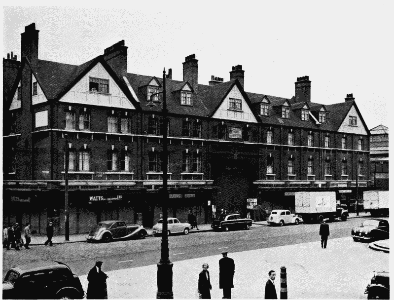
Spitalfields Market, Commercial Street front
Spitalfields Market, Commercial Street, 1886-93.
George Sherrin, architect (p. 135)