Survey of London: Volume 26, Lambeth: Southern Area. Originally published by London County Council, London, 1956.
This free content was digitised by double rekeying. All rights reserved.
'Plate 66: Brockwell Hall, elevation and plan.', in Survey of London: Volume 26, Lambeth: Southern Area, ed. F H W Sheppard (London, 1956), British History Online https://prod.british-history.ac.uk/survey-london/vol26/plate-66 [accessed 29 April 2025].
'Plate 66: Brockwell Hall, elevation and plan.', in Survey of London: Volume 26, Lambeth: Southern Area. Edited by F H W Sheppard (London, 1956), British History Online, accessed April 29, 2025, https://prod.british-history.ac.uk/survey-london/vol26/plate-66.
"Plate 66: Brockwell Hall, elevation and plan.". Survey of London: Volume 26, Lambeth: Southern Area. Ed. F H W Sheppard (London, 1956), British History Online. Web. 29 April 2025. https://prod.british-history.ac.uk/survey-london/vol26/plate-66.
In this section
Brockwell Hall, 1811-13.
D. R. Roper, architect (p. 161)
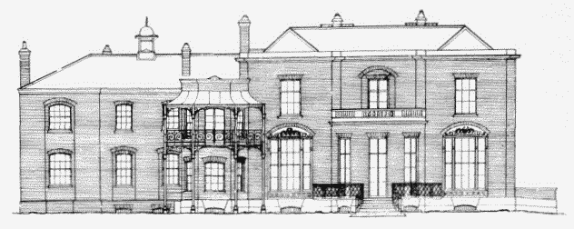
a. South-east elevation

Brockwell Hall, elevation and plan.
South-east elevation
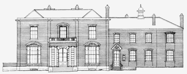
b. North-west elevation

Brockwell Hall, elevation and plan.
North-west elevation
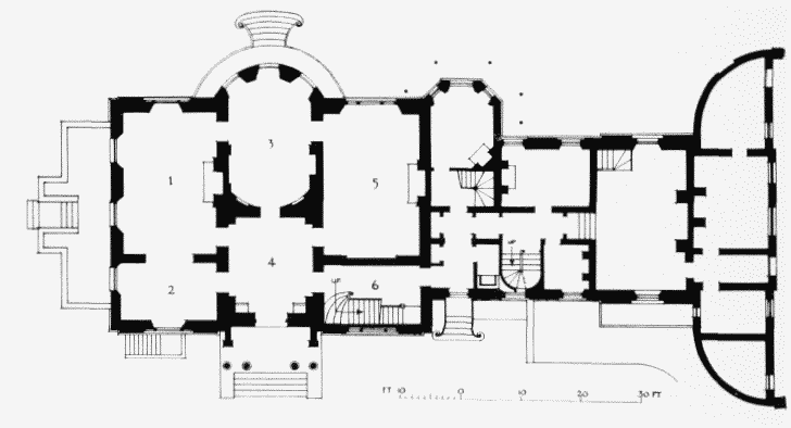
c. Plan. The numbers on the plan denote the position of the details in fig. 54

Brockwell Hall, elevation and plan.
Plan. The numbers on the plan denote the position of the details in fig. 54