Survey of London: Volume 25, St George's Fields (The Parishes of St. George the Martyr Southwark and St. Mary Newington). Originally published by London County Council, London, 1955.
This free content was digitised by double rekeying. All rights reserved.
'Plate 61: No. 226 East Street, elevation, plan and details, 1953', in Survey of London: Volume 25, St George's Fields (The Parishes of St. George the Martyr Southwark and St. Mary Newington), ed. Ida Darlington (London, 1955), British History Online https://prod.british-history.ac.uk/survey-london/vol25/plate-61 [accessed 26 April 2025].
'Plate 61: No. 226 East Street, elevation, plan and details, 1953', in Survey of London: Volume 25, St George's Fields (The Parishes of St. George the Martyr Southwark and St. Mary Newington). Edited by Ida Darlington (London, 1955), British History Online, accessed April 26, 2025, https://prod.british-history.ac.uk/survey-london/vol25/plate-61.
"Plate 61: No. 226 East Street, elevation, plan and details, 1953". Survey of London: Volume 25, St George's Fields (The Parishes of St. George the Martyr Southwark and St. Mary Newington). Ed. Ida Darlington (London, 1955), British History Online. Web. 26 April 2025. https://prod.british-history.ac.uk/survey-london/vol25/plate-61.
No 226 EAST ST SOUTHWARK
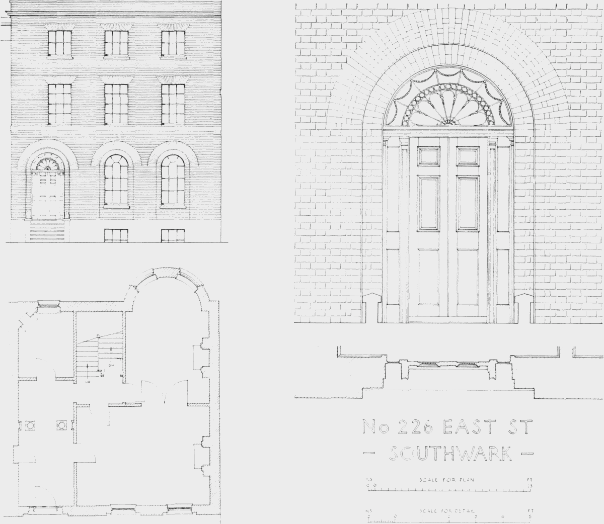
No. 226 East Street, elevation, plan and details, 1953